- Okay, Oklahoma
-
Okay, Oklahoma — Town — Location of Okay, Oklahoma
Coordinates: 35°51′10″N 95°18′57″W / 35.85278°N 95.31583°WCoordinates: 35°51′10″N 95°18′57″W / 35.85278°N 95.31583°W Country United States State Oklahoma County Wagoner Area – Total 0.8 sq mi (2.1 km2) – Land 0.8 sq mi (2.1 km2) – Water 0.0 sq mi (0.0 km2) Elevation 545 ft (166 m) Population (2000) – Total 597 – Density 737.3/sq mi (284.7/km2) Time zone Central (CST) (UTC-6) – Summer (DST) CDT (UTC-5) ZIP code 74446 Area code(s) 539/918 FIPS code 40-54100[1] GNIS feature ID 1096195[2] Okay is a town along the Verdigris River in Wagoner County, Oklahoma, United States. The population was 597 at the 2000 census.
Contents
Geography
Okay is located at 35°51′10″N 95°18′57″W / 35.85278°N 95.31583°W (35.852723, -95.315763)[3].
According to the United States Census Bureau, the town has a total area of 0.8 square miles (2.1 km2), all of it land.
Demographics
As of the census[1] of 2000, there were 597 people, 227 households, and 165 families residing in the town. The population density was 737.3 people per square mile (284.6/km²). There were 278 housing units at an average density of 343.3 per square mile (132.5/km²). The racial makeup of the town was 64.15% White, 4.36% African American, 21.27% Native American, 0.17% Asian, 0.50% Pacific Islander, 1.84% from other races, and 7.71% from two or more races. Hispanic or Latino of any race were 3.69% of the population.
There were 227 households out of which 35.2% had children under the age of 18 living with them, 48.9% were married couples living together, 18.1% had a female householder with no husband present, and 26.9% were non-families. 23.8% of all households were made up of individuals and 10.6% had someone living alone who was 65 years of age or older. The average household size was 2.63 and the average family size was 3.11.
In the town the population was spread out with 30.7% under the age of 18, 8.0% from 18 to 24, 25.6% from 25 to 44, 23.8% from 45 to 64, and 11.9% who were 65 years of age or older. The median age was 36 years. For every 100 females there were 97.0 males. For every 100 females age 18 and over, there were 92.6 males.
The median income for a household in the town was $20,385, and the median income for a family was $23,472. Males had a median income of $21,000 versus $14,444 for females. The per capita income for the town was $9,758. About 26.2% of families and 27.8% of the population were below the poverty line, including 31.9% of those under age 18 and 34.2% of those age 65 or over.
Public safety
Until December 4, 2008, the town had one of the smallest (if not the smallest) police departments in Oklahoma; the town is now temporarily using the services of the Wagoner County Sheriff's Office.
Famous residents
- Lou Henson, former college basketball coach
References
- ^ a b "American FactFinder". United States Census Bureau. http://factfinder.census.gov. Retrieved 2008-01-31.
- ^ "US Board on Geographic Names". United States Geological Survey. 2007-10-25. http://geonames.usgs.gov. Retrieved 2008-01-31.
- ^ "US Gazetteer files: 2010, 2000, and 1990". United States Census Bureau. 2011-02-12. http://www.census.gov/geo/www/gazetteer/gazette.html. Retrieved 2011-04-23.
Municipalities and communities of Wagoner County, Oklahoma Cities 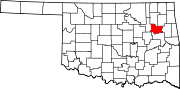
Towns Fair Oaks‡ | Okay | Porter | Redbird | Tullahassee
Unincorporated
communitiesChoska | Clarksville | Eastborough | Gibson | Mallard Bay | Neodesha | Oneta | Rocky Point | Stonebluff | Stones Corner | Taylor Ferry | Timber Brook | Toppers
Footnotes ‡This populated place also has portions in an adjacent county or counties
National Register of Historic Places in Wagoner County, Oklahoma Coweta 
Okay Porter Van Tuyl Homeplace
Redbird Miller-Washington School · Redbird City Hall
Tullahassee Wagoner Amos Parkinson House · Cobb Building · Collin McKinney House · First National Bank of Wagoner · Frederick Parkinson House · John W. Gibson House · Newport Hotel and Restaurant · St James Episcopal Church · Wagoner Armory · William McAnally House · Way House
Categories:- Towns in Oklahoma
- Populated places in Wagoner County, Oklahoma


Wikimedia Foundation. 2010.