- Maramec, Oklahoma
-
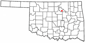
Maramec, Oklahoma — Town — Location of Maramec, Oklahoma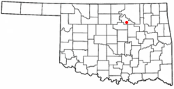
Coordinates: 36°14′33″N 96°40′52″W / 36.2425°N 96.68111°WCoordinates: 36°14′33″N 96°40′52″W / 36.2425°N 96.68111°W Country United States State Oklahoma County Pawnee Area – Total 0.2 sq mi (0.6 km2) – Land 0.2 sq mi (0.6 km2) – Water 0.0 sq mi (0.0 km2) Elevation 961 ft (293 m) Population (2000) – Total 104 – Density 427.8/sq mi (165.2/km2) Time zone Central (CST) (UTC-6) – Summer (DST) CDT (UTC-5) ZIP code 74045 Area code(s) 539/918 FIPS code 40-46400[1] GNIS feature ID 1095132[2] Maramec is a town in Pawnee County, Oklahoma, United States. The population was 104 at the 2000 census.
Geography
Maramec is located at 36°14′33″N 96°40′52″W / 36.2425°N 96.68111°W (36.242521, -96.681001)[3]. According to the United States Census Bureau, the town has a total area of 0.2 square miles (0.52 km2), all of it land.
Demographics
As of the census[1] of 2000, there were 104 people, 46 households, and 28 families residing in the town. The population density was 427.8 people per square mile (167.3/km²). There were 64 housing units at an average density of 263.3 per square mile (103.0/km²). The racial makeup of the town was 96.15% White, 2.88% Native American and 0.96% Asian. Hispanic or Latino of any race were 4.81% of the population.
There were 46 households out of which 26.1% had children under the age of 18 living with them, 52.2% were married couples living together, 8.7% had a female householder with no husband present, and 37.0% were non-families. 32.6% of all households were made up of individuals and 19.6% had someone living alone who was 65 years of age or older. The average household size was 2.26 and the average family size was 2.86.
In the town the population was spread out with 22.1% under the age of 18, 8.7% from 18 to 24, 28.8% from 25 to 44, 23.1% from 45 to 64, and 17.3% who were 65 years of age or older. The median age was 40 years. For every 100 females there were 100.0 males. For every 100 females age 18 and over, there were 92.9 males.
The median income for a household in the town was $25,357, and the median income for a family was $24,750. Males had a median income of $19,167 versus $12,083 for females. The per capita income for the town was $12,578. There were no families and 1.8% of the population living below the poverty line, including no under eighteens and none of those over 64.
References
- ^ a b "American FactFinder". United States Census Bureau. http://factfinder.census.gov. Retrieved 2008-01-31.
- ^ "US Board on Geographic Names". United States Geological Survey. 2007-10-25. http://geonames.usgs.gov. Retrieved 2008-01-31.
- ^ "US Gazetteer files: 2010, 2000, and 1990". United States Census Bureau. 2011-02-12. http://www.census.gov/geo/www/gazetteer/gazette.html. Retrieved 2011-04-23.
Municipalities and communities of Pawnee County, Oklahoma Cities 
Towns Unincorporated
communitiesFootnotes ‡This populated place also has portions in an adjacent county or counties
Categories:- Populated places in Pawnee County, Oklahoma
- Towns in Oklahoma

Wikimedia Foundation. 2010.