- McCurtain, Oklahoma
-
McCurtain, Oklahoma — Town — Location of McCurtain, Oklahoma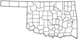
Coordinates: 35°9′1″N 94°58′17″W / 35.15028°N 94.97139°WCoordinates: 35°9′1″N 94°58′17″W / 35.15028°N 94.97139°W Country United States State Oklahoma County Haskell Area – Total 1.1 sq mi (2.9 km2) – Land 1.1 sq mi (2.9 km2) – Water 0.0 sq mi (0.0 km2) Elevation 581 ft (177 m) Population (2000) – Total 466 – Density 420.5/sq mi (162.4/km2) Time zone Central (CST) (UTC-6) – Summer (DST) CDT (UTC-5) ZIP code 74944 Area code(s) 539/918 FIPS code 40-44950[1] GNIS feature ID 1095225[2] McCurtain is a town in Haskell County, Oklahoma, United States. The population was 466 at the 2000 census.
Contents
Geography
McCurtain is located at 35°9′1″N 94°58′17″W / 35.15028°N 94.97139°W (35.150189, -94.971457)[3].
According to the United States Census Bureau, the town has a total area of 1.1 square miles (2.8 km2), of which, 1.1 square miles (2.8 km2) of it is land and 0.04 square miles (0.10 km2) of it (1.77%) is water.
Demographics
As of the census[1] of 2000, there were 466 people, 178 households, and 122 families residing in the town. The population density was 420.5 people per square mile (162.1/km²). There were 213 housing units at an average density of 192.2 per square mile (74.1/km²). The racial makeup of the town was 75.54% White, 16.74% Native American, 1.29% Asian, and 6.44% from two or more races. Hispanic or Latino of any race were 1.29% of the population.
There were 178 households out of which 36.0% had children under the age of 18 living with them, 54.5% were married couples living together, 11.8% had a female householder with no husband present, and 30.9% were non-families. 29.8% of all households were made up of individuals and 17.4% had someone living alone who was 65 years of age or older. The average household size was 2.62 and the average family size was 3.28.
In the town the population was spread out with 30.5% under the age of 18, 9.2% from 18 to 24, 24.2% from 25 to 44, 21.7% from 45 to 64, and 14.4% who were 65 years of age or older. The median age was 34 years. For every 100 females there were 95.8 males. For every 100 females age 18 and over, there were 97.6 males.
The median income for a household in the town was $22,188, and the median income for a family was $29,167. Males had a median income of $29,167 versus $15,833 for females. The per capita income for the town was $11,410. About 16.2% of families and 22.5% of the population were below the poverty line, including 28.2% of those under age 18 and 25.0% of those age 65 or over.
References
- ^ a b "American FactFinder". United States Census Bureau. http://factfinder.census.gov. Retrieved 2008-01-31.
- ^ "US Board on Geographic Names". United States Geological Survey. 2007-10-25. http://geonames.usgs.gov. Retrieved 2008-01-31.
- ^ "US Gazetteer files: 2010, 2000, and 1990". United States Census Bureau. 2011-02-12. http://www.census.gov/geo/www/gazetteer/gazette.html. Retrieved 2011-04-23.
External links
Municipalities and communities of Haskell County, Oklahoma City 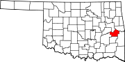
Towns Keota | Kinta | McCurtain | Tamaha | Whitefield
Unincorporated
communitiesBrooken | Cartersville | Enterprise | Garland | Hoyt | Lafayette | Lequire | Lewisville | Lona | Red Hill | Sans Bois | Star
Categories:- Populated places in Haskell County, Oklahoma
- Towns in Oklahoma


Wikimedia Foundation. 2010.