- Maysville, Oklahoma
-
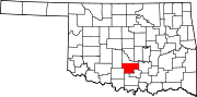
Maysville, Oklahoma — Town — Location of Maysville, Oklahoma
Coordinates: 34°49′3″N 97°24′37″W / 34.8175°N 97.41028°WCoordinates: 34°49′3″N 97°24′37″W / 34.8175°N 97.41028°W Country United States State Oklahoma County Garvin Area – Total 0.6 sq mi (1.5 km2) – Land 0.6 sq mi (1.5 km2) – Water 0.0 sq mi (0.0 km2) Elevation 938 ft (286 m) Population (2000) – Total 1,313 – Density 2,329.9/sq mi (899.6/km2) Time zone Central (CST) (UTC-6) – Summer (DST) CDT (UTC-5) ZIP code 73057 Area code(s) 405 FIPS code 40-47150[1] GNIS feature ID 1095194[2] Maysville is a town in Garvin County, Oklahoma, United States. The population was 1,313 at the 2000 census.
Geography
Maysville is located at 34°49′3″N 97°24′37″W / 34.8175°N 97.41028°W (34.817489, -97.410162)[3].
According to the United States Census Bureau, the town has a total area of 0.6 square miles (1.6 km2), all of it land.
Demographics
As of the census[1] of 2000, there were 1,313 people, 507 households, and 357 families residing in the town. The population density was 2,329.9 people per square mile (905.3/km²). There were 581 housing units at an average density of 1,031.0 per square mile (400.6/km²). The racial makeup of the town was 85.00% White, 0.38% African American, 9.60% Native American, 0.15% Pacific Islander, 0.76% from other races, and 4.11% from two or more races. Hispanic or Latino of any race were 1.68% of the population.
There were 507 households out of which 32.7% had children under the age of 18 living with them, 53.1% were married couples living together, 13.8% had a female householder with no husband present, and 29.4% were non-families. 26.8% of all households were made up of individuals and 13.0% had someone living alone who was 65 years of age or older. The average household size was 2.53 and the average family size was 3.05.
In the town the population was spread out with 28.5% under the age of 18, 8.1% from 18 to 24, 24.2% from 25 to 44, 20.6% from 45 to 64, and 18.7% who were 65 years of age or older. The median age was 37 years. For every 100 females there were 86.8 males. For every 100 females age 18 and over, there were 82.0 males.
The median income for a household in the town was $25,921, and the median income for a family was $31,369. Males had a median income of $28,194 versus $18,438 for females. The per capita income for the town was $12,449. About 16.9% of families and 21.6% of the population were below the poverty line, including 24.0% of those under age 18 and 16.1% of those age 65 or over.
References
- ^ a b "American FactFinder". United States Census Bureau. http://factfinder.census.gov. Retrieved 2008-01-31.
- ^ "US Board on Geographic Names". United States Geological Survey. 2007-10-25. http://geonames.usgs.gov. Retrieved 2008-01-31.
- ^ "US Gazetteer files: 2010, 2000, and 1990". United States Census Bureau. 2011-02-12. http://www.census.gov/geo/www/gazetteer/gazette.html. Retrieved 2011-04-23.
Municipalities and communities of Garvin County, Oklahoma Cities Davis‡ | Lindsay | Pauls Valley | Wynnewood
Towns Elmore City | Erin Springs | Foster | Katie | Maysville | Paoli | Stratford
Unincorporated
communitiesGhost town Antioch
Footnotes ‡This populated place also has portions in an adjacent county or counties
Categories:- Populated places in Garvin County, Oklahoma
- Towns in Oklahoma


Wikimedia Foundation. 2010.