- North Enid, Oklahoma
-
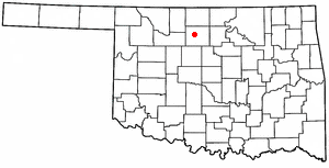
North Enid, Oklahoma — Town — Location of North Enid, Oklahoma
Coordinates: 36°26′10″N 97°52′1″W / 36.43611°N 97.86694°WCoordinates: 36°26′10″N 97°52′1″W / 36.43611°N 97.86694°W Country United States State Oklahoma County Garfield Area – Total 2.3 sq mi (5.8 km2) – Land 2.3 sq mi (5.8 km2) – Water 0.0 sq mi (0.0 km2) Elevation 1,257 ft (383 m) Population (2010) – Total 860 Time zone Central (CST) (UTC-6) – Summer (DST) CDT (UTC-5) FIPS code 40-52600[1] GNIS feature ID 1095941[2] North Enid is a town in Garfield County, Oklahoma, United States. The population was 860 at the 2010 census. The town is served by the Chisholm school district. North Enid was the original railroad town site in the Enid-Pond Creek Railroad War.
Geography
North Enid is located at 36°26′10″N 97°52′01″W / 36.435982°N 97.866934°W.[3]
According to the United States Census Bureau, the town has a total area of 2.3 square miles (6.0 km2), all of it land.
Demographics
Historical populations Census Pop. %± 1900 205 — 1960 286 — 1970 730 155.2% 1980 992 35.9% 1990 874 −11.9% 2000 796 −8.9% 2010 860 8.0% [4] As of the census[1] of 2010, there were 860 people, up from 796 people in 2000. In 2000, there were 302 households, and 244 families residing in the town. The population density was 352.6 people per square mile (136.0/km2). There were 313 housing units at an average density of 138.7 per square mile (53.5/km2). The racial makeup of the town was 96.48% White, 0.25% African American, 1.63% Native American, and 1.63% from two or more races. Hispanic or Latino of any race were 0.38% of the population.
There were 302 households out of which 33.1% had children under the age of 18 living with them, 75.2% were married couples living together, 3.3% had a female householder with no husband present, and 18.9% were non-families. 17.2% of all households were made up of individuals and 10.6% had someone living alone who was 65 years of age or older. The average household size was 2.64 and the average family size was 2.97.
In the town the population was spread out with 24.6% under the age of 18, 5.5% from 18 to 24, 25.4% from 25 to 44, 29.5% from 45 to 64, and 14.9% who were 65 years of age or older. The median age was 42 years. For every 100 females there were 96.5 males. For every 100 females age 18 and over, there were 93.5 males.
The median income for a household in the town was $47,212, and the median income for a family was $51,667. Males had a median income of $33,000 versus $21,484 for females. The per capita income for the town was $18,416. About 4.8% of families and 5.5% of the population were below the poverty line, including 5.0% of those under age 18 and 15.8% of those age 65 or over.
References
- ^ a b "American FactFinder". United States Census Bureau. http://factfinder.census.gov. Retrieved 2008-01-31.
- ^ "US Board on Geographic Names". United States Geological Survey. 2007-10-25. http://geonames.usgs.gov. Retrieved 2008-01-31.
- ^ "US Gazetteer files: 2010, 2000, and 1990". United States Census Bureau. 2011-02-12. http://www.census.gov/geo/www/gazetteer/gazette.html. Retrieved 2011-04-23.
- ^ Weaver, Bobby D., "North Enid", Encyclopedia of Oklahoma History and Culture, Oklahoma Historical Society
Municipalities and communities of Garfield County, Oklahoma Cities 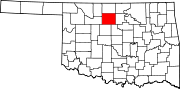
Towns Unincorporated
communitiesCategories:- Populated places in Garfield County, Oklahoma
- Towns in Oklahoma
- Enid, Oklahoma

Wikimedia Foundation. 2010.