- Canal Fulton, Ohio
Infobox Settlement
official_name = Canal Fulton, Ohio
settlement_type =City
nickname =
motto =
imagesize =
image_caption =
image_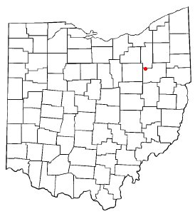
mapsize = 250px
map_caption = Location of Canal Fulton, Ohio
mapsize1 =
map_caption1 =subdivision_type = Country
subdivision_name =United States
subdivision_type1 = State
subdivision_name1 =Ohio
subdivision_type2 = County
subdivision_name2 = Starkgovernment_footnotes =
government_type =
leader_title =
leader_name =
leader_title1 =
leader_name1 =
established_title =
established_date =unit_pref = Imperial
area_footnotes =area_magnitude =
area_total_km2 = 6.4
area_land_km2 = 6.3
area_water_km2 = 0.1
area_total_sq_mi = 2.5
area_land_sq_mi = 2.4
area_water_sq_mi = 0.0population_as_of = 2000
population_footnotes =
population_total = 5061
population_density_km2 = 807.3
population_density_sq_mi = 2090.8timezone = Eastern (EST)
utc_offset = -5
timezone_DST = EDT
utc_offset_DST = -4
elevation_footnotes = GR|3
elevation_m = 290
elevation_ft = 951
latd = 40 |latm = 53 |lats = 23 |latNS = N
longd = 81 |longm = 35 |longs = 43 |longEW = Wpostal_code_type =
ZIP code
postal_code = 44614
area_code = 330
blank_name = FIPS code
blank_info = 39-11304GR|2
blank1_name = GNIS feature ID
blank1_info = 1060923GR|3
website =
footnotes =Canal Fulton is a city in Stark County in the
U.S. state ofOhio . The population was 5,061 at the 2000 census. It is part of the Canton–Massillon Metropolitan Statistical Area.Geography
Canal Fulton is located at coor dms|40|53|23|N|81|35|43|W|city (40.889806, -81.595339),GR|1 along the
Tuscarawas River . [DeLorme (1991). "Ohio Atlas & Gazetteer". Yarmouth, Maine: DeLorme. ISBN 0-89933-233-1.]According to the
United States Census Bureau , the city has a total area of 2.5square mile s (6.3km² ), of which, 2.4 square miles (6.3 km²) of it is land and 0.04 square miles (0.1 km²) of it (1.22%) is water.Demographics
As of the
census GR|2 of 2000, there were 5,061 people, 1,823 households, and 1,349 families residing in the city. Thepopulation density was 2,090.8 people per square mile (807.5/km²). There were 1,925 housing units at an average density of 795.3/sq mi (307.1/km²). The racial makeup of the city was 97.27% White, 0.91% African American, 0.16% Native American, 0.41% Asian, 0.18% from other races, and 1.07% from two or more races. Hispanic or Latino of any race were 0.67% of the population.There were 1,823 households out of which 39.9% had children under the age of 18 living with them, 59.0% were married couples living together, 11.6% had a female householder with no husband present, and 26.0% were non-families. 22.1% of all households were made up of individuals and 7.5% had someone living alone who was 65 years of age or older. The average household size was 2.65 and the average family size was 3.11.
In the city the population was spread out with 27.6% under the age of 18, 8.4% from 18 to 24, 32.0% from 25 to 44, 20.7% from 45 to 64, and 11.3% who were 65 years of age or older. The median age was 34 years. For every 100 females there were 88.7 males. For every 100 females age 18 and over, there were 84.5 males.
The median income for a household in the city was $45,359, and the median income for a family was $51,914. Males had a median income of $42,331 versus $23,540 for females. The
per capita income for the city was $21,266. About 3.2% of families and 4.4% of the population were below thepoverty line , including 4.8% of those under age 18 and none of those age 65 or over.References
External links
* [http://www.cityofcanalfulton-oh.gov/ Canal Fulton official website]
Wikimedia Foundation. 2010.