- Crown City, Ohio
-
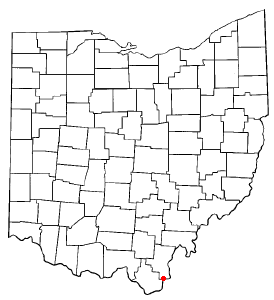
Crown City, Ohio — Village — Location of Crown City, Ohio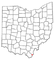
Coordinates: 38°35′25″N 82°17′8″W / 38.59028°N 82.28556°WCoordinates: 38°35′25″N 82°17′8″W / 38.59028°N 82.28556°W Country United States State Ohio County Gallia Township Guyan Area – Total 1.1 sq mi (2.9 km2) – Land 1.1 sq mi (2.8 km2) – Water 0.0 sq mi (0.1 km2) Elevation[1] 571 ft (174 m) Population (2000) – Total 411 – Density 375.7/sq mi (145.1/km2) Time zone Eastern (EST) (UTC-5) – Summer (DST) EDT (UTC-4) ZIP code 45623 Area code(s) 740 FIPS code 39-19554[2] GNIS feature ID 1075656[1] Crown City is a village in Gallia County, Ohio, United States, along the Ohio River. The population was 411 at the 2000 census. It is part of the Point Pleasant, WV–OH Micropolitan Statistical Area.
Contents
Geography
Crown City is located at 38°35′25″N 82°17′8″W / 38.59028°N 82.28556°W (38.590306, -82.285605)[3].
According to the United States Census Bureau, the village has a total area of 1.1 square miles (2.8 km2), of which, 1.1 square miles (2.8 km2) of it is land and 0.04 square miles (0.10 km2) of it (2.68%) is water.
Demographics
As of the census[2] of 2000, there were 411 people, 165 households, and 125 families residing in the village. The population density was 375.7 people per square mile (145.6/km²). There were 194 housing units at an average density of 177.3 per square mile (68.7/km²). The racial makeup of the village was 97.81% White, 0.24% African American, 0.24% from other races, and 1.70% from two or more races. Hispanic or Latino of any race were 1.22% of the population.
There were 165 households out of which 33.3% had children under the age of 18 living with them, 63.6% were married couples living together, 10.3% had a female householder with no husband present, and 24.2% were non-families. 19.4% of all households were made up of individuals and 11.5% had someone living alone who was 65 years of age or older. The average household size was 2.49 and the average family size was 2.85.
In the village the population was spread out with 24.1% under the age of 18, 7.8% from 18 to 24, 29.2% from 25 to 44, 22.9% from 45 to 64, and 16.1% who were 65 years of age or older. The median age was 37 years. For every 100 females there were 86.0 males. For every 100 females age 18 and over, there were 83.5 males.
The median income for a household in the village was $25,909, and the median income for a family was $35,000. Males had a median income of $33,750 versus $16,538 for females. The per capita income for the village was $17,553. About 13.6% of families and 20.0% of the population were below the poverty line, including 31.3% of those under age 18 and 5.8% of those age 65 or over.
Education
Public Education in the village of Crown City is provided by the Fairland Local School District.
See also
References
- ^ a b "US Board on Geographic Names". United States Geological Survey. 2007-10-25. http://geonames.usgs.gov. Retrieved 2008-01-31.
- ^ a b "American FactFinder". United States Census Bureau. http://factfinder.census.gov. Retrieved 2008-01-31.
- ^ "US Gazetteer files: 2010, 2000, and 1990". United States Census Bureau. 2011-02-12. http://www.census.gov/geo/www/gazetteer/gazette.html. Retrieved 2011-04-23.
Municipalities and communities of Gallia County, Ohio Villages Centerville | Cheshire | Crown City | Gallipolis | Rio Grande | Vinton

Townships Addison | Cheshire | Clay | Gallipolis | Green | Greenfield | Guyan | Harrison | Huntington | Morgan | Ohio | Perry | Raccoon | Springfield | Walnut
Unincorporated
communitiesCategories:- Villages in Ohio
- Populated places in Gallia County, Ohio
- Point Pleasant micropolitan area

Wikimedia Foundation. 2010.