- Courtenay, North Dakota
-
Courtenay, North Dakota — City — Location of Courtenay, North Dakota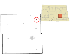
Coordinates: 47°13′23″N 98°34′3″W / 47.22306°N 98.5675°WCoordinates: 47°13′23″N 98°34′3″W / 47.22306°N 98.5675°W Country United States State North Dakota County Stutsman Area – Total 0.4 sq mi (1.1 km2) – Land 0.4 sq mi (1.1 km2) – Water 0.0 sq mi (0.0 km2) Elevation 1,529 ft (466 m) Population (2010)[1] – Total 45 – Density 120.4/sq mi (46.5/km2) Time zone Central (CST) (UTC-6) – Summer (DST) CDT (UTC-5) ZIP code 58426 Area code(s) 701 FIPS code 38-16380[2] GNIS feature ID 1028517[3] Courtenay is a city in Stutsman County, North Dakota in the United States. The population was 45 at the 2010 census.[1] Courtenay was founded in 1893.
Geography
Courtenay is located at 47°13′23″N 98°34′3″W / 47.22306°N 98.5675°W (47.223016, -98.567386)[4].
According to the United States Census Bureau, the city has a total area of 0.4 square miles (1.0 km2), all land.
Demographics
Historical populations Census Pop. %± 1910 539 — 1920 490 −9.1% 1930 350 −28.6% 1940 297 −15.1% 1950 229 −22.9% 1960 168 −26.6% 1970 125 −25.6% 1980 110 −12.0% 1990 70 −36.4% 2000 53 −24.3% 2010 45 −15.1% U.S. Decennial Census As of the census[2] of 2000, there were 53 people, 24 households, and 15 families residing in the city. The population density was 120.4 people per square mile (46.5/km²). There were 30 housing units at an average density of 68.2 per square mile (26.3/km²). The racial makeup of the city was 100.00% White.
There were 24 households out of which 29.2% had children under the age of 18 living with them, 50.0% were married couples living together, 4.2% had a female householder with no husband present, and 37.5% were non-families. 37.5% of all households were made up of individuals and 20.8% had someone living alone who was 65 years of age or older. The average household size was 2.21 and the average family size was 2.87.
In the city the population was spread out with 20.8% under the age of 18, 3.8% from 18 to 24, 30.2% from 25 to 44, 24.5% from 45 to 64, and 20.8% who were 65 years of age or older. The median age was 44 years. For every 100 females there were 112.0 males. For every 100 females age 18 and over, there were 100.0 males.
The median income for a household in the city was $25,938, and the median income for a family was $48,125. Males had a median income of $26,250 versus $50,625 for females. The per capita income for the city was $19,276. There were no families and 5.6% of the population living below the poverty line, including no under eighteens and 33.3% of those over 64.
References
- ^ a b "2010 Census Redistricting Data (Public Law 94-171) Summary File". American FactFinder. United States Census Bureau. http://factfinder2.census.gov/faces/tableservices/jsf/pages/productview.xhtml?pid=DEC_10_PL_GCTPL2.ST13&prodType=table. Retrieved 2 May 2011.
- ^ a b "American FactFinder". United States Census Bureau. http://factfinder.census.gov. Retrieved 2008-01-31.
- ^ "US Board on Geographic Names". United States Geological Survey. 2007-10-25. http://geonames.usgs.gov. Retrieved 2008-01-31.
- ^ "US Gazetteer files: 2010, 2000, and 1990". United States Census Bureau. 2011-02-12. http://www.census.gov/geo/www/gazetteer/gazette.html. Retrieved 2011-04-23.
Municipalities and communities of Stutsman County, North Dakota Cities Buchanan | Cleveland | Courtenay | Jamestown | Kensal | Medina | Montpelier | Pingree | Spiritwood Lake | Streeter | Woodworth
Townships Alexander | Ashland | Bloom | Bloomenfield | Buchana | Chicago | Conklin | Corinne | Corwin | Courtenay | Cusator | Deer Lake | Durham | Edmunds | Eldridge | Flint | Fried | Gerber | Germania | Glacier | Gray | Griffin | Hidden | Homer | Iosco | Jim River Valley | Kensal | Lenton | Lippert | Lowery | Lyon | Manns | Marstonmoor | Midway | Montpelier | Moon Lake | Newbury | Nogosek | Paris | Peterson | Pingree | Pipestem Valley | Plainview | Rose | Round Top | St. Paul | Severn | Sharlow | Sinclair | Spiritwood | Stirton | Streeter | Strong | Sydney | Valley Spring | Wadsworth | Walters | Weld | Windsor | Winfield | Woodbury | Ypsilanti
CDPs Spiritwood | Ypsilanti
Unorganized
territoriesChase Lake | Northwest Stutsman
Unincorporated
communitiesBloom | Clementsville | Durupt | Edmunds | Eldridge | Goldwin | Homer | Johnson | Kloze | Millarton | Parkhurst | Reeves | Sharlow | Sydney | Vashti | Windsor
Categories:- Cities in North Dakota
- Populated places in Stutsman County, North Dakota
- Populated places established in 1893


Wikimedia Foundation. 2010.