- Covington, New York
-
This article is about the town in Wyoming County in Western New York. For the town in Franklin County that borders Canada, see Fort Covington, New York.
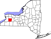
Covington, New York — Town — Location within the state of New York
 Covington, New York
Coordinates: 42°50′23″N 78°0′41″W / 42.83972°N 78.01139°W Country United States State New York County Wyoming Area – Total 26.1 sq mi (67.7 km2) – Land 26.1 sq mi (67.7 km2) – Water 0.0 sq mi (0.0 km2) Elevation 991 ft (302 m) Population (2000) – Total 1,357 – Density 51.9/sq mi (20.0/km2) Time zone Eastern (EST) (UTC-5) – Summer (DST) EDT (UTC-4) FIPS code 36-18696 GNIS feature ID 0978875 Covington is a town in Wyoming County, New York, United States. The population was 1,357 at the 2000 census. The town was named after General Leonard Covington.
The Town of Covington is on eastern border of the county.
Contents
History
The Town of Covington was created in 1817 from the Towns of Perry and Le Roy (in Genesee County).
Geography
According to the United States Census Bureau, the town has a total area of 26.1 square miles (68 km2), all of it land.
The Oatka Creek flows through the Wyoming Valley in the town.
Demographics
As of the census[1] of 2000, there were 1,357 people, 473 households, and 377 families residing in the town. The population density was 51.9 people per square mile (20.1/km²). There were 491 housing units at an average density of 18.8 per square mile (7.3/km²). The racial makeup of the town was 97.27% White, 0.15% African American, 0.37% Native American, 0.29% Asian, 0.29% from other races, and 1.62% from two or more races. Hispanic or Latino of any race were 0.96% of the population.
There were 473 households out of which 34.5% had children under the age of 18 living with them, 67.0% were married couples living together, 7.2% had a female householder with no husband present, and 20.1% were non-families. 15.4% of all households were made up of individuals and 4.4% had someone living alone who was 65 years of age or older. The average household size was 2.87 and the average family size was 3.15.
In the town the population was spread out with 27.6% under the age of 18, 7.3% from 18 to 24, 30.3% from 25 to 44, 24.6% from 45 to 64, and 10.2% who were 65 years of age or older. The median age was 37 years. For every 100 females there were 104.1 males. For every 100 females age 18 and over, there were 106.3 males.
The median income for a household in the town was $40,446, and the median income for a family was $41,683. Males had a median income of $28,676 versus $23,417 for females. The per capita income for the town was $15,745. About 5.5% of families and 8.1% of the population were below the poverty line, including 17.1% of those under age 18 and 3.9% of those age 65 or over.
Communities and locations in Covington
- Boyds Corners – A location in the northeast town corner.
- Covington – A hamlet, also known as Covington Center, located at Routes 246 and 19.
- LaGrange – A hamlet on Route 246 on the south town line.
- Orrs Corners – A location in the northeast corner of the town.
- Pearl Creek – A hamlet near the north town line on Route 19.
- Peoria – A hamlet on Route 63 near the eastern town line.
- Quinlans Corners – A location in the northeast town corner.
- Spragues Corners – A hamlet between Covington and Pearl Creek.
- Wyoming Valley – A valley on the western edge of the town, containing Oatka Creek.
References
- ^ "American FactFinder". United States Census Bureau. http://factfinder.census.gov. Retrieved 2008-01-31.
Municipalities and communities of Wyoming County, New York Towns Arcade | Attica | Bennington | Castile | Covington | Eagle | Gainesville | Genesee Falls | Java | Middlebury | Orangeville | Perry | Pike | Sheldon | Warsaw | Wethersfield
Villages Hamlets Pike | Portageville | Silver Lake | Strykersville
Footnotes ‡This populated place also has portions in an adjacent county or counties
Coordinates: 42°51′12″N 78°00′37″W / 42.85333°N 78.01028°W
Categories:- Towns in New York
- Populated places established in 1817
- Populated places in Wyoming County, New York


Wikimedia Foundation. 2010.