- Orangeville, New York
-
For other places with the same name, see Orangeville (disambiguation).
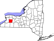
Orangeville, New York — Town — Location within the state of New York
 Orangeville, New York
Coordinates: 42°44′15″N 78°15′55″W / 42.7375°N 78.26528°WCoordinates: 42°44′15″N 78°15′55″W / 42.7375°N 78.26528°W Country United States State New York County Wyoming Area – Total 35.7 sq mi (92.4 km2) – Land 35.6 sq mi (92.1 km2) – Water 0.1 sq mi (0.2 km2) Elevation 1,804 ft (550 m) Population (2000) – Total 1,301 – Density 36.6/sq mi (14.1/km2) Time zone Eastern (EST) (UTC-5) – Summer (DST) EDT (UTC-4) FIPS code 36-55222 GNIS feature ID 0979317 Orangeville is a town in Wyoming County, New York, United States. The population was 1,301 at the 2000 census.
The Town of Orangeville is centrally located in the county. U.S. Route 20A passes across the town.
Contents
History
The Town of Orangeville was established in 1816 from part of the Town of Attica. Orangeville later gave up part of its territory to form the Town of Wethersfield.
Geography
According to the United States Census Bureau, the town has a total area of 35.7 square miles (92 km2), of which, 35.6 square miles (92 km2) of it is land and 0.1 square miles (0.26 km2) of it (0.25%) is water.
Demographics
As of the census[1] of 2000, there were 1,301 people, 485 households, and 358 families residing in the town. The population density was 36.6 people per square mile (14.1/km²). There were 602 housing units at an average density of 16.9 per square mile (6.5/km²). The racial makeup of the town was 99.08% White, 0.08% African American, 0.08% Native American, 0.31% Asian, 0.08% from other races, and 0.38% from two or more races. Hispanic or Latino of any race were 0.31% of the population.
There were 485 households out of which 34.0% had children under the age of 18 living with them, 63.1% were married couples living together, 6.2% had a female householder with no husband present, and 26.0% were non-families. 18.1% of all households were made up of individuals and 5.6% had someone living alone who was 65 years of age or older. The average household size was 2.68 and the average family size was 3.07.
In the town the population was spread out with 26.4% under the age of 18, 6.2% from 18 to 24, 30.6% from 25 to 44, 27.0% from 45 to 64, and 9.8% who were 65 years of age or older. The median age was 37 years. For every 100 females there were 100.2 males. For every 100 females age 18 and over, there were 101.9 males.
The median income for a household in the town was $45,208, and the median income for a family was $49,643. Males had a median income of $36,146 versus $24,615 for females. The per capita income for the town was $18,547. About 7.2% of families and 9.5% of the population were below the poverty line, including 14.7% of those under age 18 and 5.9% of those age 65 or over.
Communities and locations in Orangeville
- Dutch Flats — A hamlet on Buffalo Road near the northern town line.
- Halls Corners — A hamlet on Route 20A near the eastern town line.
- Johnsonburg — A hamlet on the border shared with the Town of Sheldon.
- Orangeville Center — A hamlet on Route 20A in the middle of the town.
- Quaker Town — A hamlet on Route 362 south of Orangeville Center.
References
- ^ "American FactFinder". United States Census Bureau. http://factfinder.census.gov. Retrieved 2008-01-31.
Municipalities and communities of Wyoming County, New York Towns Arcade | Attica | Bennington | Castile | Covington | Eagle | Gainesville | Genesee Falls | Java | Middlebury | Orangeville | Perry | Pike | Sheldon | Warsaw | Wethersfield
Villages Hamlets Pike | Portageville | Silver Lake | Strykersville
Footnotes ‡This populated place also has portions in an adjacent county or counties
Categories:- Towns in New York
- Populated places in Wyoming County, New York


Wikimedia Foundation. 2010.