- Cropston
-
Coordinates: 52°41′N 1°11′W / 52.69°N 1.18°W
Cropston 
Cropston
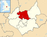
 Cropston shown within Leicestershire
Parish Thurcaston and Cropston District Charnwood Shire county Leicestershire Region East Midlands Country England Sovereign state United Kingdom Post town CROPSTON Postcode district LE7 Dialling code 0116 Police Leicestershire Fire Leicestershire Ambulance East Midlands EU Parliament East Midlands List of places: UK • England • Leicestershire
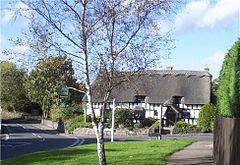
Cropston is a village within the civil parish of Thurcaston & Cropston,[1] part of the Charnwood Borough of Leicestershire, England. It is on the edge of Charnwood Forest, and lies close to Bradgate Park. The village itself is small, with the older properties close to the crossroads of Reservoir and Station Roads. Near the crossroads there are two pubs, The Bradgate Arms and The Badger's Sett (formerly The Reservoir Inn), a post office and a garage. There are a number of cottages dating back to the 16th century. Cropston Reservoir lies between the village and Bradgate Park. The Victorian pumping station next to the reservoir has now been replaced with a more modern facility, but the original engineering can still be seen at the Severn Trent Visitor Centre, which also has an education centre for children.[2] Cropston Cricket Club hold regular fixtures at their Waterfield Road cricket field. [3]The Rothley Brook flows between Cropston and Thurcaston, and other nearby villages include Rothley, Anstey, Swithland and Newtown Linford.
References
External links
- Cropston at Leicestershirevillages.com
- Thurcaston & Cropston Parish Council
- Cropston Pumping Station image at ViewFinder
Towns 
Large villages Anstey • Barrow upon Soar • Birstall • East Goscote • Mountsorrel • Quorn • Rothley • Sileby • Thurmaston
Small villages Barkby • Beeby • Burton on the Wolds • Cossington • Cropston • Hathern • Hoton • Newtown Linford • Queniborough • Ratcliffe on the Wreake • Rearsby • Seagrave • South Croxton • Swithland • Thrussington • Thurcaston • Ulverscroft • Walton on the Wolds • Wanlip • Woodhouse • Woodhouse Eaves • Wymeswold
Hamlets Categories:- Villages in Leicestershire
- Leicestershire geography stubs
Wikimedia Foundation. 2010.

