Cropston Reservoir

Cropston Reservoir
Cropston Reservoir
Location Leicestershire
Coordinates 52°41′37.07″N 1°11′38.68″W / 52.6936306°N 1.1940778°W / 52.6936306; -1.1940778Coordinates: 52°41′37.07″N 1°11′38.68″W / 52.6936306°N 1.1940778°W / 52.6936306; -1.1940778
Lake type reservoir
Primary inflows River Lin
Primary outflows River Lin
Basin countries United Kingdom
Settlements Cropston

Cropston Reservoir lies in Charnwood Forest in Leicestershire, England. The dam and associated water works are in Cropston, while the bulk of the reservoir is in the neighbouring Newtown Linford parish. It was opened in May 1871 in a corner of Bradgate Park, a large expanse of open land just northwest of Leicester. grid reference SK545110

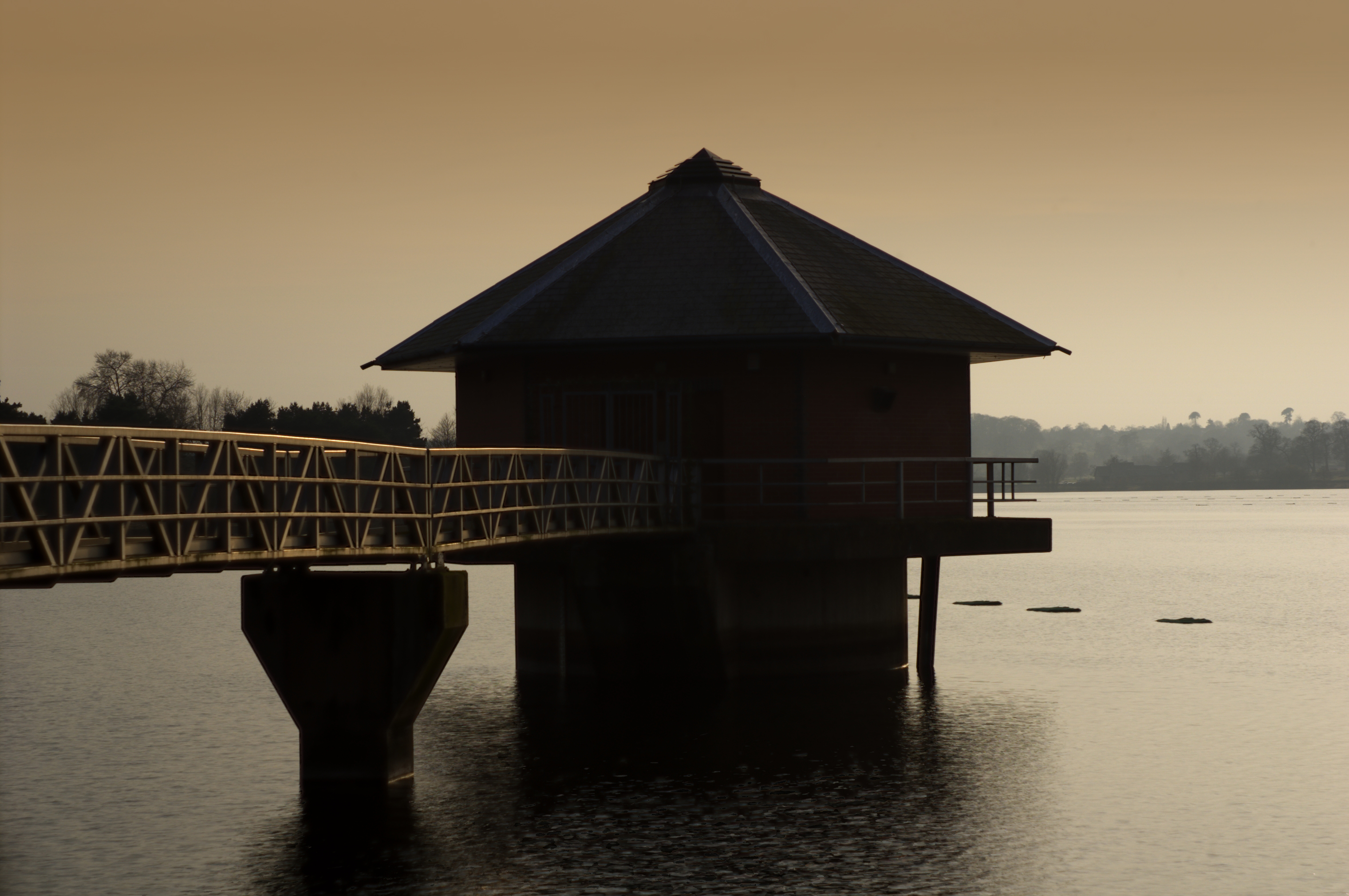
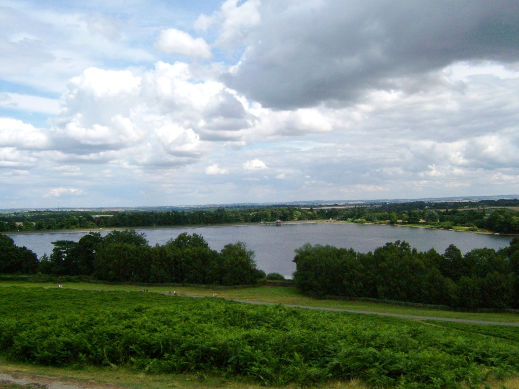
Cropston Reservoir viewed from Bradgate Park


London-based consulting engineer, Thomas Hawksley, was appointed by Leicester Water Works in 1865 to carry out the surveying work. In September 1867, 180 acres of land was purchased adjacent to the deer park at Bradgate Park for a cost of £24,000. A stonewall was built by George Rudkin around the boundary to separate the deer park from the reservoir, at a cost of 8s 10d per yard. The dam is 760 yards long and rises to a height of 51 feet at its highest point, which gives a depth of water of 38 feet. The cost of the dam was £41,356 and the reservoir £8,500 with the contract being awarded to Benton & Woodiwiss of Derby. [1]

The reservoir is formed by the River Lin and is owned and managed by Severn Trent.


References


Wikimedia Foundation. 2010.

Игры ⚽ Поможем решить контрольную работу

Look at other dictionaries:

  • Cropston — Coordinates: 52°41′N 1°11′W / 52.69°N 1.18°W / 52.69; 1.18 …   Wikipedia

  • Thurcaston and Cropston — is a civil parish in Leicestershire, England. It consists of Thurcaston and Cropston. The parish has a population of around 2,000, of which about 1,200 are in Cropston and 800 are in Thurcaston.The villages are separated by the Rothley Brook and… …   Wikipedia

  • Thornton Reservoir — Infobox lake lake name = Thornton Reservoir image lake = ThorntonReservoir.jpg caption lake = The reservoir from the dam image bathymetry = caption bathymetry = location = Leicestershire coords = coord|52|39|50|N|1|18|8|W|type:waterbody… …   Wikipedia

  • Bradgate Park — is a public park in Charnwood Forest, in Leicestershire, England, just northwest of Leicester. It covers 850 acres (3 km²). The park lies between the villages of Newtown Linford, Anstey, Cropston, Woodhouse Eaves and Swithland. The River Lin… …   Wikipedia

  • Charnwood Forest — The summit of Beacon Hill …   Wikipedia

  • List of reservoirs and dams in the United Kingdom — This is a list of reservoirs and dams in the United Kingdom.EnglandBedfordshireBuckinghamshire*Foxcote Reservoir, north of Buckingham *Weston Turville Reservoir, between Weston Turville and WendoverCambridgeshire*Grafham WaterCheshire*Bosley… …   Wikipedia

  • List of lakes in England — This is a list of lakes and reservoirs in England. Largest lakes and reservoirs LakeArea (sq mi)1Windermere5.692Kielder Reservoir3.863Ullswater3.444Bassenthwaite Lake2.065Derwent Water2.06 Lakes larger than 5 hectares This list is restricted to… …   Wikipedia

  • List of dams and reservoirs in the United Kingdom — Contents 1 England 1.1 Bedfordshire 1.2 Buckinghamshire 1.3 …   Wikipedia

  • List of Sites of Special Scientific Interest in Leicestershire — The following is a list of Sites of Special Scientific Interest in the Leicestershire Area of Search, which includes Rutland. For other counties, see List of SSSIs by Area of Search.List of sites* Allexton Wood * Ashby Canal * Bardon Hill *… …   Wikipedia

  • Rothley Brook — The Rothley Brook is a minor waterway in Leicestershire, England. It first becomes noticeable after Thornton Reservoir, near the village of Thornton in the National Forest. It then flows through Desford and Ratby before being joined by a… …   Wikipedia

Share the article and excerpts

Direct link
Do a right-click on the link above
and select “Copy Link”