- Monroe Township, Andrew County, Missouri
-
Monroe Township — Township — 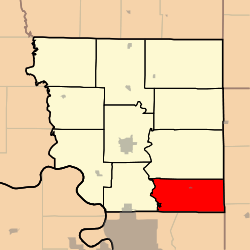
Coordinates: 39°51′23″N 094°40′37″W / 39.85639°N 94.67694°WCoordinates: 39°51′23″N 094°40′37″W / 39.85639°N 94.67694°W Country United States State Missouri County Andrew Area – Total 34.15 sq mi (88.45 km2) – Land 33.92 sq mi (87.85 km2) – Water 0.23 sq mi (0.61 km2) 0.69% Elevation[1] 945 ft (288 m) Population (2000) – Total 777 – Density 22.9/sq mi (8.8/km2) FIPS code 29-49286[2] GNIS feature ID 0766226 Monroe Township is one of ten townships in Andrew County, Missouri, USA. As of the 2000 census, its population was 777.
Geography
Monroe Township covers an area of 34.15 square miles (88.4 km2) and contains one incorporated settlement, Cosby. It contains five cemeteries: Bethel, Brown, Concord, High Prairie and Oak Ridge.
The stream of Long Branch runs through this township.
References
- ^ "US Board on Geographic Names". United States Geological Survey. 2007-10-25. http://geonames.usgs.gov. Retrieved 2008-01-31.
- ^ "American FactFinder". United States Census Bureau. http://factfinder.census.gov. Retrieved 2008-01-31.
External links
Municipalities and communities of Andrew County, Missouri Cities 
Villages Townships Unincorporated
communitiesCategories:- Townships in Andrew County, Missouri
- Missouri geography stubs


Wikimedia Foundation. 2010.