- Medina, New York
-
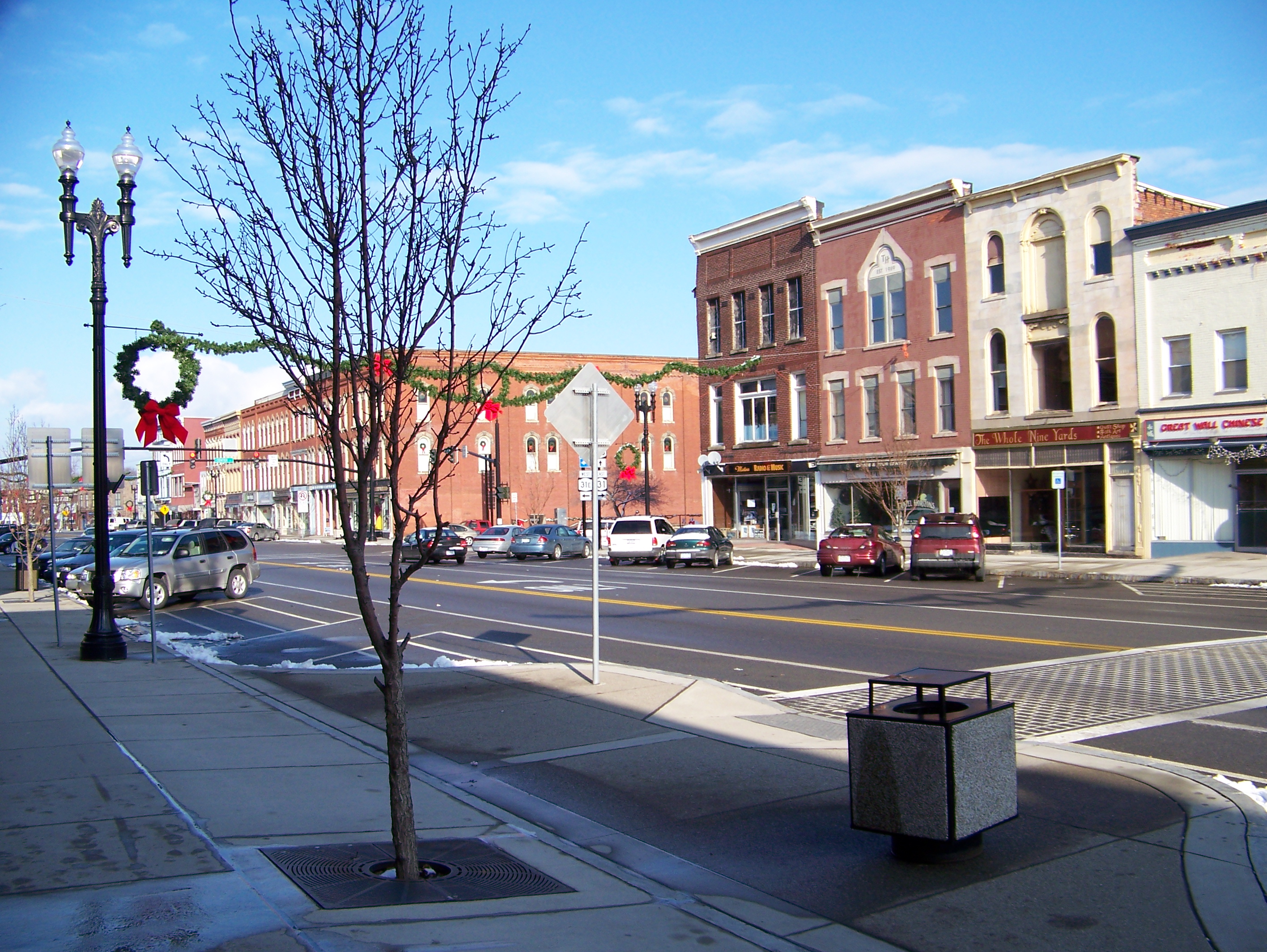
Medina Village  Main and Center Street junction
Country USA State New York Region Western New York County Orleans Towns Ridgeway, Shelby Landmark Erie Canal River Oak Orchard Creek Center Main and Center streets - elevation 525 ft (160 m) - coordinates 43°13′13″N 78°23′12″W / 43.22028°N 78.38667°W Highest point S border of village near SW corner along NY 31 - elevation 590 ft (180 m) - coordinates 43°12′24″N 78°24′15″W / 43.20667°N 78.40417°W Lowest point Glenwood Lake - elevation 453 ft (138 m) - coordinates 43°14′0″N 78°23′21″W / 43.233333°N 78.38917°W Area 3.3 sq mi (9 km2) - water 0.1 sq mi (0 km2) Population 6,415 (2000) Density 1,962.1 / sq mi (758 / km2) Settled 1817 - Incorporated 1832 Government City Hall - location 600 Main St. - elevation 542 ft (165 m) - coordinates 43°13′7″N 78°23′14″W / 43.21861°N 78.38722°W Mayor Adam Tabelski Timezone EST (UTC-5) - summer (DST) EDT (UTC-4) ZIP Code 14103 Area code 585 Exchange 798 FIPS code 36-46415 GNIS feature ID 0956905 
 Location of Medina within New York
Wikimedia Commons: Medina, New York Website: Village of Medina:Homepage Medina is a village in the towns of Shelby and Ridgeway in Orleans County, New York, United States. The population was 6,415 at the 2000 census, making it the second most populous municipality in the county after Albion, the county seat. The village was named by its surveyor. It is part of the Rochester Metropolitan Statistical Area.
It developed from a stopover on the Erie Canal, which bends as it passes through the village, creating a basin that served as a stopover point. Mills on Oak Orchard Creek provided water power, and the fertile lands around it gave it fruit to export via the canal. At the turn of the 20th century the village was a thriving industrial town.
A branch campus of Genesee Community College is located in Medina.
Contents
History
Joseph Ellicott, the agent of the Holland Land Company, once owned land that encompassed part of the village.
Prosperity began around 1825 when the Erie Canal opened passing through Medina.
The Village of Medina was incorporated in 1832, creating an entity contained within the two towns.
Although the towns of Ridgeway and Shelby have begun merging functions, Medina has determined to remain an incorporated village.
Geography
Medina is located at 43°13′11″N 78°23′24″W / 43.21972°N 78.39°W (43.219808, -78.390101)[1].
According to the United States Census Bureau, the village has a total area of 3.3 square miles (8.5 km2), of which, 3.3 square miles (8.5 km2) of it is land and 0.1 square miles (0.26 km2) of it (2.39%) is water.
Medina lies at the junction of east-west highway NYS Route 31 and north-south highway NYS Route 63. In addition, Medina marks the location where NYS Route 31E and NYS Route 31A split off from NY-31.
Demographics
As of the census[2] of 2000, there were 6,415 people, 2,567 households, and 1,576 families residing in the village. The population density was 1,962.1 people per square mile (757.4/km²). There were 2,796 housing units at an average density of 855.2 per square mile (330.1/km²). The racial makeup of the village was 87.89% White, 7.56% African American, 0.59% Native American, 0.56% Asian, 0.03% Pacific Islander, 1.62% from other races, and 1.75% from two or more races. Hispanic or Latino of any race were 3.83% of the population.
There were 2,567 households out of which 31.8% had children under the age of 18 living with them, 42.3% were married couples living together, 15.0% had a female householder with no husband present, and 38.6% were non-families. 32.3% of all households were made up of individuals and 16.3% had someone living alone who was 65 years of age or older. The average household size was 2.41 and the average family size was 3.07.
In the village the population was spread out with 26.9% under the age of 18, 7.9% from 18 to 24, 27.2% from 25 to 44, 20.0% from 45 to 64, and 18.0% who were 65 years of age or older. The median age was 37 years. For every 100 females there were 83.7 males. For every 100 females age 18 and over, there were 80.3 males.
The median income for a household in the village was $30,300, and the median income for a family was $37,857. Males had a median income of $31,857 versus $21,633 for females. The per capita income for the village was $16,138. About 13.0% of families and 16.4% of the population were below the poverty line, including 24.7% of those under age 18 and 4.6% of those age 65 or over.
Additional Medina facts
 "Church In The Middle of the Street" made of Medina Sandstone
Medina is known for its "Medina sandstone" a brown stone used widely in buildings in the region.[3]
In May 2006 New York Governor George Pataki announced the construction of the first ethanol plant in the Northeastern United States. The plant began receiving deliveries of corn in October 2007 [4] and was expected to start production in November 2007.[5] Partial production began shortly thereafter and full production was announced by GreenShift Corporation on Feb, 25, 2008.[6] Since that time, the Western New York Energy, LLC plant has been in production processing significant portions of the local corn crop.[7]
Medina is in Ripley's Believe it or Not for St. John's Episcopal Church which is the "Church in the Middle of the Road"[8] and the Culvert, which is the only place in which a road passes under the Erie Canal.[9]
Medina is home to the Medina Railroad Museum, one of the largest railroad and toy train museums in NY.
One of the oldest homes in Medina exists at 224 Eagle Street, a block from the Erie canal, on the north side of town. This home was built in the early 1820s and was purchased by the Burnam family in the 1830s. It stayed in the family's possession until around 1984.
References
- ^ "US Gazetteer files: 2010, 2000, and 1990". United States Census Bureau. 2011-02-12. http://www.census.gov/geo/www/gazetteer/gazette.html. Retrieved 2011-04-23.
- ^ "American FactFinder". United States Census Bureau. http://factfinder.census.gov. Retrieved 2008-01-31.
- ^ Medina Sandstone on ErieCanalMedina.com
- ^ Slide Show on Niagara Gazette, October 25, 2007
- ^ ORLEANS COUNTY: First corn received at new ethanol plant on Journal Register, October 26, 2007
- ^ GreenShift Press Release
- ^ Western NY Energy LLC Website
- ^ Saint John's Episcopal - Church in the Middle of the Road
- ^ Culvert Under the Erie Canal
External links
Municipalities and communities of Orleans County, New York Towns 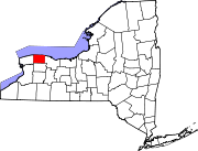
Villages Albion | Holley | Lyndonville | Medina
Hamlets Barre Center | Childs | Millville | Oak Orchard
Categories:- Villages in New York
- Rochester, New York metropolitan area
- Erie Canal
- Populated places established in 1817
- Populated places in Orleans County, New York


Wikimedia Foundation. 2010.