- Denniston, Kentucky
-
Denniston — Unincorporated community — Location within the state of Kentucky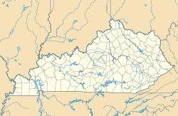
 Denniston
Coordinates: 37°54′57″N 83°32′17″W / 37.91583°N 83.53806°WCoordinates: 37°54′57″N 83°32′17″W / 37.91583°N 83.53806°W Country United States State Kentucky County Menifee Elevation 1,106 ft (337 m) Time zone Eastern (EST) (UTC-5) – Summer (DST) EDT (UTC-4) ZIP codes 40316 FIPS code GNIS feature ID 511788 Denniston is an unincorporated community in Menifee County, Kentucky, United States. It lies along U.S. Route 460 and Kentucky Route 746 southeast of the city of Frenchburg, the county seat of Menifee County.[1] Its elevation is 1,106 feet (337 m).[2] Although it is unincorporated, it has a post office, with the ZIP code of 40316.[3]
Denniston is part of the Mount Sterling Micropolitan Statistical Area.
References
- ^ Rand McNally. The Road Atlas '06. Chicago: Rand McNally, 2006, p. 43.
- ^ U.S. Geological Survey Geographic Names Information System: Denniston, Kentucky, Geographic Names Information System, 1979-09-20. Accessed 2008-01-03.
- ^ Zip Code Lookup
Municipalities and communities of Menifee County, Kentucky City 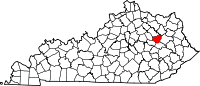
Unincorporated
communitiesDenniston | Korea | Mariba | Means | Pomeroyton | Scranton | Sudith | Wellington
Categories:- Kentucky geography stubs
- Populated places in Menifee County, Kentucky
- Unincorporated communities in Kentucky
- Mount Sterling micropolitan area


Wikimedia Foundation. 2010.