- Dardenne Prairie, Missouri
-
Dardenne Prairie, Missouri — Town — 
SealLocation in the state of Missouri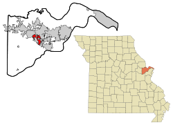
Coordinates: 38°45′15″N 90°43′50″W / 38.75417°N 90.73056°WCoordinates: 38°45′15″N 90°43′50″W / 38.75417°N 90.73056°W Country United States State Missouri County St. Charles Incorporated 1983 (town), 2001 (city) Government – Mayor Pamela Fogarty Area – Total 4.37 sq mi (11.31 km2) – Land 4.37 sq mi (11.31 km2) – Water 0.00 sq mi (0.00 km2) 0% Elevation 614 ft (187 m) Population (2000) – Total 4,384 – Density 1,004.28/sq mi (387.75/km2) Time zone CST (UTC-6) – Summer (DST) CDT (UTC-5) FIPS code 29-18253[1] GNIS feature ID 1669603[2] Website http://www.dardenneprairie.org/ Dardenne Prairie is a city in St. Charles County, Missouri, United States. The population was 4,384 at the 2000 census.
Contents
Geography
Dardenne Prairie is located at 38°45′15″N 90°43′50″W / 38.75417°N 90.73056°W (38.754068, -90.730655).[3] According to the United States Census Bureau, the town has a total area of 4.4 square miles (11.3 km²), all of it land.
History
The town is the namesake of the Dardenne family, early settlers in the Mississippi Valley. Prior to settlement, the area was a prairie, and today has relatively few trees compared to the surrounding lower-lying areas. The town was incorporated in 1983, and was certified as a fourth-class city in 2001.[citation needed] Melissa Witte was its first natural born citizen.
Marilyn Field was the first mayor of the town; she served from 2001 until her resignation in 2003. Her term was finished by the President of the Board of Aldermen, Terry Matejka, who served as Mayor Pro Tem until current mayor Pam Fogarty was elected to a two-year term. Fogarty was re-elected as Dardenne Prairie mayor in April 2005, and received a four-year term through 2009. The town is in transition from farming to suburban tract development.[citation needed]
In October 2006, controversy focused on Dardenne Prairie after the suicide of Megan Meier, a Dardenne Prairie teenager who committed suicide after internet harassment.[4]
Demographics
As of the census[1] of 2000, there were 4,384 people, 1,431 households, and 1,273 families residing in the city. The population density was 1,004.3 people per square mile (387.3/km²). There were 1,516 housing units at an average density of 347.3 per square mile (133.9/km²). The racial makeup of the town was 96.42% White, 1.67% African American, 0.11% Native American, 0.96% Asian, 0.07% Pacific Islander, 0.36% from other races, and 0.41% from two or more races. Hispanic or Latino of any race were 0.96% of the population.
There were 1,431 households out of which 48.8% had children under the age of 18 living with them, 84.3% were married couples living together, 3.3% had a female householder with no husband present, and 11.0% were non-families. 8.5% of all households were made up of individuals and 2.1% had someone living alone who was 65 years of age or older. The average household size was 3.05 and the average family size was 3.25.
In the city the population was spread out with 32.3% under the age of 18, 3.9% from 18 to 24, 37.1% from 25 to 44, 19.7% from 45 to 64, and 7.0% who were 65 years of age or older. The median age was 34 years. For every 100 females there were 99.5 males. For every 100 females age 18 and over, there were 97.3 males.
The median income for a household in the city was $77,086, and the median income for a family was $80,486. Males had a median income of $56,780 versus $30,037 for females. The per capita income for the city was $29,325. None of the families and 0.7% of the population were living below the poverty line, including no one under the age of 18 and 3.0% of those over 64.
The city has grown to 11,494 residents, according to the 2010 census.
Education
Dardenne Prairie spans the Fort Zumwalt, Wentzville and Francis Howell School Districts.
References
- ^ a b "American FactFinder". United States Census Bureau. http://factfinder.census.gov. Retrieved 2008-01-31.
- ^ "US Board on Geographic Names". United States Geological Survey. 2007-10-25. http://geonames.usgs.gov. Retrieved 2008-01-31.
- ^ "US Gazetteer files: 2010, 2000, and 1990". United States Census Bureau. 2011-02-12. http://www.census.gov/geo/www/gazetteer/gazette.html. Retrieved 2011-04-23.
- ^ Key events in the Megan Meier case." Associated Press at USA Today. May 15, 2008. Retrieved on August 14, 2009. The town has been working on a New Urbanist downtown surrounding ICD Church at Highway N and Hanley Road. To date, the new Dardenne Prairie City Hall and St. Williams Senior Center are completed. In 2010 the Mayor is Pam Fogarty, elected until 2012 and Alderman Scott Kolbe, Dave Kampelman, Bob Menichino, Kevin Harris, Mike Conroy and Sharon West.
External links
Municipalities and communities of St. Charles County, Missouri Cities Augusta | Cottleville | Dardenne Prairie | Flint Hill | Foristell‡ | Lake St. Louis | New Melle | O'Fallon | Portage Des Sioux | St. Charles | St. Peters | St. Paul | Weldon Spring | Wentzville | West Alton

Villages Townships Blanchette | Boone | Cottleville | Dardenne | Friedens | Frontier | Harvester | Lindenwood | O'Fallon | Rivers | St. Peters | Spencer Creek | Wentzville | Zumbehl
Unincorporated
communitiesDefiance | Harvester | Matson | Nona | Orchard Farm | Seeburger
Footnotes ‡This populated place also has portions in an adjacent county or counties
Categories:- Cities in St. Charles County, Missouri
- Populated places established in 1983


Wikimedia Foundation. 2010.