- Sugarloaf Mountain (Franklin County, Massachusetts)
-
This article is about Sugarloaf Mountain in Franklin County, Massachusetts. For other summits by the same name, see Sugarloaf (mountain).
Sugarloaf Mountain (South Sugarloaf and North Sugarloaf) 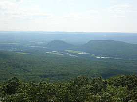
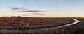
South and North Sugarloaf viewed from Mt. TobyElevation 652 ft (199 m) and 791 ft (241 m) Location Location Deerfield, Massachusetts Range Pocumtuck Range/ Metacomet Ridge Coordinates 42°28′22″N 72°35′51″W / 42.47278°N 72.5975°WCoordinates: 42°28′22″N 72°35′51″W / 42.47278°N 72.5975°W and 42°29′28″N 72°35′53″W / 42.49111°N 72.59806°W Geology Type Fault-block; sedimentary Age of rock 210 million yrs. Climbing Easiest route Auto road Sugarloaf Mountain or Mount Sugarloaf, is a butte-like mountain located in Deerfield, Massachusetts, United States, with two summits, North Sugarloaf Mountain 791 ft (241 m) and its more popular knee, South Sugarloaf Mountain 652 ft (199 m). Its cliffs, made of arkose sandstone, are a very prominent landscape feature visible for miles. Despite the low elevation of the summits to the nearby Berkshire Mountains, dramatic cliff faces and a rise of 500 to 600 feet (180 m) from the nearby Connecticut River make the mountain a popular tourist and hiking destination. Sugarloaf Mountain is the southern terminus of the Pocumtuck Range.
Contents
Origin of the name

The name sugarloaf refers to the loaf-like shape that sugar was once molded into for shipment. The names Sugarloaf Mountain and Mount Sugarloaf are both used to describe this mountain. USGS sources and published hiking maps refer to (North and South) Sugarloaf Mountain. However, the Massachusetts state reservation encompassing them is called the Mount Sugarloaf State Reservation. The name Mount Sugarloaf is sometimes used to describe only the south summit,[1] and the north summit is sometimes described as the Pocumtuck Ridge.[2] Both names are used locally.[3][4][5]
The original Native American name for the mountain is Wequamps (or Wequomps). The root wehqu- in this name or weckw- in Weckwannuck "Sugarloaf Brook" means "at the point of or extremity of" and occurs in placenames indicating a stopping point. According to native American myth, Sugarloaf Mountain is the carcass of a human-eating giant beaver who lived in a lake now occupied by the Connecticut River. The beaver was killed by the benevolent spirit Hobomock. There may be some truth to this tale; 15,000 years ago the Connecticut River from northern Vermont to southern Connecticut was a post-glacial lake. A now extinct species of giant beaver as big as black bears once inhabited North America at about the same time (see Pocumtuck Range for details).[2]
Geology
Sugarloaf Mountain, geologically contiguous with the Pocumtuck Ridge to the north, is composed of sedimentary arkose sandstone. It is associated with the geologic processes which created the Metacomet Ridge which extends through New England from Long Island Sound to the Vermont border. Mount Sugarloaf is the bottom layer of a geologic layer cake. The middle layer is composed basalt; it is most visible as part of the geology of the Pocumtuck Ridge to the north. The top (youngest) layer is composed of conglomerate (known as Mount Toby Conglomerate), which makes up Mount Toby directly across the Connecticut River from Sugarloaf Mountain. About 200 million years ago, as the continent of North America began rifting apart from Africa and Eurasia, a series of erosion and deposition episodes interspersed with heavy basalt lava flows created this layer cake. Faulting and earthquakes tilted the layers diagonally; subsequent erosion and glacial activity exposed the tilted "layers" of sandstone, basalt, and erosion-resistant conglomerate visible today. Although not composed of trap rock, Sugarloaf Mountain is a closely associated with the Metacomet Ridge by virtue of its origin via the same rifting and uplift that created those mountains.[6][7]
Recreation
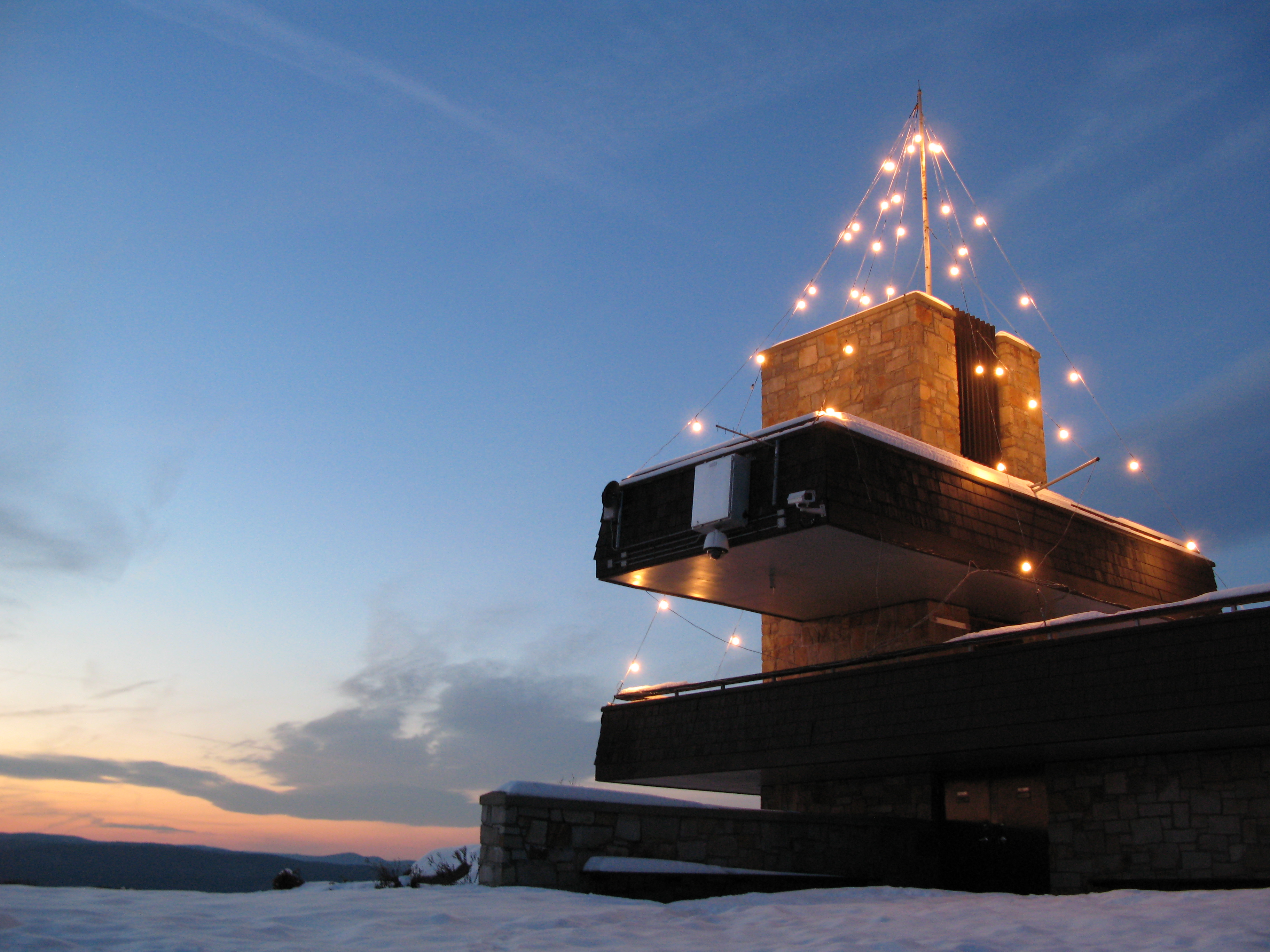
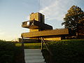 South Sugarloaf observation platform
A seasonal auto road climbs the summit of South Sugarloaf (open late spring through the fall foliage season), and a small seasonal observation tower is located on the summit. Several steep hiking trails, including the 20-mile (32 km) Pocumtuck Ridge Trail, make the mountain a favorite local hiking destination.[3][8]
Most of the mountain has been conserved as part of the Mount Sugarloaf State Reservation. The reservation is easily accessible via Route 116 and is only a 15 minute drive from the University of Massachusetts, Amherst campus. There is parking at the base of the mountain and at the top of the paved road that leads from the parking area to the summit of South Sugarloaf. It is free to hike the trails or climb the road by foot or by bike, but there is a nominal fee for vehicles.[9] North Sugarloaf Mountain is only accessible by foot; a small cave is located just beneath the summit ledges.
Film and television
In Fall 2008, the Mel Gibson film Edge of Darkness was filmed at the summit of South Sugarloaf. The observation tower was temporarily renovated for the film.[10]
See also
- Information specific to the Mount Sugarloaf State Reservation.
- Mount Sugarloaf and Sugarloaf Mountain are also the names of numerous other hills and mountains worldwide. Several nearby mountains with the name "Sugarloaf" are located in Maine, Vermont, New Hampshire, and Connecticut.
Gallery
-
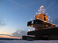
Observation Deck on Mt Sugarloaf in South Deerfield MA.
-
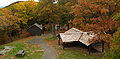
Picnic Grove on Mt Sugarloaf, South Deerfield MA
-
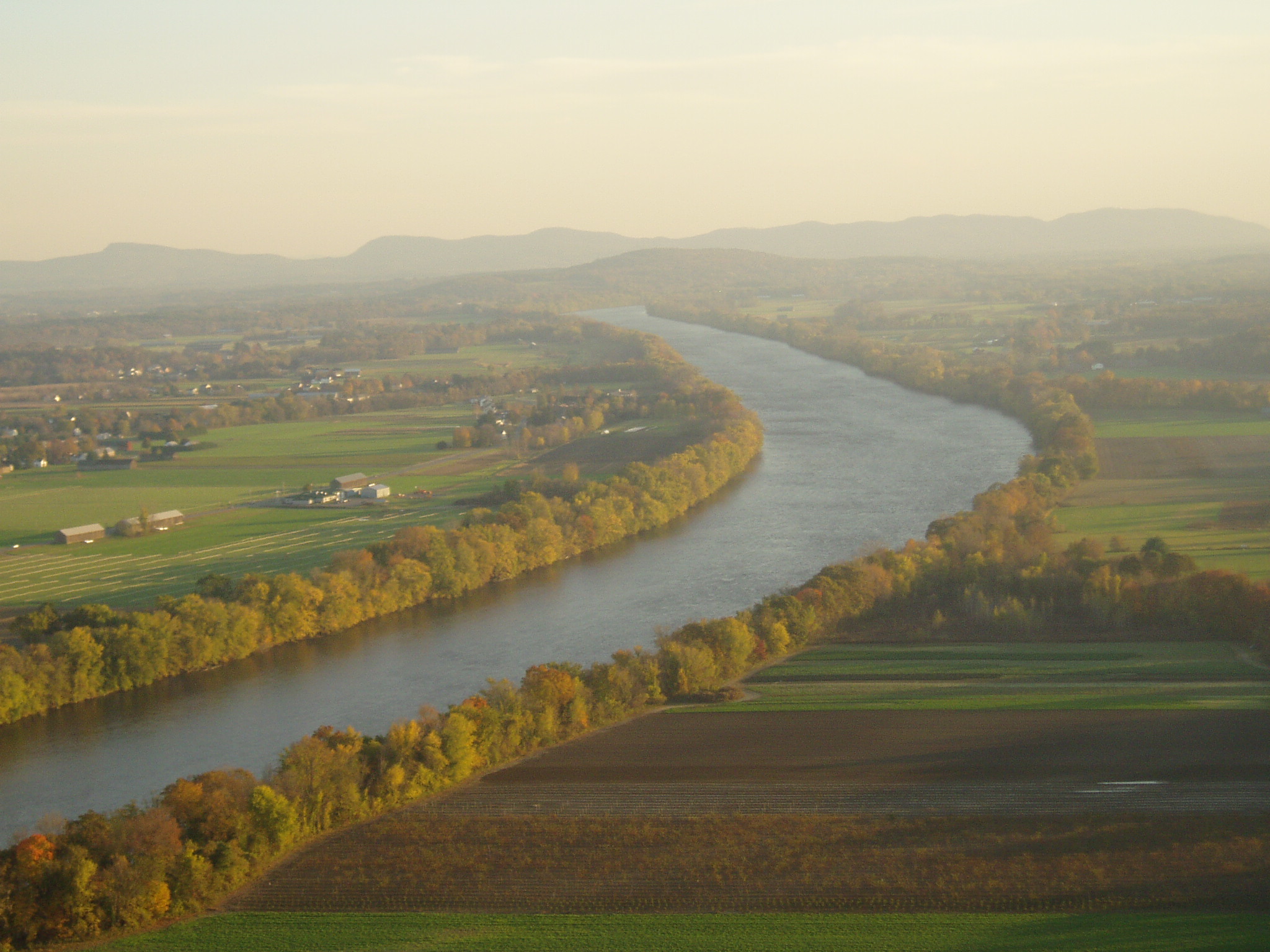
View of the Connecticut River and the Pioneer Valley looking East South East from Mt Sugarloaf in South Deerfield MA.
-

South Sugarloaf. 1910 postcard.
References
- ^ Massachusetts Trail Guide 8th ed. Appalachian Mountain Club. Boston, 2004.
- ^ a b Connecticut River Home Page. Cited Dec. 17, 2007
- ^ a b AMC massachusetts and Rhode Island Trail Guide. 6th ed. Appalachian Mountain Club, Boston, Massachusetts, 1989.
- ^ Christopher J. Ryan. “Mount Toby Trail Map.” Fourth edition. Newall Printing, Amherst, Massachusetts, 1999.
- ^ [1] United States Board on Geographic Names. Cinted Dec. 5, 2007
- ^ "Stratigraphy and Paleocology of the Deerfield Rift Basin (Triassic-Jurassic, Newark Supergroup), Massachusetts." Guidebook for Field Trips in the Connecticut Valley Region of Massachusetts and Adjacent States. vol. 2, 84th annual meeting, New England Intergollegiate Geological Conference, The Five Colleges. Amherst, Massachusetts. October 9–10-11, 1992: 488-535. Cited from the web, Dec. 1, 2007.
- ^ Raymo, Chet and Maureen E.Written in Stone: A Geologic History of the Northeastern United States. Globe Pequot, Chester, Connecticut, 1989.
- ^ [2] South Sugarloaf Mountain - FranklinSites.com Hiking Guide
- ^ http://www.mass.gov/dcr/parks/central/msug.htm Massachusetts DCR. Cited Dec. 5, 2007
- ^ http://www.recorder.com/story.cfm?id_no=5330140
External links
Categories:- Deerfield, Massachusetts
- Mountains of Massachusetts
- Pocumtuck Range
- Landforms of Franklin County, Massachusetts


Wikimedia Foundation. 2010.