- Olean, Missouri
-
Olean, Missouri — Village — Location of Olean, Missouri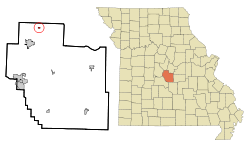
Coordinates: 38°24′38″N 92°31′44″W / 38.41056°N 92.52889°WCoordinates: 38°24′38″N 92°31′44″W / 38.41056°N 92.52889°W Country United States State Missouri County Miller Area – Total 0.2 sq mi (0.4 km2) – Land 0.2 sq mi (0.4 km2) – Water 0.0 sq mi (0.0 km2) Elevation 774 ft (236 m) Population (2000) – Total 157 – Density 922.0/sq mi (356.0/km2) Time zone Central (CST) (UTC-6) – Summer (DST) CDT (UTC-5) ZIP code 65064 Area code(s) 573 FIPS code 29-54560[1] GNIS feature ID 0729593[2] Olean is a village in Miller County, Missouri, United States. The population was 157 at the 2000 census, at which time it was a town.
Geography
Olean is located at 38°24′38″N 92°31′44″W / 38.41056°N 92.52889°W (38.410498, -92.528873)[3].
According to the United States Census Bureau, the town has a total area of 0.2 square miles (0.4 km²), all of it land.
Demographics
As of the census[1] of 2000, there were 157 people, 62 households, and 40 families residing in the town. The population density was 922.0 people per square mile (356.6/km²). There were 67 housing units at an average density of 393.4 per square mile (152.2/km²). The racial makeup of the town was 97.45% White, 1.27% Native American, and 1.27% from two or more races.
There were 62 households out of which 41.9% had children under the age of 18 living with them, 38.7% were married couples living together, 22.6% had a female householder with no husband present, and 33.9% were non-families. 29.0% of all households were made up of individuals and 12.9% had someone living alone who was 65 years of age or older. The average household size was 2.53 and the average family size was 3.10.
In the town the population was spread out with 36.9% under the age of 18, 8.3% from 18 to 24, 30.6% from 25 to 44, 12.7% from 45 to 64, and 11.5% who were 65 years of age or older. The median age was 30 years. For every 100 females there were 98.7 males. For every 100 females age 18 and over, there were 80.0 males.
The median income for a household in the town was $18,333, and the median income for a family was $21,667. Males had a median income of $24,167 versus $22,000 for females. The per capita income for the town was $10,296. About 17.4% of families and 24.0% of the population were below the poverty line, including 18.4% of those under the age of eighteen and 48.1% of those sixty five or over.
References
- ^ a b "American FactFinder". United States Census Bureau. http://factfinder.census.gov. Retrieved 2008-01-31.
- ^ "US Board on Geographic Names". United States Geological Survey. 2007-10-25. http://geonames.usgs.gov. Retrieved 2008-01-31.
- ^ "US Gazetteer files: 2010, 2000, and 1990". United States Census Bureau. 2011-02-12. http://www.census.gov/geo/www/gazetteer/gazette.html. Retrieved 2011-04-23.
Municipalities and communities of Miller County, Missouri Cities Bagnell | Eldon | Iberia | Lake Ozark‡ | Lakeside | Osage Beach‡

Villages Brumley | Olean | St. Elizabeth | Tuscumbia
Unincorporated
communitiesEtterville | Kaiser | Ulman
Footnotes ‡This populated place also has portions in an adjacent county or counties
Categories:- Villages in Miller County, Missouri


Wikimedia Foundation. 2010.