- Climax Springs, Missouri
-
Climax Springs, Missouri — Village — Location of Climax Springs, Missouri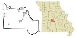
Coordinates: 38°6′13″N 93°3′5″W / 38.10361°N 93.05139°WCoordinates: 38°6′13″N 93°3′5″W / 38.10361°N 93.05139°W Country United States State Missouri County Camden Area - Total 0.3 sq mi (0.7 km2) - Land 0.3 sq mi (0.7 km2) - Water 0.0 sq mi (0.0 km2) Elevation 971 ft (296 m) Population (2000) - Total 80 - Density 294.6/sq mi (113.8/km2) Time zone Central (CST) (UTC-6) - Summer (DST) CDT (UTC-5) ZIP code 65324 Area code(s) 573 FIPS code 29-14914[1] GNIS feature ID 0755543[2] Climax Springs is a village in Camden County, Missouri, United States. The population was 80 at the 2000 census.
Contents
History
A large spring flowing out of the hillside was discovered when A.R. Jackson & W.W. Hockman were traveling from the then county seat of Linn Creek to Edwards, MO. In 1880, Mr. Hockman was quoted as saying, “This caps the climax”. When the town was formed and other springs were found, this quote inspired the name “Climax Springs”. In 1882 he first house built in the village. The first store and a log hotel were also built that year. A group of men formed the Climax Association in 1883 based on the possibilities of the “health benefits” of the waters from the main spring and seven others located nearby. In 1883, to take advantage of the springs, they built the large white frame hotel that still stands. Later on the town had a drug store, a blacksmith shop, a shoemaker, and a school with 20 pupils. Not long after, part of the Climax Springs school burned down and was rebuilt shortly thereafter. The town had one church, United Brethren, and three doctors. Climax Springs was a thriving small town until the mid-1980s when it started to enter a gradual decline. Currently the old section of the town is mostly abandoned. Today most of the town's businesses are located at the south end on Missouri Route 7. These businesses included a realty office, bank, concrete company, garage, small restaurant, a US post office, a small grocery/general store, and a building materials center. There is also a community center that serves as a meeting place for a variety of community groups. The Veteran's of Foreign Wars has a chapter also. Today, as you enter Climax Springs, you notice that it still remains a small community with a population of 80. The town is part of the Climax Springs R-4 School District and has a Pre-K-12 school. The school has been improving greatly in recent years and is now being recognized as a leader in technology integration. In 2009 a new, modern library and a convenience store were built. There is a local legend that the entire town of Climax Springs is formed over an underwater cave. This has been talked about for years but these rumors have never been substantiated.
Geography
Climax Springs is located at 38°6′13″N 93°3′5″W / 38.10361°N 93.05139°W (38.103626, -93.051339)[3]. According to the United States Census Bureau, the village has a total area of 0.3 square miles (0.78 km2), all of it land. The town is located on a ridge-like landform in the northern Ozarks. It is about six miles south of the Lake of the Ozarks, and about 3.5 miles north of the Little Niangua River. The area just southeast of Climax Springs is called Kolb Hollow with the Kolb Creek running through it.
Demographics
As of the census[1] of 2000, there were 80 people, 37 households, and 19 families residing in the village. The population density was 294.6 people per square mile (114.4/km²). There were 45 housing units at an average density of 165.7 per square mile (64.4/km²). The racial makeup of the village was 97.50% White, 1.25% Native American, and 1.25% from two or more races.
There were 37 households out of which 32.4% had children under the age of 18 living with them, 37.8% were married couples living together, 10.8% had a female householder with no husband present, and 48.6% were non-families. 40.5% of all households were made up of individuals and 13.5% had someone living alone who was 65 years of age or older. The average household size was 2.16 and the average family size was 2.95.
In the village the population was spread out with 23.8% under the age of 18, 10.0% from 18 to 24, 30.0% from 25 to 44, 22.5% from 45 to 64, and 13.8% who were 65 years of age or older. The median age was 38 years. For every 100 females there were 105.1 males. For every 100 females age 18 and over, there were 110.3 males.
The median income for a household in the village was $30,000, and the median income for a family was $43,750. Males had a median income of $21,875 versus $18,125 for females. The per capita income for the village was $13,620. There were no families and 8.4% of the population living below the poverty line, including no under eighteens and 11.8% of those over 64.
References
- ^ a b "American FactFinder". United States Census Bureau. http://factfinder.census.gov. Retrieved 2008-01-31.
- ^ "US Board on Geographic Names". United States Geological Survey. 2007-10-25. http://geonames.usgs.gov. Retrieved 2008-01-31.
- ^ "US Gazetteer files: 2010, 2000, and 1990". United States Census Bureau. 2011-02-12. http://www.census.gov/geo/www/gazetteer/gazette.html. Retrieved 2011-04-23.
Municipalities and communities of Camden County, Missouri Cities Camdenton | Lake Ozark‡ | Linn Creek | Macks Creek | Osage Beach‡ | Richland‡

Villages Climax Springs | Stoutland‡ | Sunrise Beach‡ | Village of Four Seasons
Townships Unincorporated
communitiesBranch | Hurricane Deck | Kaiser | Montreal | Roach
Footnotes ‡This populated place also has portions in an adjacent county or counties
Categories:- Villages in Camden County, Missouri
- Populated places established in 1882


Wikimedia Foundation. 2010.