- Oshawa Airport
-
Oshawa Municipal Airport
Toronto/Oshawa Municipal AirportIATA: YOO – ICAO: CYOO
– WMO: 71697Summary Airport type Public Operator City of Oshawa Location Oshawa, Ontario Elevation AMSL 459 ft / 140 m Coordinates 43°55′22″N 078°53′48″W / 43.92278°N 78.89667°WCoordinates: 43°55′22″N 078°53′48″W / 43.92278°N 78.89667°W Website Map Location in Ontario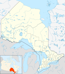
 CYOO
CYOORunways Direction Length Surface ft m 05/23 2,654 809 Asphalt 12/30 4,000 1,219 Asphalt Statistics (2010) Aircraft movements 50,331 Sources: Canada Flight Supplement[1]
Environment Canada[2]
Movements from Statistics Canada[3]Oshawa Municipal Airport, (IATA: YOO, ICAO: CYOO), is a municipal airport adjacent to the north end of the city of Oshawa, Ontario, Canada. Oshawa Airport is one of the major general aviation airports in the Greater Toronto Area It includes two paved runways and instrument approaches. From 2002 to 2008, Oshawa hosted the annual Canadian Aviation Expo, Canada's largest annual aviation event, before the expo moved to Hamilton, Ontario in 2009.
The airport is classified as an airport of entry by NAV CANADA and is staffed by the Canada Border Services Agency. CBSA officers at this airport currently can handle aircraft with no more than 50 passengers.[1]
The airport originally opened in June 1941 under the British Commonwealth Air Training Plan as No. 20 Elementary Flying Training School RCAF Station Oshawa. Student flyers used Tiger Moth aircraft and were trained by civilian instructors from the Oshawa, Kingston, and Brant-Norfolk flying clubs. A relief landing field was located at Whitby. The school closed in December 1944.
The planned construction of a Pickering Airport, between Oshawa and Toronto, raised questions about the future of the Oshawa airport. However, there remains strong opposition to the construction of the Pickering Airport, as this project has been a false-start since the conception of the idea in 1972. Additionally, the Greater Toronto Airports Authority (GTAA) lacks the authority to decommission Oshawa Airport because it is outside their jurisdiction.
In 2008 the City of Oshawa adopted the Oshawa Municipal Airport Business Plan which includes a commitment to operate the airport for a minimum of 25 years. Dozens of upgrades completed by 2010 include construction of new Taxiway "C", Phase 1 of Hangarminium Complex, cardlock fuel facility, and Automated Weather Observation System.
Commercial radio stations CKDO and CKGE-FM, licensed to Oshawa, and CJKX, licensed to Ajax, operate from studios on the Oshawa Airport grounds. These organizations operate on former airport land at the entrances to the airport on Taunton Road: Mandarin Chinese Buffet restaurant; Taunton Health Centre, part of the largest, multi-specialty medical group practice in Canada, including Urgent Care, Laboratory, Pharmacy and a dental office; Airport Self Storage Ltd., with ten buildings on six acres; National Defence, The Ontario Regiment, Royal Canadian Armoured Corps, Oshawa Airport Armoury; and the Durham Children's Aid Society.
A live fire training simulator opened south of the control tower in October 2009. It is a partnership between Durham College and the fire departments of Clarington, Oshawa and Whitby.
Contents
Airport Data
- 1 Runway 12/30: 4,000 × 100 ft (1,219 × 30 m)
- 2 Runway 05/23: 2,654 × 100 ft (809 × 30 m)
- Navigational Aids Air Traffic Control: LOC/DME - 111.35 and Tower - 120.10
Tenants
- NovaJet (Worldwide Executive Aircraft Charter)
- Aerographic
- Air Express Ontario
- Enterprise Airlines
- Canadian Flight Academy
- Corporate Aircraft Restorations
- Nav Canada - Control Tower
- Canada Customs
- Canadian Aviation Expo
- Durham Flight Centre (Flight Training)
- Durham Regional Police Air Support Unit
- Graham Energy
- Oshawa Military and Industrial Museum
- Robert Stuart Aviation Museum
- Skyway Cafe
- Jeffery Homes
- Oshawa Airport Golf Club
- Oshawa COPA Flight 70, Canadian Owners And Pilots Association
- Recreational Aircraft Association, Oshawa District
- R.C.A.F. 420 Wing, Royal Canadian Air Force Association
- Roaero Aircraft Handling
- Triumph Airways
- W.G. Cox Aviation Supply
- Durham Region Branch, Ontario Genealogical Society (in NavCanada building)
- Gemini Gymnastics, in Hangar 3
- KX 96*
- CKDO 1580AM/107.7FM
- 94.9 The Rock
Emergency services
History
- In 2005 and 2006 the Canadian Forces Snowbirds flew 3 Airshows around the airport and over Oshawa's lake view park during the Canadian Aviation Expo.
- The airport is frequently used for Canadian Airforce C-17 Globemaster low level training passes.
See also
References
- ^ a b Canada Flight Supplement. Effective 0901Z 20 October 2011 to 0901Z 15 December 2011
- ^ Synoptic/Metstat Station Information
- ^ Total aircraft movements by class of operation — NAV CANADA towers
External links
Airports in Canada By name A–B · C–D · E–G · H–K · L–M · N–Q · R–S · T–ZBy location indicator CA · CB · CC · CD · CE · CF · CG · CH · CI · CJ · CK · CL · CM · CN · CO · CP · CR · CS · CT · CV · CW · CY · CZBy province/territory National Airports System Calgary · Charlottetown · Edmonton · Fredericton · Gander · Halifax · Iqaluit · Kelowna · London · Moncton · Montréal-Mirabel · Montréal-Trudeau · Ottawa · Prince George · Québec · Regina · Saint John · St. John's · Saskatoon · Thunder Bay · Toronto · Vancouver · Victoria · Whitehorse · Winnipeg · YellowknifeRelated List of airports by ICAO code: C · List of defunct airports in Canada · List of heliports in Canada · List of international airports in Canada · National Airports System · Operation Yellow RibbonCategories:- Airports in Ontario
- Transportation in Durham Region
- Oshawa

Wikimedia Foundation. 2010.