- Montrose, Minnesota
-
Montrose, Minnesota — City — Location of Montrose, Minnesota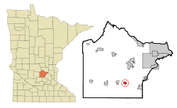
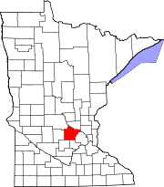
Coordinates: 45°4′2″N 93°54′45″W / 45.06722°N 93.9125°W Country United States State Minnesota County Wright Area – Total 1.0 sq mi (2.5 km2) – Land 1.0 sq mi (2.5 km2) – Water 0.0 sq mi (0.0 km2) Elevation 994 ft (303 m) Population (2010)[1] – Total 2,847 – Density 1,190.4/sq mi (459.6/km2) Time zone Central (CST) (UTC-6) – Summer (DST) CDT (UTC-5) ZIP code 55363 Area code(s) 763 FIPS code 27-43810[2] GNIS feature ID 0648049[3] Website http://www.montrose-mn.com Montrose is a city in Wright County, Minnesota, United States. The population was 2,847 at the 2010 census.[1]
Contents
Geography
According to the United States Census Bureau, the city has a total area of 1.0 square mile (2.6 km2), of which, 1.0 square mile (2.6 km2) of it is land and 1.03% is water. U.S. Route 12 and Minnesota State Highway 25 are two of the main routes in the community.
Demographics
As of the census[2] of 2000, there were 1,143 people, 454 households, and 281 families residing in the city. The population density was 1,190.4 people per square mile (459.7/km²). There were 467 housing units at an average density of 486.3 per square mile (187.8/km²). The racial makeup of the city was 97.20% White, 0.70% African American, 0.17% Asian, 1.31% from other races, and 0.61% from two or more races. Hispanic or Latino of any race were 1.31% of the population.
There were 454 households out of which 36.6% had children under the age of 18 living with them, 51.1% were married couples living together, 6.8% had a female householder with no husband present, and 37.9% were non-families. 30.8% of all households were made up of individuals and 7.3% had someone living alone who was 65 years of age or older. The average household size was 2.52 and the average family size was 3.18.
In the city the population was spread out with 28.7% under the age of 18, 11.6% from 18 to 24, 34.1% from 25 to 44, 17.7% from 45 to 64, and 7.9% who were 65 years of age or older. The median age was 30 years. For every 100 females there were 107.4 males. For every 100 females age 18 and over, there were 107.9 males.
The median income for a household in the city was $39,583, and the median income for a family was $52,833. Males had a median income of $31,434 versus $26,481 for females. The per capita income for the city was $19,281. About 4.6% of families and 6.4% of the population were below the poverty line, including 6.1% of those under age 18 and 4.0% of those age 65 or over.
References
- ^ a b "2010 Census Redistricting Data (Public Law 94-171) Summary File". American FactFinder. U.S. Census Bureau, 2010 Census. http://factfinder2.census.gov/faces/tableservices/jsf/pages/productview.xhtml?pid=DEC_10_PL_GCTPL2.ST13&prodType=table. Retrieved 23 April 2011.
- ^ a b "American FactFinder". United States Census Bureau. http://factfinder.census.gov. Retrieved 2008-01-31.
- ^ "US Board on Geographic Names". United States Geological Survey. 2007-10-25. http://geonames.usgs.gov. Retrieved 2008-01-31.
External links
Municipalities and communities of Wright County, Minnesota Cities Albertville | Annandale | Buffalo | Clearwater‡ | Cokato | Dayton‡ | Delano | Hanover‡ | Howard Lake | Maple Lake | Monticello | Montrose | Otsego | Rockford‡ | St. Michael | South Haven | Waverly
Townships Albion | Buffalo | Chatham | Clearwater | Cokato | Corinna | Franklin | French Lake | Maple Lake | Marysville | Middleville | Monticello | Rockford | Silver Creek | Southside | Stockholm | Victor | Woodland
Unincorporated
communitySilver Creek
Ghost town Footnotes ‡This populated place also has portions in an adjacent county or counties
Categories:- Cities in Minnesota
- Populated places in Wright County, Minnesota


Wikimedia Foundation. 2010.