- Meall Glas
-
Meall Glas 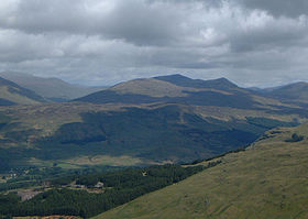
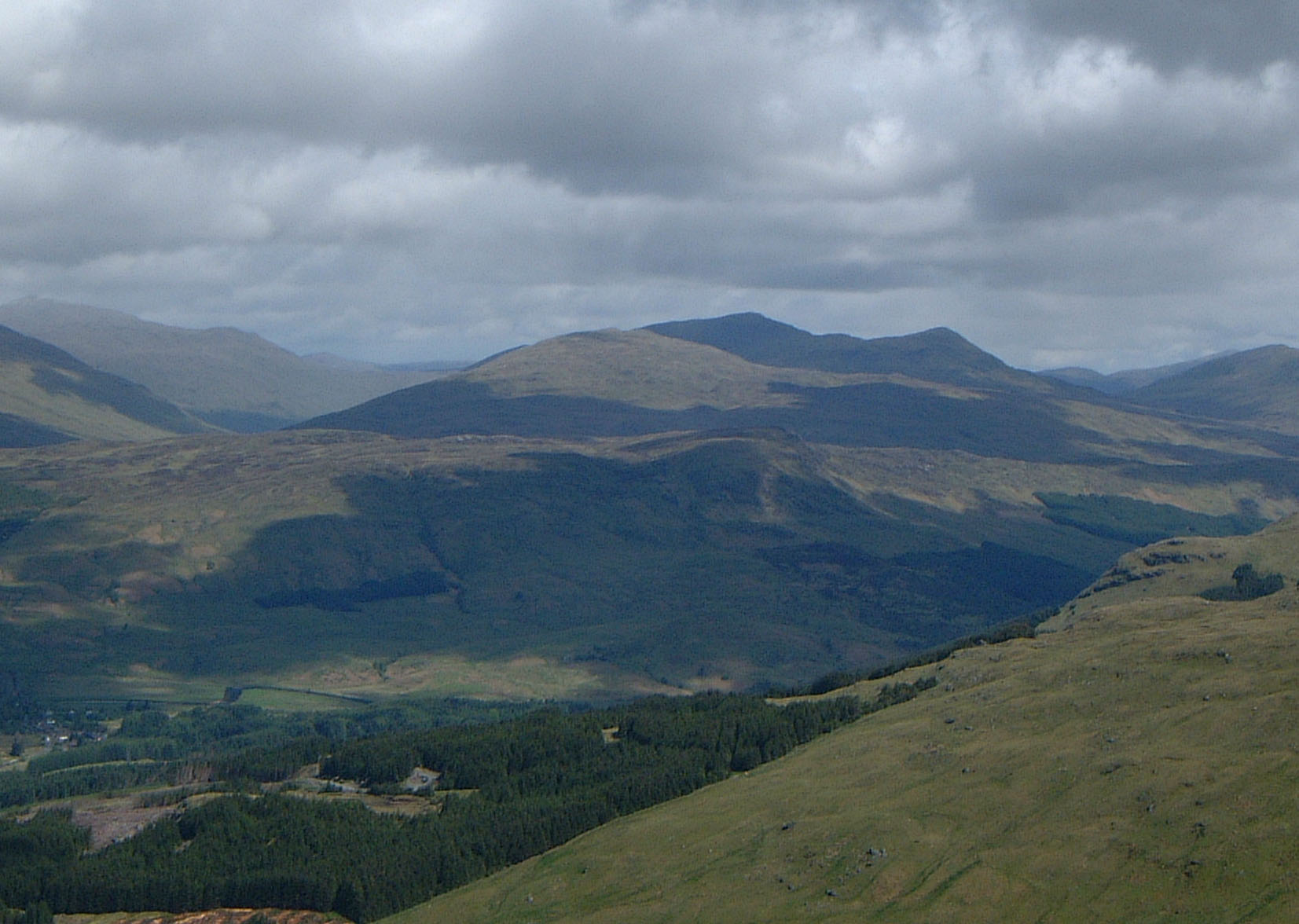
The Meall Glas group of hills from the high ground above Crianlarich, 9 km to the SW. Meall Glas is the highest peak in shade.Elevation 959 m (3,146 ft) Prominence 554 m (1,818 ft) Parent peak Beinn Heasgarnich Listing Munro, Marilyn Translation Greenish-grey hill (Gaelic) Pronunciation Scottish Gaelic: [ˈmjaulˠ̪ ˈklˠ̪as̪] Location Location Stirlingshire,  Scotland
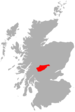
Range Grampians Topo map OS Landranger 51, OS Explorer 378 OS grid NN431321 Listed summits of Meall Glas Name Grid ref Height Status Beinn Cheathaich NN444326 937 m (3074 ft) Munro Top Meall Glas is a mountain situated in the southern highlands of Scotland, it stands on the northern border of the Loch Lomond and the Trossachs National Park, some 8.5 kilometres north east of Crianlarich.
Contents
Overview
Meall Glas reaches Munro status with a height of 959 metres (3146 feet) and is the highest point in the high rolling uplands between Glen Lochay and Glen Dochart, this area has no distinctive mountainous character[1] but includes another Munro Sgiath Chuil, two km to the east, and the Corbett Beinn nan Imirean which lies two km to the south west. The three hills can be climbed together in the same walk.
Meall Glas is overshadowed by the more impressive mountains around the Crianlarich area and its name which translates from the Gaelic as “Greenish-grey hill” shows its lack of importance and topographic highlights. It was probably named by the inhabitants of Glen Lochay to which it shows its more impressive northern outline, with the summit ridge seen as a curving hollow[2]. The hill is not well seen from Glen Dochart to the south, from where it is usually climbed, being observed as just the top of rising moorland.
Geography
Meall Glas is composed of mainly grassy rolling slopes, it has two main ridges, the north west ridge drops to Glen Lochay and can be used for a direct ascent from that valley. The mountains other crest, initially forms the summit ridge as it goes east curving round the lip of a corrie and dropping to a height of approximately 860 metres before rising to an unnamed top with a height of 908 metres, then swinging north east to the subsidiary summit of Beinn Cheathaich (937 metres) which lies just over 1.5 kilometre from the main peak. Beinn Cheathaich has a trig point on it and is listed in the Munro Tables as a “Top”. In Sir Hugh Munro’s original tables of 1891 Beinn Cheathaich was listed as the Munro with Meall Glas as the “top”, a situation rectified in the 1921 revision of the tables[3]. From Beinn Cheathaich the ridge swings north and drops to Glen Lochay while broad slopes to the east descend to the Lairig a’ Churain (609 metres) which connects to the adjacent Munro of Sgiath Chuil.
The large Coire Cheathaich stands on the mountains northern slopes, it is almost two kilometres across at its widest point as it falls to Glen Lochay, it is rimmed by the summit ridge. Although the mountain is made up of schist rocks of the Dalradian group there are outcrops of pink granite on the mountains upper slopes. The south side of the mountain has a broad shelf at a height of around 450 metres this is the result of lateral erosion by glaciers in the Ice Age[4]. Rainfall on Meall Glas drains to the east coast of Scotland via the glens of Dochart (south) or Lochay (north) and then by Loch Tay and the River Tay.
Ascents and view
Meall Glas can be climbed from either Glen Dochart or Glen Lochay. The southern approach from Glen Dochart is the most popular because of ease of access from a main road. The route starts at Auchessan (grid reference NN446276) on the A85 road and goes northerly across moorland to reach the summit ridge just to the east of the highest point[5]. The northern approach starts at the road end in Glen Lochay at Kenknock (grid reference NN465364), walk for 1.5 km west up the glen, cross the River Lochay by a ford (the bridge no longer exists) and follow a track by the Lubchurran Burn which goes south and west and gains height to reach the summit of Beinn Cheathaich and then Meall Glas[6].
The summit of Meall Glas is marked by a small cairn perched on a rocky outcrop, the mountain has a considerable prominence of 554 metres and is a good viewpoint with the Mamlorn peaks around the head of Glen Lochay and the Crianlarich hills to the south west looking especially fine.
References
- The Munros, Donald Bennett (Editor) ISBN 0 0907521 13 4
- The Southern Highlands, Donald Bennett (Editor) ISBN 0 907521 34 7
- The Munros, Scotland's Highest Mountains, Cameron McNeish, ISBN 1 84204 082 0
- The Magic Of The Munros, Irvine Butterfield, ISBN 0 7153 2168 4
- Hamish’s Mountain Walk, Hamish Brown, ISBN 1 898573 08 5
- In The Hills Of Breadalbane, V.A. Firsoff,
Footnotes
- ^ "The Southern Highlands" Page 165 Gives description of area.
- ^ "The Magic of the Munros" Page 35 Gives details of name and translation.
- ^ Online version of Munro‘s Tables. Gives details of Beinn Cheathaich.
- ^ "In The Hills of Breadalbane" Pages 151 - 153 Gives geology and details of glaciation.
- ^ "The Munros" Page 36 Gives description of southern approach.
- ^ "The Munros, Scotland‘s Highest Mountains" Page 43 Gives description of northern approach.
 An Stùc · Beinn Achaladair · Beinn Challuim · Beinn a' Chreachain · Beinn Dòrain · Beinn an Dòthaidh · Beinn Ghlas · Beinn Heasgarnich · Ben Lawers · Beinn Mhanach · Càrn Gorm · Càrn Mairg · Creag Mhòr · Meall Corranaich · Meall nan Aighean · Meall Buidhe · Meall a' Choire Leith · Meall Ghaordaidh · Meall Garbh (Càrn Mairg Group) · Meall Garbh (Lawers Group) · Meall Glas · Meall Greigh · Meall nan Tarmachan · Schiehallion · Sgiath Chùil · Stuchd an Lochain
List of Munros Categories:- Munros
- Marilyns of Scotland
- Mountains and hills of the Southern Highlands
- Mountains and hills of Stirling council area


Wikimedia Foundation. 2010.