- Mahnomen, Minnesota
-
Mahnomen, Minnesota — City — Location of Mahnomen, Minnesota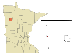
Coordinates: 47°18′57″N 95°58′10″W / 47.31583°N 95.96944°W Country United States State Minnesota County Mahnomen Government – Mayor Martin Warnsholz Area – Total 1.0 sq mi (2.5 km2) – Land 1.0 sq mi (2.5 km2) – Water 0.0 sq mi (0.0 km2) Elevation 1,211 ft (369 m) Population (2010)[1] – Total 1,214 – Density 1,214.0/sq mi (485.6/km2) Time zone Central (CST) (UTC-6) – Summer (DST) CDT (UTC-5) ZIP code 56557 Area code(s) 218 FIPS code 27-39392[2] GNIS feature ID 0647385[3] Mahnomen (pronunciation: /məˈnoʊmən/ mə-noh-mən) is a city in Mahnomen County, Minnesota, United States, along the Wild Rice River. The population was 1,214 at the 2010 census.[1] It is the county seat of Mahnomen County[4].
U.S. Route 59 and Minnesota State Highway 200 are two of the main arterial routes in the city.
Contents
Geography
According to the United States Census Bureau, the city has a total area of 1.0 square mile (2.6 km2), all of it land.
Demographics
Historical populations Census Pop. %± 1910 796 — 1920 1,076 35.2% 1930 989 −8.1% 1940 1,429 44.5% 1950 1,464 2.4% 1960 1,462 −0.1% 1970 1,313 −10.2% 1980 1,283 −2.3% 1990 1,154 −10.1% 2000 1,202 4.2% 2010 1,214 1.0% U.S. Decennial Census As of the census[2] of 2000, there were 1,202 people, 532 households, and 311 families residing in the city. The population density was 1,252.9 people per square mile (483.4/km²). There were 576 housing units at an average density of 600.4 per square mile (231.7/km²). The racial makeup of the city was 74.29% White, 0.08% African American, 16.06% Native American, and 9.57% from two or more races. Hispanic or Latino of any race were 1.08% of the population.
There were 532 households out of which 25.9% had children under the age of 18 living with them, 42.5% were married couples living together, 12.6% had a female householder with no husband present, and 41.4% were non-families. 37.4% of all households were made up of individuals and 25.6% had someone living alone who was 65 years of age or older. The average household size was 2.16 and the average family size was 2.85.
In the city the population was spread out with 23.3% under the age of 18, 5.0% from 18 to 24, 21.9% from 25 to 44, 22.7% from 45 to 64, and 27.1% who were 65 years of age or older. The median age was 45 years. For every 100 females there were 87.8 males. For every 100 females age 18 and over, there were 77.0 males.
The median income for a household in the city was $26,000, and the median income for a family was $37,500. Males had a median income of $24,479 versus $21,625 for females. The per capita income for the city was $14,538. About 9.8% of families and 14.0% of the population were below the poverty line, including 16.1% of those under age 18 and 19.5% of those age 65 or over.
References
- ^ a b "2010 Census Redistricting Data (Public Law 94-171) Summary File". American FactFinder. U.S. Census Bureau, 2010 Census. http://factfinder2.census.gov/faces/tableservices/jsf/pages/productview.xhtml?pid=DEC_10_PL_GCTPL2.ST13&prodType=table. Retrieved 23 April 2011.
- ^ a b "American FactFinder". United States Census Bureau. http://factfinder.census.gov. Retrieved 2008-01-31.
- ^ "US Board on Geographic Names". United States Geological Survey. 2007-10-25. http://geonames.usgs.gov. Retrieved 2008-01-31.
- ^ "Find a County". National Association of Counties. http://www.naco.org/Counties/Pages/FindACounty.aspx. Retrieved 2011-06-07.
External links
Municipalities and communities of Mahnomen County, Minnesota Cities 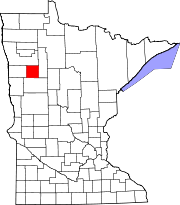
Townships Beaulieu | Bejou | Chief | Clover | Gregory | Heier | Island Lake | La Garde | Lake Grove | Little Elbow | Marsh Creek | Oakland | Pembina | Popple Grove | Rosedale | Twin Lakes
CDP Indian
reservationsCoordinates: 47°18′55″N 95°58′07″W / 47.31528°N 95.96861°W
Categories:- Cities in Minnesota
- Populated places in Mahnomen County, Minnesota
- County seats in Minnesota


Wikimedia Foundation. 2010.