- Deep Creek Hot Springs
-
Deep Creek Hot Springs 

Location San Bernardino County, California, USA Nearest city Hesperia Coordinates 34°20′22″N 117°10′37″W / 34.33944°N 117.17694°WCoordinates: 34°20′22″N 117°10′37″W / 34.33944°N 117.17694°W Governing body San Bernardino National Forest,
United States Forest Service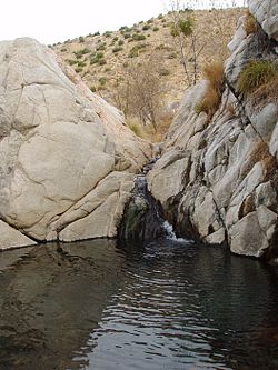 Deep Creek Hot Springs: the Upper Main Pool, fed by hot springs.
Deep Creek Hot Springs, DCHS, are natural hot springs located in the northern Mojave Desert section of the San Bernardino National Forest, near Hesperia in San Bernardino County, Southern California.[1]
Contents
Geography
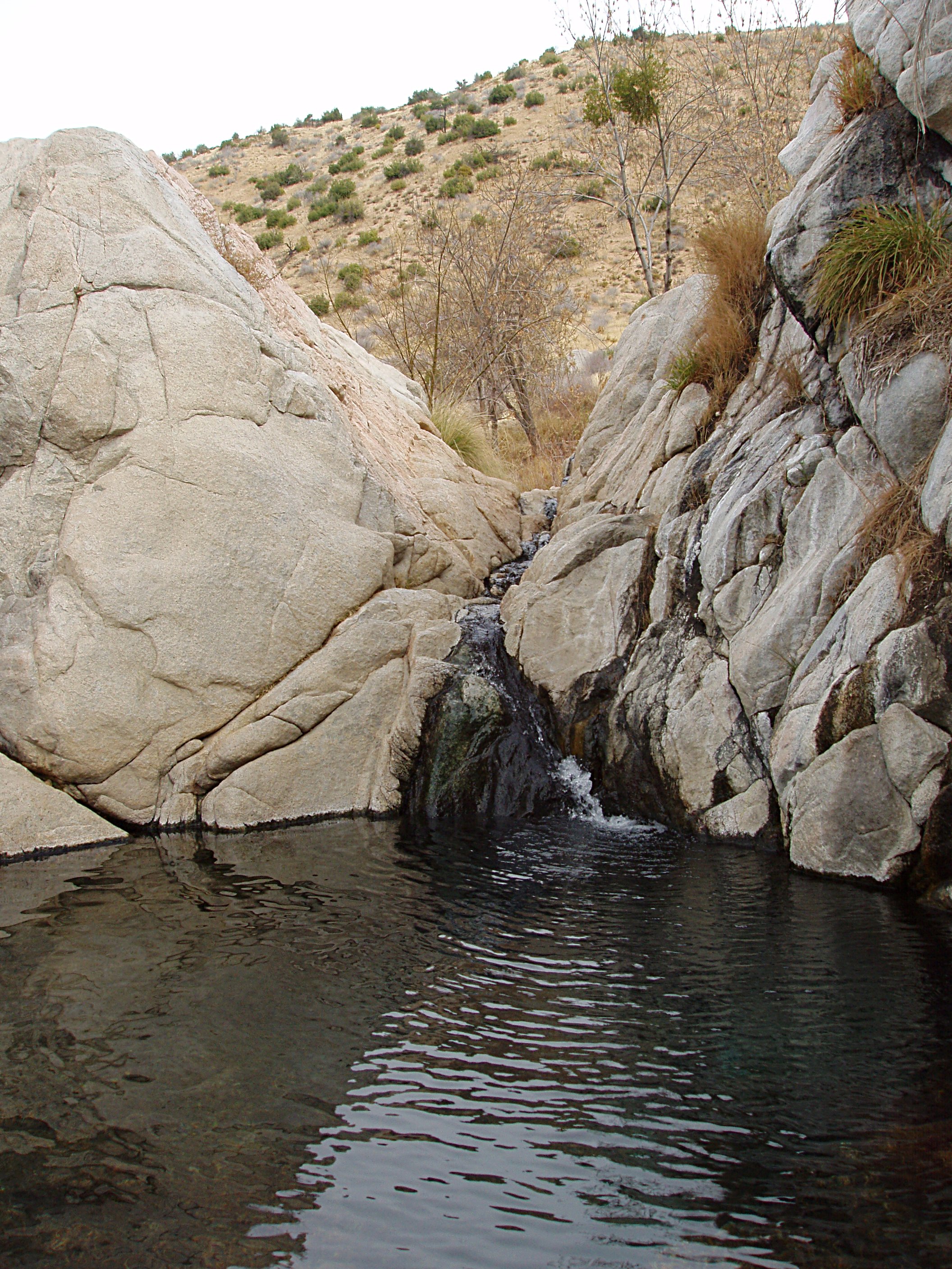
The springs are in the rain shadowed desert foothills of the San Bernardino Mountains on the Deep Creek fork of the Mojave River. They are in a large bouldered riparian zone, surrounded by an rich habitat ecotone of the xeric shrublands—desert chaparral, montane chaparral and woodlands, and conifer forest plant communities.[1]
The Southwestern Arroyo Toad—Bufo Californicus, an endangered species, lives along Deep Creek.[1][2]
Recreation
Deep Creek Hot Springs, being located next to Deep Creek, provides both hot and cold water locations for clothing optional bathing. The site is managed by the San Bernardino National Forest.[1] Water from the creek or pools is not advised for consumption without treatment or filtering, and bringing sufficient drinking water is advised.[1] The Pacific Crest Trail along the creek crosses the area.[1]
Directions
- Interstate 15 to the Bear Valley exit in Victorville.
- Bear Valley (east) proceeding ten miles (16 km) to Central.
- Right on Central (south) proceeding three miles (past railroad tracks and over a steep hill) to Ocotillo.
- Left (east) on Ocotillo proceeding 2.2 miles (3.5 km) to Bowen Ranch Road (after it becomes dirt surfaced).
- Right (south) on Bowen Ranch Road, proceeding approximately six miles to Bowen Ranch (fee) parking and trailhead.
- The hike, approximately two miles, drops over 900 feet (270 m) in altitude. Some parts of the trail are rough, with sturdy hiking boots advised.
- or
- Pacific Crest Trail (free), a six mile hike east from the trailhead at Arrowhead Lake Road.
Regulations
The Deep Creek Hot Springs regulations include:[1]
- Closed to the public from sundown to sunrise
- Public nudity is not permitted within 1/4 mile of 'T-6 crossing.'
- No camping is permitted within 1-mile (1.6 km) of Deep Creek.
- No fire, campfires or stoves allowed in the Deep Creek drainage basin.
- No glass containers permitted within 1-mile (1.6 km) of Deep Creek
- Pack out all refuse.
- State designation Wild Trout Stream, the Deep Creek Wild Trout Area
See also
- List of hot springs
References
- ^ a b c d e f g "San Bernardino National Forest, Deep Creek Hot Springs". http://www.fs.usda.gov/wps/portal/fsinternet/!ut/p/c4/04_SB8K8xLLM9MSSzPy8xBz9CP0os3gDfxMDT8MwRydLA1cj72BTJw8jAwjQL8h2VAQAzHJMsQ!!/?ss=110512&navtype=BROWSEBYSUBJECT&cid=FSE_003714&navid=110160000000000&pnavid=110000000000000&position=BROWSEBYSUBJECT&recid=34152&actid=50&ttype=recarea&pname=San%20Bernardino%20National%20Forest%20-%20Deep%20Creek%20Hot%20Springs. Retrieved 2010-06-10.
- ^ "SDNHM - Arroyo Toad". San Diego Natural History Museum. http://www.sdnhm.org/fieldguide/herps/bufo-cal.html. Retrieved 2011-10-22.
External links
Categories:- Hot springs of California
- Bathing
- Naturism
- Public nudity
- San Bernardino Mountains
- Rivers of San Bernardino County, California
- Protected areas of the Mojave Desert
- Protected areas of San Bernardino County, California

Wikimedia Foundation. 2010.