Mount Pisgah Benevolence Cemetery
- Mount Pisgah Benevolence Cemetery
-
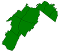
Coordinates: 39°20′30″N 78°46′04″W / 39.3417°N 78.7678°W / 39.3417; -78.7678 Mount Pisgah Benevolence Cemetery is an African-American cemetery in Romney, West Virginia, United States. The cemetery is located along the Northwestern Turnpike (U.S. Route 50) below Indian Mound Cemetery overlooking Sulphur Spring Run. Historically known as the Romney Colored Cemetery and more recently as the Romney African-American Cemetery, the cemetery was created for African-Americans in the South Branch Valley who were not permitted to be interred in the city's Indian Mound Cemetery. The cemetery has been in use since the early 19th century and continues to serve Romney's African-American community. It is currently maintained by the Mount Pisgah United Methodist Church, from which it takes its name.
See also
External links
Categories:
- Protected areas of Hampshire County, West Virginia
- Cemeteries in West Virginia
- Northwestern Turnpike
- African American cemeteries
- African American history of West Virginia
- Hampshire County, West Virginia geography stubs
- African American stubs
Wikimedia Foundation.
2010.
Look at other dictionaries:
Mount Pisgah — is the name of several mountains and places: Contents 1 Mountains 2 Communities 3 Other … Wikipedia
Indian Mound Cemetery — is a cemetery located along the Northwestern Turnpike (U.S. Route 50) on a bluff overlooking the South Branch Potomac River in Romney, West Virginia. The Indian Mound Cemetery Company was incorporated by an act of the Virginia General Assembly… … Wikipedia
Romney, West Virginia — Infobox Settlement official name = City of Romney, West Virginia settlement type = City nickname = West Virginia s Oldest Town |Early 20th Century view of Romney imagesize = image caption = image mapsize = 250x200px map caption = Location of… … Wikipedia
Northwestern Turnpike — The Northwestern Turnpike is a historic road in West Virginia (Virginia at the time the road was created), important for being historically one of the major roads crossing the Appalachians, financed by the Virginia Board of Public Works in the… … Wikipedia
U.S. Route 50 in West Virginia — Infobox road state=WV type=US route=50 alternate name= length mi=196.20 length round=2 length ref=Federal Highway Administration, [http://www.fhwa.dot.gov/planning/nhpn/ National Highway Planning Network GIS data] version 2005.08] yrcom=1926… … Wikipedia

