- Neighborhoods of Albany, New York
-
The neighborhoods of Albany, New York are varied demographically, geographically, architecturally, and historically. Downtown Albany is the city's oldest neighborhood, centered on State Street, one of Albany's oldest streets and its original main street. Today downtown consists mostly of office buildings inhabited by state agencies, though a recent push to bring in permanent residents has led to proposed apartments and condominiums, many of which have failed to get past the proposal phase.[1][2] North and south of Downtown are old residential communities often consisting of row houses. North is Sheridan Hollow, Arbor Hill, and North Albany; to the south is the super-neighborhood of the South End, which consists of a multitude of smaller neighborhoods including the Mansion District, the Pastures, Kenwood, Groesbeckville, Delaware Avenue, and Krank Park.[3][4] These neighborhoods tend to have more minorities and lower-income residents than the western, more suburbanized part of the city.[5]
West of Downtown is the Empire State Plaza, which effectively cuts Downtown off from the gentrified neighborhoods of Center Square, Hudson/Park, Lark Street, and Washington Park. Collectively referred to as mid-town, these neighborhoods are often compared to New York City's Greenwich Village for their eclectic mix of residential and commercial uses, including bars, night clubs, restaurants, and unique stores. Albany's gay culture is vibrant in this area.[6] Nearby Park South, a nine-block area surrounding New Scotland Avenue[4] and home to roughly 1,000 individuals, is currently undergoing an urban renewal as existing housing units are removed or renovated and new office, commercial, and apartment buildings are added.[7] New construction includes expansion of Albany Medical Center, one of the largest employers in Albany. Nearby is University Heights, a united campus consisting of Albany Medical Center Hospital, Albany Medical College, Albany Law School, Albany College of Pharmacy, and the Sage College of Albany.[8]
Single-family detached homes, duplexes, and apartments, along with single-family houses that have been carved up into multiple units, can be found west of the older neighborhoods. These neighborhoods, such as Pine Hills, Delaware Avenue, Whitehall, Helderberg, New Scotland, and Beverwyck, tend to have larger lots and more suburban surroundings.[3] The Eastern section of Pine Hills is often referred to as the "student ghetto" due to the proximity of the campuses of Saint Rose College and University at Albany. The area from North Main to South Lake between Myrtle and Washington avenues has become home to off-campus college students living in houses carved into multiple units by usually absentee landlords.[9]
Further west, the neighborhoods become more affluent and are dominated almost exclusively by single-family dwellings. These neighborhoods, such as Melrose, Western Pine Hills, New Albany, Eagle Hill, Westland Park, Campus, and Buckingham Park, have some of the quieter streets and larger lots in the city, and more closely resemble neighboring areas of the suburban towns than they do the downtown parts of the city.[3] Further west is the W. Averell Harriman State Office Campus and the University at Albany's main campus. West of those campuses are offices and commercial properties lining frontage roads along Washington Avenue Extension, with a small housing development called The Dunes, all surrounded by the Pine Bush Preserve.[4][10]
Arbor Hill
Arbor Hill historically the area from Clinton Avenue (formerly called Patroon Street) north to the Livingston Avenue Railroad Bridge (where North Albany begins) and from the Hudson River west to Lexington Ave., was outside Albany's first boundaries as set up in the Dongan Charter of 1686. The original name of the area was Colonie (from which the name of the current town to the north comes from), incorporated as a village on April 9, 1804; it was annexed by the city in 1815, at which time Patroon St. became Clinton Ave.[11] The current name, Arbor Hill, comes from the nickname of the Ten Broeck Mansion ("Arbor Hill"), the mansion is still an important cultural and historical museum. The neighborhood has many other historic and cultural spots including the Palace Theatre and Quackenbush House (downtown), and the St. Joseph's Church (in Ten Broeck Triangle, actually a sub-section of Arbor Hill). Demographically it is predominantly African-American.
Buckingham Pond
Residents enjoy the hiking path with ducks and geese at Buckingham Pond as well as local amenities within easy walking distance on New Scotland and Western Avenues. Homes are primarily single-family and are located on tree-lined streets, some with medians.
Beverwyck
A neighborhood of interior streets between Central and Western Avenues, Beverwyck is mostly a residential neighborhood. The neighborhood received its name from Beverwyck Park, which in turn was named for Albany's original Dutch name, Beverwyck.
Campus
So named for its proximity to the W. Averell Harriman State Office Building Campus,[citation needed] many mistakenly believe it was named for the nearby State University of New York at Albany uptown campus, but the neighborhood was named prior to this construction. This neighborhood features predominantly single-family homes on side streets with many retail, commercial, and office spaces on Western Avenue. US Route 20 and NY 85 are the major roads that pass through the neighborhood.
Center Square
Center Square is often compared by locals to New York City's SoHo or Greenwich Village. Center Square contains many buildings of architectural significance and is locally famous for its nightlife, entertainment, culture, and dining. Center Square includes the area bounded by Lark Street on the west, Spring Street on the north, South Swan Street on the east and Jay Street on the south, plus the upper portion of Lancaster Street between Lark Street and Willett Street.
Eagle Hill
Eagle Hill is a residential neighborhood named for the Eagle Hill Cemetery.[citation needed] It borders the Buckingham Pond Neighborhood, as well as the State Office Campus, and SUNY Albany.
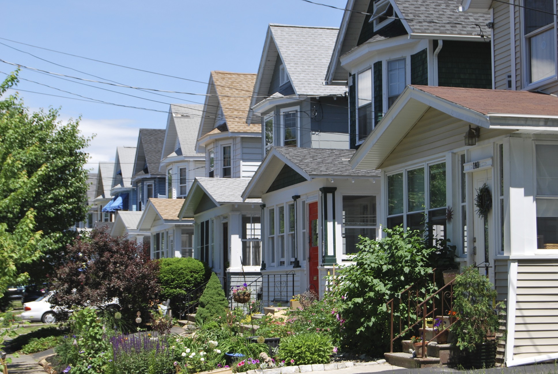
Helderberg
 Middle-class housing on Grove Avenue
The Helderberg neighborhood can be roughly defined by the quadrangle formed by New Scotland Avenue, South Manning and Hackett Boulevards and Academy Road. Its namesake is a small road (Helderberg Road) than runs parallel between Hackett Boulevard and New Scotland Avenue. The neighborhood is situated between the city's two primary hospitals, St. Peters and Albany Medical Center. It also borders the combined campus of Albany Law School, Albany College of Pharmacy and the Sage College of Albany, located in the University Heights neighborhood. Helderberg also contains the The Albany Academy, a prep school for boys and girls.[citation needed]
Delaware Neighborhood
Delaware Avenue is a main entrance to the city from the south, specifically the Bethlehem/Delmar area. The neighborhood is located southwest of the Empire State Plaza. Delaware Avenue is the western border of the South End. Only a small part of Delaware Avenue is considered the "Delaware Neighborhood". In recent years, Federal stimulus money was invested into the neighborhood to build new streets, lighting, trees, and contribute to safety. [12]
Dudley Heights
Primarily an African-American neighborhood, it was the first location of the Dudley Observatory. Separated from Arbor Hill by Livingston Avenue it is mostly composed of older single family homes, and its centerpiece is the Livingston Middle School.[citation needed]
Dunes
A residential development located east of New Karner Road, south of Washington Avenue Extension, and bounded by sections of the Pinebush Preserve and Guilderland.[citation needed]
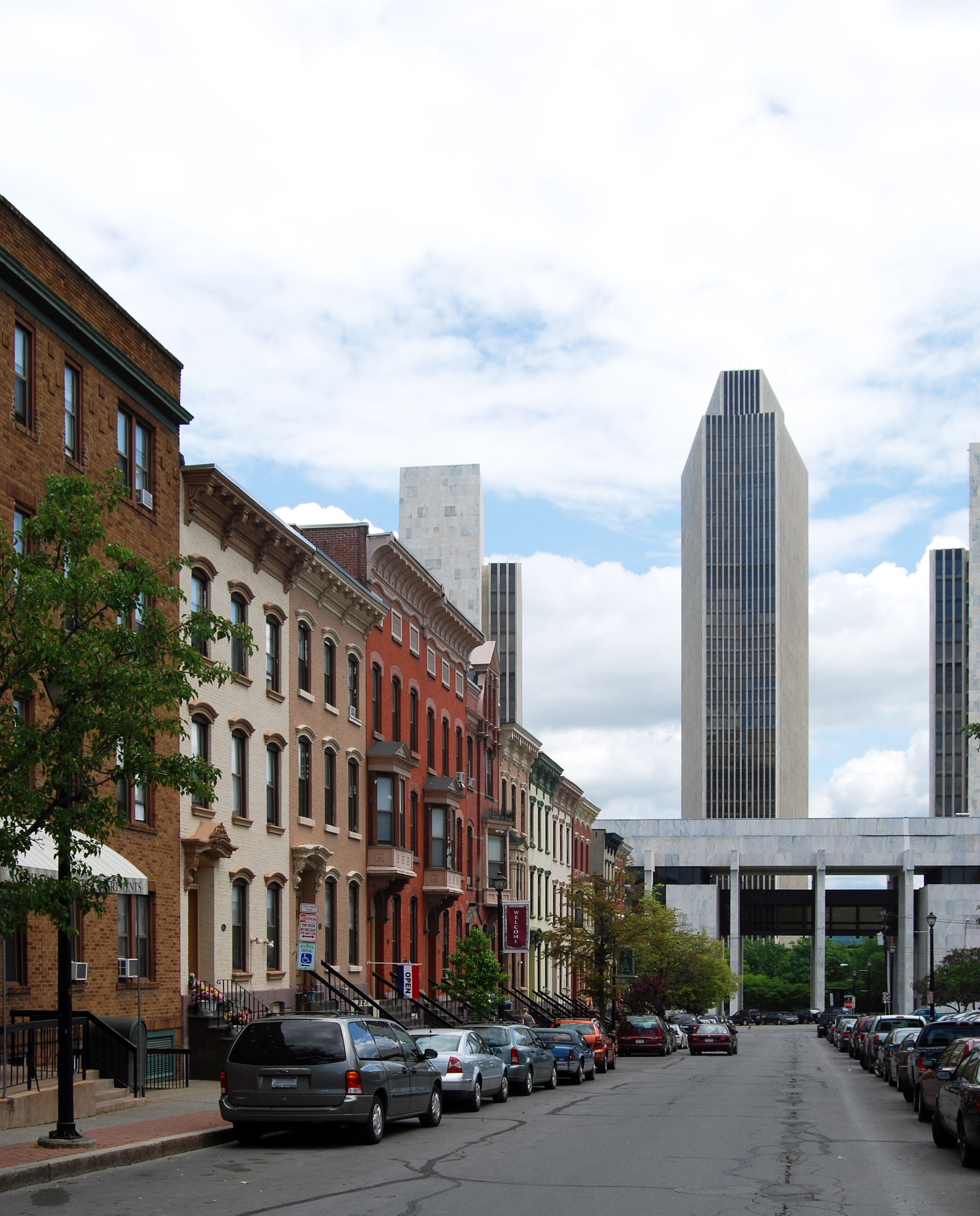
Hudson/Park
 Rowhouses in Hudson/Park with the ESP in the background
Albany’s Hudson/Park is bordered on the north by Center Square, on the south by Lincoln Park, and the east by the Nelson Rockefeller Empire State Plaza, it is bisected by Madison Avenue. The neighborhood has seen spill over from the Lark Street and Center Square areas and is similar in appearance to both neighborhoods in its mix of entertainment, restaurants, and historic housing. South of Madison Avenue, the Hudson/Park neighborhood is a part of the South End.
Melrose
Melrose is an area east of the State Office Campus which features mostly residential homes and includes Rosemont Park. It runs roughly from Brevator St. to Manning Blvd. Melrose Avenue itself is built on the right-of-way of the first passenger railroad in the state of New York, which went from Albany to Schenectady, originally the Mohawk and Hudson, later the Albany and Schenectady Railroad. The nearby Frank Waterson Park Little League field adjacent to Westland Hills Park off Colvin Avenue was listed by Guinness Book of Records in 1992 as being the largest Little League field.[citation needed]
New Albany
New Albany is the residential area roughly located at the west end of the Pine Hills neighborhood, the east end of the Melrose neighborhood, and the northeast end of the Buckingham Pond neighborhood. Most residences are single family homes of varying styles constructed by developers from around the turn of the century through the nineteen-teens.[citation needed]
Normansville
Named for the Normans Kill, a Dutch-named creek of considerable size making up Albany's southern border. The neighborhood was originally called Upper Hollow, and was a hamlet in the neighboring town of Bethlehem, it was on both sides of the Normans Kill until the Normans Kill became the Albany-Bethlehem boundary. Located on a yellow brick road off Delaware Avenue it is rural and forested. Located here are Steven's Farm, a historic active farm and the location of the official horses of Albany's police force. An old abandoned bridge underneath the modern Delaware Avenue bridge links to the town of Bethlehem but is closed to traffic.
North Albany
North Albany is an older neighborhood located roughly from the Livingston Ave. railroad bridge (at Colonie Street) north to the city line with Menands,[13] and west from the Hudson River to Van Rensselaer Boulevard. Historically settled by Irish immigrants, North Albany has long been a diverse neighborhood with single family homes, duplexes, apartment buildings, and older row houses, as well as older industrial sites along Broadway and North Pearl Street.
Park South
Tucked between the growing University Heights and Washington Park neighborhoods, Park South is bordered on the east by the southern end of Lark Street. The city has recently decided on a plan of urban renewal in this neighborhood of over 1,000 people in nine city blocks. This is subject to an urban development plan, which as of 2007 will not include eminent domain.[citation needed]
Pine Hills
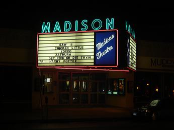
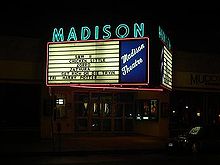 Madison Theater
The Pine Hills neighborhood is roughly bounded by Washington Avenue to the north, Lake Ave to the east, Woodlawn & Cortland to the south, and Manning Boulevard to the west. Pine Hills received its name from the Albany Land Improvement Company in 1891. This was also the year that Engine #10, a neighborhood and city landmark was built.[14]
The neighborhood consists mainly of freestanding multi-unit, duplex, and semi-detached houses and is home to Albany High School, the LaSalle school, the College of St. Rose, and the Alumni Quad of the University at Albany. The area of Pine Hills east of Main Avenue and north of Myrtle Avenue is commonly referred to as the "student ghetto" due to its predominant population of college students, many from Long Island or New York City.[15] The area of Pine Hills west of Main Avenue features many large Queen Anne, Folk Victorian, and Colonial Revival homes. The area where Madison Avenue meets Western Avenue a block from St. Rose is the center of a commercial area, complete with a movie theater, grocery store, fast food strip mall, retail, restaurants, a library, community playhouse, police station, pharmacy, and elementary school.
Sheridan Hollow
Although Sheridan Hollow is often mistakenly labeled part of Arbor Hill the gorge carved out by the Fox Creek (diverted into pipes around 1797 on the north side of Sheridan Avenue, once named Fox[es] Street and then Canal Street) is an old part of the city that has fallen on hard times. Recent spill over from downtown has helped revitalize the eastern edge with a Hampton Inn and plans for redevelopment of the Boyd printing plant. A bridge carries Henry Johnson Boulevard (formerly Northern Boulevard) over the Hollow.
South End
A large and diverse area of Albany, the South End consists of several small neighborhoods. Bounded on the east by the Hudson River, on the south by the Normans Kill (boundary with the town of Bethlehem), the west by Delaware Avenue, and the north by Madison Avenue. The city's website recently touted a plan to address blight in this area and encourage development of empty lots and a possible redevelopment of underused sites. The city states that there are eight neighborhoods in the South End under its Capital South plan, but does not state what it considers to be those eight neighborhoods. Important roads in this area include Delaware, Madison, Morton, Park, and Second Avenues; Southern Boulevard, and South Pearl Street. Some parts of this vast area are neighborhoods, other areas have no name and are just generically referred to as being in the South End, even though they may be separated by named neighborhoods from each other. The Delaware Avenue neighborhood south and east of Delaware Avenue is a part of the South End, as is the portion of the Hudson/Park neighborhood south of Madison Avenue, for information on these areas see their respective entries.
- Some other South End neighborhoods are:
Kenwood
Though Kenwood is not often thought of as a neighborhood today it was once an important hamlet along the Albany and Bethlehem Turnpike (later named South Pearl Street, today Old South Pearl Street). It was the site of a Dutch fort in 1618 and the mill of Albert Bradt, nicknamed The Norman, to whom the Normans Kill is named after. It is also the home to the former Kenwood Academy and until its move to Rensselaer the Doane Stuart School. This former hamlet of the neighboring town of Bethlehem (until annexed in 1916) has lent its name to the Kenwood Rail Yard next to the Port of Albany-Rensselaer and the Kenwood Industrial Park on Binghamton Street.
Krank Park
This neighborhood surrounds Krank Park, a park well used by baseball teams from throughout the city and a great asset to the people of the area.
Mansion District
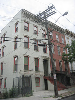 Townhouses in the Mansion District.
In the Mansion District, all major 19th-century styles are represented. Italianate is the most widely represented style in the district and it is present in many levels of sophistication. A number of buildings employ elements of both the Greek Revival and Italianate styles, but there are also some highly refined examples of these individual styles. There are also some unusual examples of the application of Gothic Revival decoration to rowhouse construction. The Mansion District is dominated by the nearby Empire State Plaza and Governor's Mansion. Along Madison Ave. next to and within part of the Mansion District is Albany's Little Italy.
Though no longer dominated by Italians, an Italian influence is still present in two established Italian restaurants. An attempt to turn a former Catholic church into a community arts center is well under way. The Mansion District also has a library branch, the Schuyler Mansion museum, Philip Street Park which is an active park with playground and basketball courts, and Bleecker Park a passive park with Albany's oldest public water fountain.
Pastures
The Pastures is a distinct neighborhood that features mixed-use living where tennis courts, shops and courtyards are interspersed among historic owner and tenant occupied historic homes. The neighborhood is adjacent to downtown and the waterfront. This neighborhood is in the South End and was at one point almost devoid of people but was brought back by one of the few urban renewal programs that worked in Albany late last century.[citation needed] It is bounded on the north by downtown, on the west by Little Italy and the Mansion District, and on the south by unnamed South End sub-neighborhoods.
Second Avenue
Second Avenue runs from Delaware Ave. east downhill to South Pearl Street, and with its side streets this neighborhood is mostly residential and relies on Delaware Avenue for most retail services. Blight has struck most of Second Avenue especially the half closer to South Pearl Street. Most of the side streets closer to Delaware Avenue are safe residential single family streets. Second Avenue becomes Whitehall Road at Delaware Avenue.
University Heights
University Heights is home to the Albany College of Pharmacy, Albany Law School, Sage College of Albany, and Albany Medical College. This expanding commercial area contains many health care–related businesses, a few retail stores and restaurants. Health and human services facilities in the neighborhood include: Albany Medical Center Hospital, the Stratton V.A. Hospital, the Capital District Psychiatric Center, the NYS Office of Mental Health, and the NYS Office of Mental Retardation and Developmental Disabilities. University Heights is bounded by Park South to the north, and the South End to the south.
Washington Park
For 300 years, Washington Park have been used by the residents of Albany for recreational and other public purposes. Originally granted to the city by the English Crown in colonial times, the Park area has been used as a parade ground, a cemetery, a public square, and a welfare farm. Shortly after the American Civil War, work began on what is today's park - a manicured combination of gardens and lawn landscaped in the finest Victorian tradition. With some 100 species of trees from exotic lands throughout the world, the Park resembles a botanical garden. The park's boat house hosts "Park Playhouse" which puts on outdoor plays in the summer. The park is also host to the Tulip Fest, which is celebrated annually on the second weekend in May. Washington Park is host to numerous other public events throughout the year including a large holiday lights display, and other culturally diverse events.[citation needed]
West Hill
West Hill stretches from Central Avenue north to Tivoli Hollow, and from Henry Johnson Boulevard west to Manning Boulevard.[16] It is dominated by Central Avenue, which is Albany's "Main Street" and an important thoroughfare into Albany.
Whitehall
The Whitehall neighborhood features tree lined streets and sidewalks in a suburban/low density urban atmosphere of single family homes. Whitehall has many churches and synagogues, and a Jewish Community Center. Nearby New Scotland and Delaware Avenues provide the neighborhood with hospitals and retail services.
See also
- History of Albany, New York
- Streets of Albany, New York
- National Register of Historic Places listings in Albany, New York
References
- ^ Chris Churchill (2010-05-13). "Downtown Homesteading". Times Union (Albany) (Hearst Newspapers): p. E1. http://albarchive.merlinone.net/mweb/wmsql.wm.request?oneimage&imageid=6449204. Retrieved 2007-03-18.
- ^ "Downtown Residential". Downtown Albany Business Improvement District. http://www.downtownalbany.org/uploads/publications/18_DowntownResidential.pdf. Retrieved 2010-07-06.
- ^ a b c "Albany's Neighborhoods". City of Albany. http://www.albanyny.org/Residents/Neighborhoods.aspx. Retrieved 2010-07-06.
- ^ a b c "Albany's Neighborhood Associations" (PDF). City of Albany. http://www.albanyny.org/_files/Government/Development_Planning/Neighborhood_Map_Website21.pdf. Retrieved 2010-07-06.
- ^ Karlin, Rick (2002-12-22). "Race Tilts Middle School Debate". Times Union (Albany) (Hearst Corporation): p. D1. http://albarchive.merlinone.net/mweb/wmsql.wm.request?oneimage&imageid=6149361. Retrieved 2010-07-14.
- ^ O'Brien, Tim (2007-05-09). "Lark Street Group Fills Jobs". Times Union (Albany) (Hearst Newspapers): p. B4. http://albarchive.merlinone.net/mweb/wmsql.wm.request?oneimage&imageid=6457635. Retrieved 2010-07-06.
- ^ Churchill, Chris (2010-06-25). "More Park South Plans?". Times Union (Albany) (Hearst Newspapers): p. C1. http://albarchive.merlinone.net/mweb/wmsql.wm.request?oneimage&imageid=11147475. Retrieved 2010-07-06.
- ^ "University Heights Association". University Heights Association, Inc.. http://www.universityheights.org. Retrieved 2010-07-06.
- ^ Scott Waldman (March 18, 2010). "Guess "District" Sounds Better Than Ghetto". Albany Times Union. p. D3. http://albarchive.merlinone.net/mweb/wmsql.wm.request?oneimage&imageid=9958403. Retrieved 2010-05-24.
- ^ Google, Inc. Google Maps – Albany, New York, United States (Map). Cartography by Google, Inc. http://maps.google.com/?ie=UTF8&ll=42.694801,-73.840313&spn=0.072041,0.181789&t=h&z=13. Retrieved 2010-06-01.
- ^ French, J.H. (1860). Gazetteer of the State of New York. R. Pearsall Smith. p. 159. http://books.google.com/books?id=R_zHwh4xByQC&printsec=frontcover&dq=gazetteer+of+new+york#v=onepage&q=&f=false. Retrieved 2009-08-16.
- ^ "Stimulus starts by paving the way to work," by Casey Seiler, Albany Times Union, Saturday, May 2, 2009.
- ^ "North Albany". Albany Institute of History and Art. http://www.albanyinstitute.org/info/exhibits/city%20neighborhoods/north%20albany/North%20Albany.htm. Retrieved 2010-07-25.
- ^ "A History of Pine Hills". Pine Hills Neighborhood Association. 1977.
- ^ "How can troubles in Albany's student ghetto be". http://www.timesunion.com/default/article/How-can-troubles-in-Albany-s-student-ghetto-be-1308967.php.
- ^ Rosemary Lazaro (October 21, 1991). "Not Arbor Hill". Albany Times Union. http://archives.timesunion.com/mweb/wmsql.wm.request?oneimage&imageid=5579754. Retrieved 2009-08-15.
External links
- Neighborhood Map, map of the various neighborhood association boundaries
- Google Maps overlay, various neighborhood associations boundaries
Categories:

Wikimedia Foundation. 2010.