- Narborough, Leicestershire
-
Coordinates: 52°34′22″N 1°12′08″W / 52.5727°N 1.2023°W
Narborough 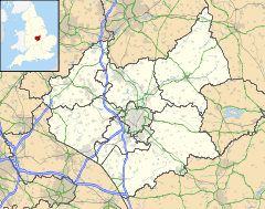
 Narborough
Narborough shown within LeicestershireOS grid reference SP540975 District Blaby Shire county Leicestershire Region East Midlands Country England Sovereign state United Kingdom Post town Leicester Postcode district LE19 Dialling code 0116 Police Leicestershire Fire Leicestershire Ambulance East Midlands EU Parliament East Midlands UK Parliament Blaby List of places: UK • England • Leicestershire Narborough is a village south of Leicester, England. It lies in the Blaby district of Leicestershire. Its name originally meant 'North Stronghold'.
Surrounding villages include Enderby, Whetstone, Littlethorpe, Cosby, and Huncote.
Contents
Location
Narborough is a large village in South Leicestershire. It has a population of around 7,000, with the Narborough and Littlethorpe Parish having a population of 8,402 according the 2001 census. Narborough is situated on or near several major transport corridors. The M1 motorway passes through the east of Narborough, and the Leicester to Birmingham railway line runs beside the River Soar on its way through the village. Coventry Road in the village centre runs along the course of the Fosse Way (Roman road), which then joins back onto the present course of the B4114 link from Birmingham to Leicester.
Narborough is often split into two distinct parts, the (old) village core to the South and the newer Pastures estate to the north east. These areas are separated by the B4114 which runs through the middle of the two areas.
The village centre and The Pastures area are served by the number 50 bus operated by Arriva Midlands, linking it directly with Enderby, Croft, Fosse Shopping Park, and Leicester city centre. In addition, the village centre is also served by the 45 (operated by Centrebus) to Blaby and Oadby and the 140 (also operated by Centrebus on behalf of Leicestershire County Council) to Broughton Astley, Lutterworth, and Rugby; meanwhile Arriva Midlands service 50A connects the village centre with Huncote and Croft, Fosse Shopping Park, Rowley Fields and Leicester city centre.
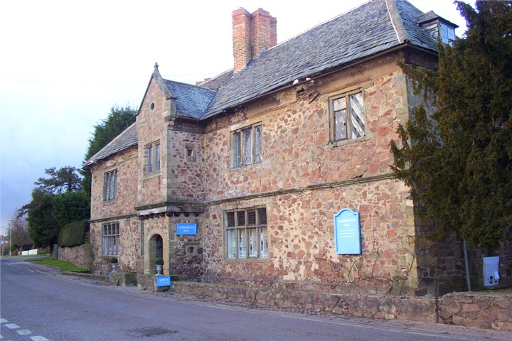
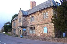 Narborough Hall
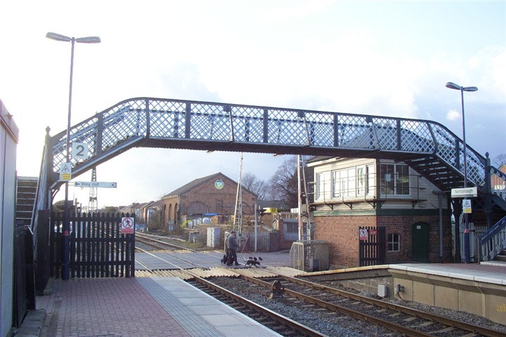
 Narborough railway station
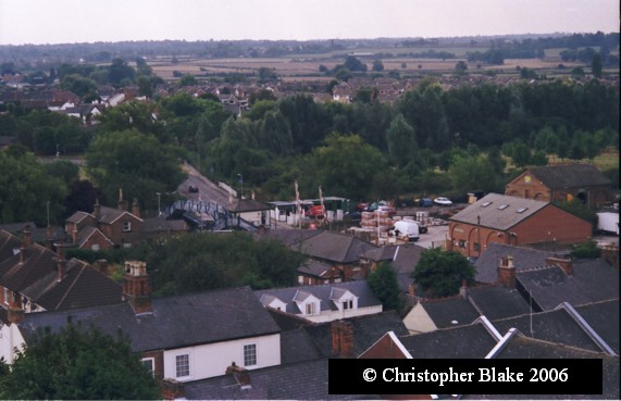
 View from All Saints Tower with Littlethorpe in the distance
Narborough railway station, with its level crossing, is situated in the village centre, linking the village with South Wigston and Leicester to the north, and Hinckley, Nuneaton, Coventry, and Birmingham in the south and west.
Amenities
The village contains many amenities including two doctors' surgeries, a dentist, two banks, several hairdressers, a beauty salon, a Post Office, two estate agents and a chemist. There are also four newsagents, a bakery, a Chinese takeaway, a pizza takeaway and a fish and chip shop. Narborough also boasts two small supermarkets, a Tesco Express and a Co-Op, and two pubs: The Copt Oak outside the village centre and Narborough Arms within it. Two other pubs have since been converted into Indian Restaurants: "The Bell" is now Spice 45 Indian restaurant and the "Dovecote" is now Monsoon Indian Restaurant. A third property has been converted into an Indian restaurant/hotel: the Heritage Hotel and Restaurant can be found on Leicester Road.
To the north-east of the village lies Carlton Park, a business park that includes the headquarters of Alliance & Leicester, who employ over 1,800 people locally. Carlton Park also has a Racquets and Health Club, David Lloyd (formerly Next Generation), which opened in the summer of 2006 [1]. Near to the village centre are the Blaby District Council offices. As well as Greystoke Primary School in the village, The Pastures Primary and Red Hill field Primary School are the two other primary schools serving the village. Pupils from these schools will generally go on to Brockington College in Enderby and on to Lutterworth College to complete their GCSEs and A-Levels.
There is a railway station in the village.
Religion
Narborough also has a Congregational Church situated on School Lane and a Catholic church, St. Pius X, on Leicester Road.
Narborough has been home to The Buddhist House, HQ for the Amida Trust, a Pureland Buddhist school, since 2001.
See also
External links
- The Official Narborough Village Website
- Narborough Village Website
- Parish Council
- Narborough Congregational Church Website
- Greystoke Primary School Narborough Website
- Narborough Hall Website
Towns Large villages Blaby • Cosby • Countesthorpe • Enderby • Glen Parva • Glenfield • Kirby Muxloe • Leicester Forest East • Narborough • Stoney Stanton • Whetstone
Small villages Aston Flamville • Croft • Elmesthorpe • Huncote • Kilby • Littlethorpe • Potters Marston • Sapcote • Sharnford • Thurlaston
Hamlets Leicester Forest West • Lubbesthorpe • Wigston Parva
Categories:- Villages in Leicestershire
- Civil parishes in Leicestershire

Wikimedia Foundation. 2010.