- Melvern, Kansas
-
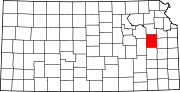
Melvern, Kansas — City — Location of Melvern, Kansas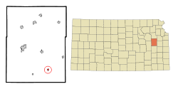
Coordinates: 38°30′27″N 95°38′18″W / 38.5075°N 95.63833°WCoordinates: 38°30′27″N 95°38′18″W / 38.5075°N 95.63833°W Country United States State Kansas County Osage Area – Total 0.3 sq mi (0.9 km2) – Land 0.3 sq mi (0.9 km2) – Water 0.0 sq mi (0.0 km2) Elevation 1,014 ft (309 m) Population (2000) – Total 429 – Density 1,297.3/sq mi (500.9/km2) Time zone Central (CST) (UTC-6) – Summer (DST) CDT (UTC-5) ZIP code 66510 Area code(s) 785 FIPS code 20-45700[1] GNIS feature ID 0477555[2] Melvern is a city in Osage County, Kansas, United States, along the Marais des Cygnes River. The population was 429 at the 2000 census. It is part of the Topeka, Kansas Metropolitan Statistical Area.
Contents
Geography
Melvern is located at 38°30′27″N 95°38′18″W / 38.5075°N 95.63833°W (38.507446, -95.638332)[3].
According to the United States Census Bureau, the city has a total area of 0.3 square miles (0.78 km2), all of it land.
Demographics
Historical populations Census Pop. %± 1990 423 — 2000 429 1.4% U.S. Decennial Census As of the census[1] of 2000, there were 429 people, 173 households, and 120 families residing in the city. The population density was 1,297.3 people per square mile (501.9/km²). There were 202 housing units at an average density of 610.9 per square mile (236.3/km²). The racial makeup of the city was 98.14% White, 0.70% Native American, 0.23% from other races, and 0.93% from two or more races. Hispanic or Latino of any race were 0.93% of the population.
There were 173 households out of which 31.8% had children under the age of 18 living with them, 56.1% were married couples living together, 10.4% had a female householder with no husband present, and 30.6% were non-families. 28.9% of all households were made up of individuals and 14.5% had someone living alone who was 65 years of age or older. The average household size was 2.47 and the average family size was 3.00.
In the city the population was spread out with 26.3% under the age of 18, 6.8% from 18 to 24, 28.9% from 25 to 44, 17.9% from 45 to 64, and 20.0% who were 65 years of age or older. The median age was 37 years. For every 100 females there were 98.6 males. For every 100 females age 18 and over, there were 85.9 males.
The median income for a household in the city was $32,321, and the median income for a family was $50,833. Males had a median income of $30,313 versus $17,143 for females. The per capita income for the city was $16,206. About 5.3% of families and 9.2% of the population were below the poverty line, including 4.5% of those under age 18 and 9.2% of those age 65 or over.
References
- ^ a b "American FactFinder". United States Census Bureau. http://factfinder.census.gov. Retrieved 2008-01-31.
- ^ "US Board on Geographic Names". United States Geological Survey. 2007-10-25. http://geonames.usgs.gov. Retrieved 2008-01-31.
- ^ "US Gazetteer files: 2010, 2000, and 1990". United States Census Bureau. 2011-02-12. http://www.census.gov/geo/www/gazetteer/gazette.html. Retrieved 2011-04-23.
External links
Municipalities and communities of Osage County, Kansas Cities Burlingame | Carbondale | Lyndon | Melvern | Olivet | Osage City | Overbrook | Quenemo | Scranton
Township Agency
Unincorporated
communityVassar
Categories:- Cities in Kansas
- Populated places in Osage County, Kansas
- Topeka metropolitan area


Wikimedia Foundation. 2010.