- Coleman, Ontario
-
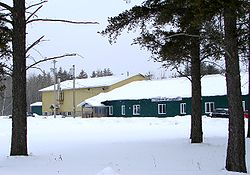
Coleman — Township — Municipal building Motto: Over 2 billion square feet of opportunity! Coordinates: 47°23′N 79°46′W / 47.383°N 79.767°WCoordinates: 47°23′N 79°46′W / 47.383°N 79.767°W Country  Canada
Province  Ontario
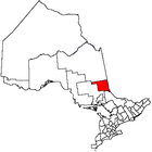
District Timiskaming District Settled Incorporated 1906 Government – Type Township – Mayor Colleen Belanger – Federal riding Nipissing—Timiskaming – Prov. riding Timiskaming—Cochrane Area[1] – Land 177.60 km2 (68.6 sq mi) Population (2006)[1] – Total 580 – Density 2.4/km2 (6.2/sq mi) Time zone EST (UTC-5) – Summer (DST) EDT (UTC-4) Postal Code P0J 1C0 Area code(s) 705 Website www.colemantownship.ca Coleman is a township in the northeastern part of the Canadian province of Ontario. It is situated in the Timiskaming District of Northern Ontario. The township had a population of 580 in the Canada 2006 Census.
It is located along Highway 11 and 11-B.
Contents
History
The community was first formed around 1906. The community was named after Florence Coleman Flumerfelt, the daughter of coal company president A.C. Flumerfelt. The township celebrated its first 100 years in 2006.
Demographics
In the Canada 2006 Census, the township has a land area of 177.60 square kilometres and a population density of 2.4 persons per square kilometre. The median age of the population is 47.6 years of age. The number of private dwellings occupied by usual residents is 248 (total dwellings: 341).[1]
Mother tongue:
- English as first language: 77.0 %
- French as first language: 14.9 %
- English and French as first language: 4.6 %
- Other as first language: 3.5 %
Population trend:[2]
- Population in 2006: 580
- Population in 2001: 550
- Population in 1996: 499 (or 534 when adjusted to 2001 boundaries)
- Population in 1991: 470
References
- ^ a b c Statistics Canada (2006). "Coleman community profile". Canada 2006 Census. http://www12.statcan.ca/english/census06/data/profiles/community/Details/Page.cfm?Lang=E&Geo1=CSD&Code1=3554001&Geo2=PR&Code2=35&Data=Count&SearchText=Coleman&SearchType=Begins&SearchPR=01&B1=All&GeoLevel=&GeoCode=3554001. Retrieved 2007-09-08.
- ^ Statistics Canada: 1996, 2001, 2006 census
External links

Temiskaming Shores Cobalt 
Unorganized West Timiskaming 
Unorganized West Timiskaming  Coleman

Latchford City 
Towns Townships Armstrong • Brethour • Casey • Chamberlain • Charlton and Dack • Coleman • Evanturel • Gauthier • Harley • Harris • Hilliard • Hudson • James • Kerns • Larder Lake • Matachewan • McGarryVillage ThornloeIndian Reserves MatachewanUnorganized areas East • WestSee also: Communities in Timiskaming District • Census divisions of OntarioCategories:- Municipalities in Timiskaming District, Ontario
- Township municipalities in Ontario
- Northern Ontario geography stubs
Wikimedia Foundation. 2010.


