- Gauthier, Ontario
-
Gauthier — Township — Gauthier Community Hall in Dobie

 Gauthier
Coordinates: 48°09′N 79°49′W / 48.15°N 79.817°WCoordinates: 48°09′N 79°49′W / 48.15°N 79.817°W Country  Canada
Province  Ontario
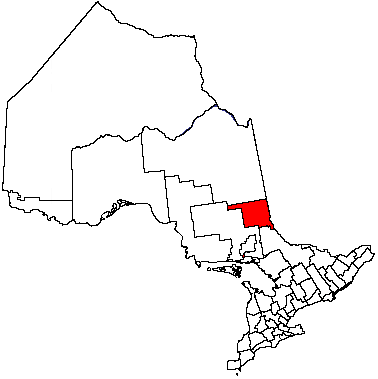
District Timiskaming Established Incorporated Government – Type Township – Reeve David Fraser – Federal riding Timmins—James Bay – Prov. riding Timiskaming—Cochrane Area[1] – Land 88.36 km2 (34.1 sq mi) Population (2006)[1] – Total 133 – Density 1.5/km2 (3.9/sq mi) Time zone EST (UTC-5) – Summer (DST) EDT (UTC-4) Postal Code P0K 1B0 Area code(s) 705 Gauthier is a township in the Canadian province of Ontario, located in the Timiskaming District east of Kirkland Lake. The township had a population of 133 in the Canada 2006 Census. Its main population centre is Dobie, located just north of Highway 66.
Demographics
Population:[2]
- Population in 2006: 133 (2001 to 2006 population change: 3.9 %)
- Population in 2001: 128
- Population in 1996: 152
- Population in 1991: 149
Private dwellings, excluding seasonal cottages: 53 (total: 65)
Mother tongue:
- English as first language: 85 %
- French as first language: 7.5 %
- English and French as first language: 7.5 %
- Other as first language: 0 %
 Dobie
Dobie
References

Kirkland Lake Unorg. East Timiskaming Unorg. West Timiskaming 
Larder Lake  Gauthier

Unorg. West Timiskaming City 
Towns Townships Armstrong • Brethour • Casey • Chamberlain • Charlton and Dack • Coleman • Evanturel • Gauthier • Harley • Harris • Hilliard • Hudson • James • Kerns • Larder Lake • Matachewan • McGarryVillage ThornloeIndian Reserves MatachewanUnorganized areas East • WestSee also: Communities in Timiskaming District • Census divisions of OntarioCategories:- Township municipalities in Ontario
- Municipalities in Timiskaming District, Ontario
- Northern Ontario geography stubs


Wikimedia Foundation. 2010.