- Sutter Buttes
-
Sutter Buttes Mountain Range 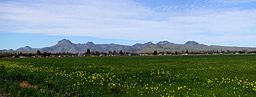
Country United States State California Region Sacramento Valley District Sutter County Coordinates 39°12′20.606″N 121°49′12.898″W / 39.20572389°N 121.82024944°W Highest point - elevation 628 m (2,060 ft) Geology volcanic neck Timezone Pacific (UTC-8) - summer (DST) PDT (UTC-7) Topo map USGS Sutter Buttes 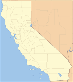

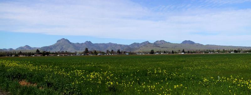
The Sutter Buttes are a small circular complex of eroded volcanic lava domes which rise as buttes above the flat plains of the Central Valley of California in the United States. The highest peak, South Butte, reaches about 2,130 feet (650 m) above sea level. The Buttes are located just outside of Yuba City, California in the Sacramento Valley, the northern part of the Central Valley. They are named for John Sutter, who received a large land grant from the Mexican government. The Sutter Buttes also hold the title of being the world's smallest mountain range.[1]
Contents
Natural history
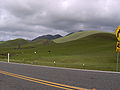
The mountains are about 10 miles (16 km) from north to south and east to west, and are the smallest mountain range in the world.[1]
The Sutter Buttes contain many flora and fauna species. Wildflowers are represented by numerous taxa; included in these many wildflowers is the Yellow Mariposa Lily, Calochortus luteus.[2]
Geology
The Sutter Buttes were formed about 1.6 million years ago in the early Pleistocene era by a volcano. The eruptions continued until about 1.4 million years ago.[3] Some geological references suggested that it represents the southernmost of the Cascade Volcanoes, but there are significant differences in age and form compared to the other volcanoes in that range.[4] Others suggest that its age places it with the volcanic elements of the California Coast Ranges and its composition is closer to that range but does have significant differences. The volcano is believed to have erupted along a now inactive fault line.[3] The questions about their origin and connection to other regional volcanic activity are the subject of ongoing research.
Native American lore
The Sutter Buttes figure prominently in the creation stories and other traditions of the indigenous Maidu and Wintun peoples. The Maidu (or Nisenan) lived to the east of the Buttes and the Wintun (Patwin) to the mountain's west. No tribe claimed ownership of the Buttes and there are only season encampments in the mountain. Native Americans did visit the mountain regularly to gather acorns and other foods or to hunt game. The Buttes were also a center of regional Native American religion. According to anthropologist Alfred Kroeber, the Patwin village where the city of Colusa now stands was the “hotbed” where the Kuksu Cult was established. This religion spread through much of northern California. Ceremonies were performed in earthen dance lodges where spirit impersonators would re-enact ancient mythological events. The Maidu, who lived in their shadow for thousands of years, called them Esto Yamani, which means "the Middle Mountain", the Wintun called the Sutter Buttes Onolai.
Recent history and access
Public access to the Sutter Buttes is limited. All of the land is privately held by cattle, sheep ranchers and farmers, but a few naturalists and local organizations, including the Middle Mountain Foundation and the Yuba Historical Society,[5] lead hikes through some areas. Since 1929, the State of California had considered purchasing the land for protection and a State Park.
In 1963, a missile silo complex containing three separate Titan I ICBM missiles was constructed near the base of the Buttes. The site was only active from 1963 to 1965, and it was decommissioned and mostly dismantled in 1965. The site has been host to many vandals and trespassers since the early 1980s to the present.[6] 39°16′32″N 121°49′45″W / 39.27556°N 121.82917°W
In 2003, the California Department of Parks and Recreation purchased 1,784.5 acres (7.2 km²) in Peace Valley on the north side of the Sutter Buttes with the intent to develop it as a State Park. The land did not have a public access. The land is still without public access going into 2011.
The only way into the property is an old dirt farm easement 20 feet wide running about two miles from North Butte Road. The route crosses private lands and is not suitable for the public to enter. In 2005 the Department tried to buy an adjacent original 1,123 acre Buttes ranch founded in the 1860s by John Henry Myers (1829–1908) who is buried in the close by Live Oak Cemetery. This property would have added park land and more importantly yielded the needed pathway for an access road for the public. That effort went on for some time pitting the Myers descendents against one another. In 2006 those who wanted to keep the land in the family ultimately bought the other half of the land from the family members who wanted to sell, thereby excluding State Parks from further ownership.
This land will continue to sit unused for the foreseeable future.
Power lines connecting to Path 15 and Path 66 run on the eastern edge of the Sutter Buttes.
Gallery
-
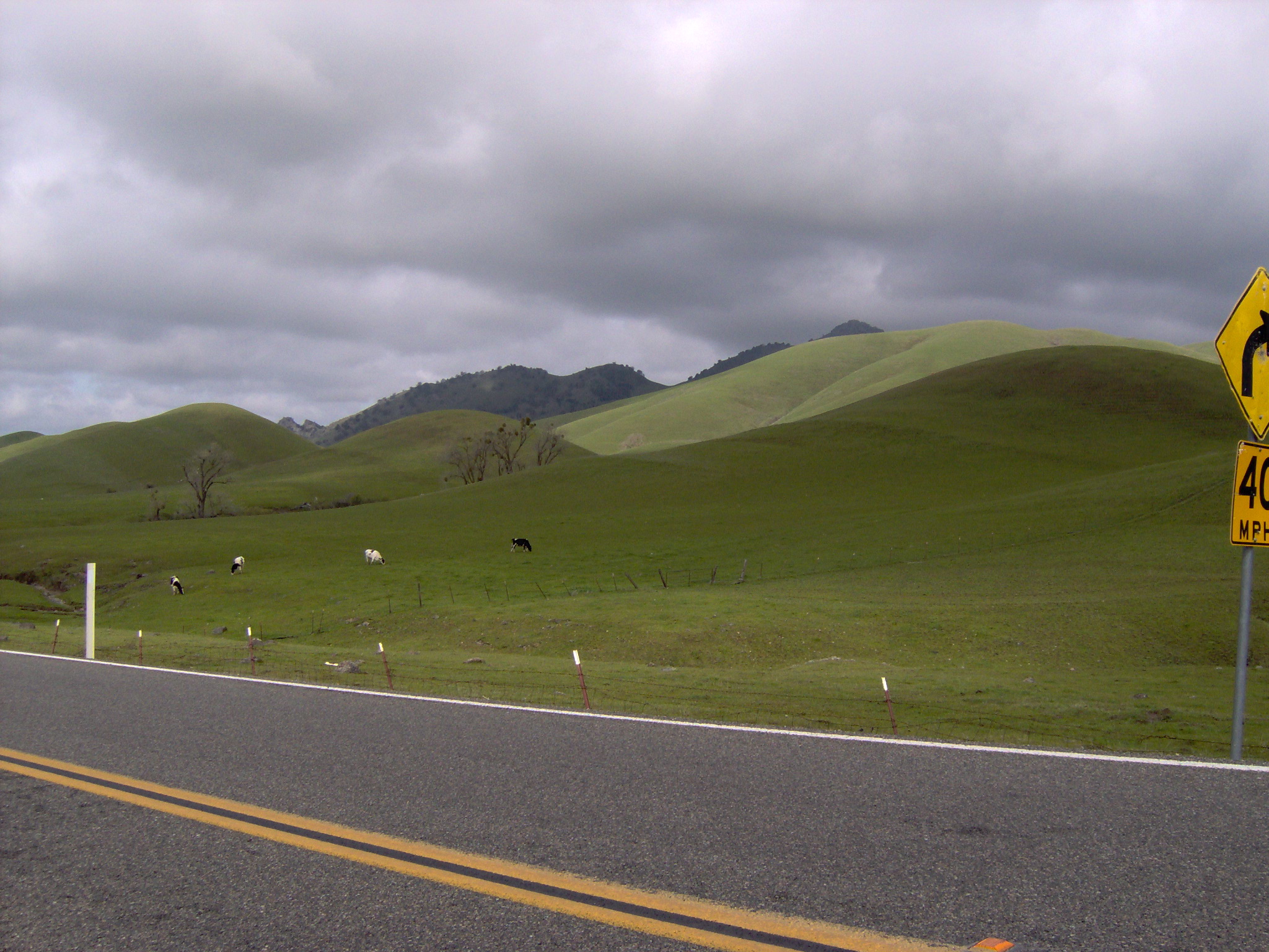
A view of the Sutter Buttes on an overcast day
-

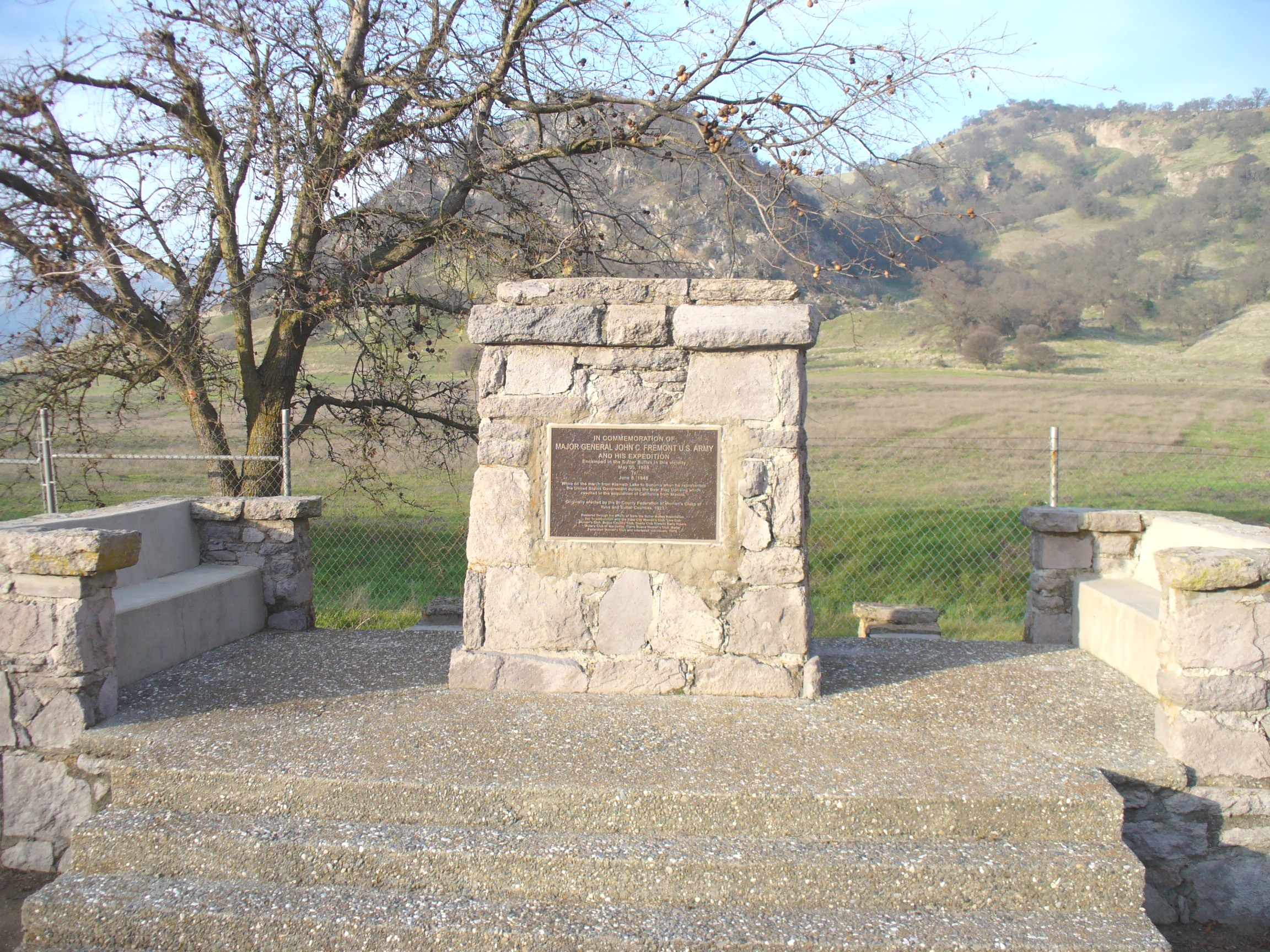
A monument at the base of the mountains indicating that John C. Frémont camped near here
-
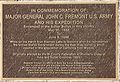
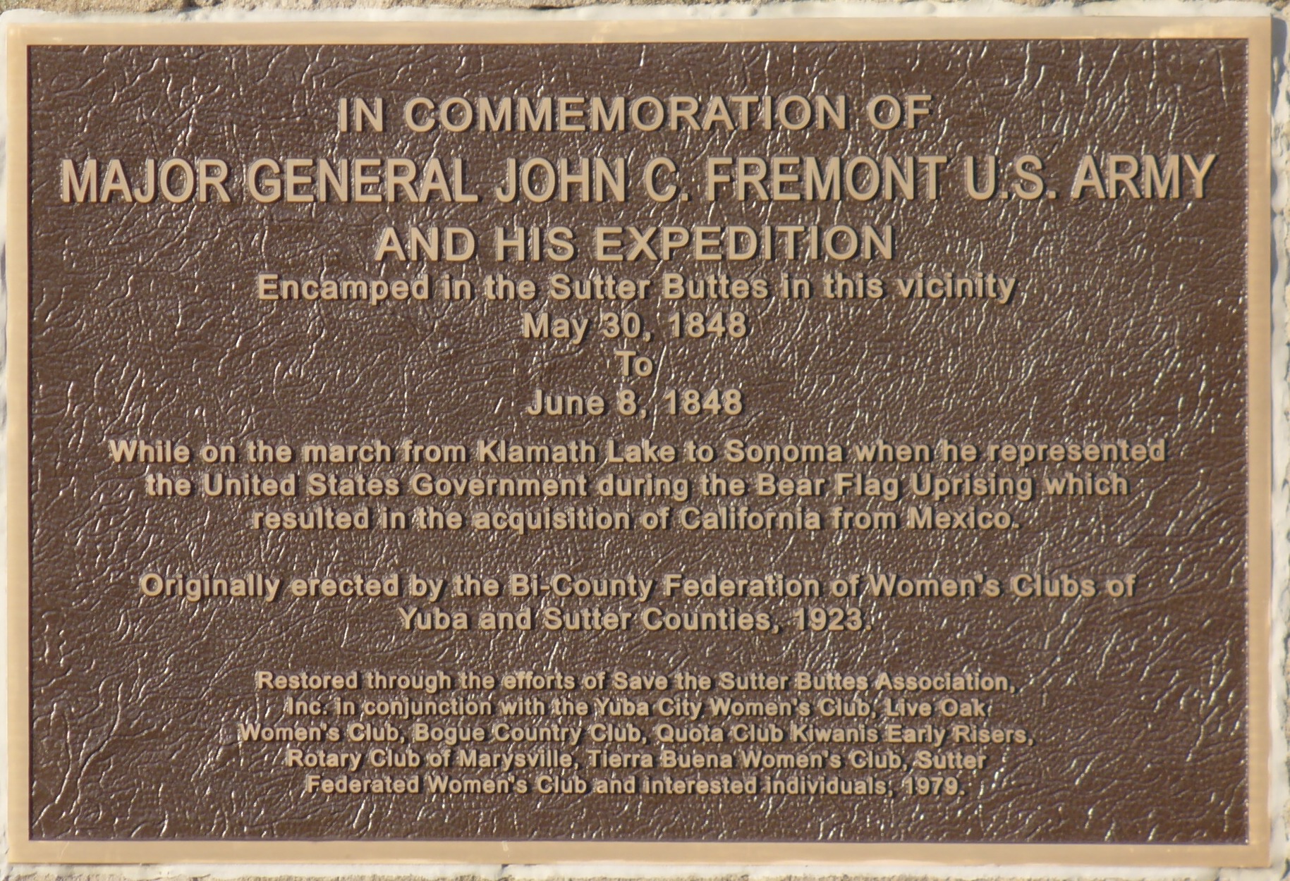
A close up of the inscription on the memorial. The inscription erreoneously uses 1848, rather than the correct 1846 year date.
See also
Notes
- ^ a b Stienstra, Tom (2004-03-18). "State buys parcel in Sutter Buttes But public access to Peace Valley could take years". San Francisco Chronicle (Hearst Corporation): pp. B-1. http://www.sfgate.com/cgi-bin/article.cgi?file=/c/a/2004/03/18/BAG6S5MUGB1.DTL&type=printable. Retrieved 2009-05-29.
- ^ C. Michael Hogan. 2009
- ^ a b Hausback, Brian P.; Muffler, L.J. Patrick; and Clynne, Michael A. (March 2011). "Sutter Buttes—The Lone Volcano in California’s Great Valley" (PDF). U.S. Geological Survey. http://pubs.usgs.gov/fs/2011/3024/fs2011-3024.pdf.
- ^ Charles A. Wood. 1990
- ^ "Introduction (Yuba Historical Society)". Yubahistory.com.
- ^ "Titan 1". California Cold War Museum & Memorial. http://www.calcoldwar.org/Titan-Missile-Page.php. Retrieved 2008-12-12.
References
- Stuart Allan (2005). California Road and Recreation Atlas. Benchmark Maps. p. 64. ISBN 0-929591-80-1.
- Middle Mountain Foundation - A Sutter Buttes Regional Land Trust Yuba Historical Society [1]
- C. Michael Hogan. 2009. Yellow Mariposa Lily: Calochortus luteus, GlobalTwitcher.com, ed. N. Stromberg
- Charles A. Wood; Jürgen Kienle, eds. (1990). Volcanoes of North America. Cambridge University Press. pp. 225–226. ISBN 0-521-43811-X.
- U.S. Geological Survey Geographic Names Information System: Sutter Buttes
- "South Butte, California". Peakbagger.com. 2004-11-01. http://www.peakbagger.com/peak.aspx?pid=2543. Retrieved 2007-11-28.
Categories:- Mountain ranges of Northern California
- Buttes of the United States
- Volcanoes of California
- Mountain ranges of Sutter County, California
- Lava domes
- Extinct volcanoes
- Pleistocene volcanoes
- John Sutter
- Central Valley of California
-

Wikimedia Foundation. 2010.