- Ocheyedan, Iowa
-
Ocheyedan, Iowa — City — Location of Ocheyedan, Iowa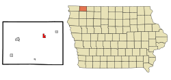
Coordinates: 43°24′52″N 95°32′7″W / 43.41444°N 95.53528°WCoordinates: 43°24′52″N 95°32′7″W / 43.41444°N 95.53528°W Country  United States
State  Iowa
IowaCounty Osceola Area – Total 1.2 sq mi (3.0 km2) – Land 1.2 sq mi (3.0 km2) – Water 0.0 sq mi (0.0 km2) Elevation 1,575 ft (480 m) Population (2000) – Total 536 – Density 461.1/sq mi (178.0/km2) Time zone Central (CST) (UTC-6) – Summer (DST) CDT (UTC-5) ZIP codes 51349, 51354 Area code(s) 712 FIPS code 19-58530 GNIS feature ID 0459794 Ocheyedan is a city in Osceola County, Iowa, United States. The population was 536 at the 2000 census.
Geography
Ocheyedan is located at 43°24′52″N 95°32′7″W / 43.41444°N 95.53528°W (43.414497, -95.535274)[1].
According to the United States Census Bureau, the city has a total area of 1.2 square miles (3.1 km2), all of it land.
There is a common misconception that the highest point in Iowa is the Ocheyedan Mound located near Ocheyedan. The Ocheyedan Mound rises to 1,655 feet above sea level, just fifteen feet short of the actual highest point in Iowa, Hawkeye Point, which has an elevation of 1,670 feet.
Demographics
As of the census[2] of 2000, there were 536 people, 223 households, and 146 families residing in the city. The population density was 461.1 people per square mile (178.4/km²). There were 254 housing units at an average density of 218.5 per square mile (84.5/km²). The racial makeup of the city was 99.63% White, 0.19% from other races, and 0.19% from two or more races. Hispanic or Latino of any race were 0.56% of the population.
There were 223 households out of which 29.6% had children under the age of 18 living with them, 59.6% were married couples living together, 4.9% had a female householder with no husband present, and 34.1% were non-families. 31.8% of all households were made up of individuals and 17.5% had someone living alone who was 65 years of age or older. The average household size was 2.40 and the average family size was 3.04.
In the city the population was spread out with 25.4% under the age of 18, 8.0% from 18 to 24, 25.9% from 25 to 44, 20.5% from 45 to 64, and 20.1% who were 65 years of age or older. The median age was 40 years. For every 100 females there were 100.7 males. For every 100 females age 18 and over, there were 92.3 males.
The median income for a household in the city was $31,513, and the median income for a family was $36,607. Males had a median income of $29,464 versus $16,944 for females. The per capita income for the city was $14,554. About 5.3% of families and 4.8% of the population were below the poverty line, including 1.5% of those under age 18 and 10.8% of those age 65 or over.
References
- ^ "US Gazetteer files: 2010, 2000, and 1990". United States Census Bureau. 2011-02-12. http://www.census.gov/geo/www/gazetteer/gazette.html. Retrieved 2011-04-23.
- ^ "American FactFinder". United States Census Bureau. http://factfinder.census.gov. Retrieved 2008-01-31.
Municipalities and communities of Osceola County, Iowa Cities 
Unincorporated
communityAllendorf
Categories:- Populated places in Osceola County, Iowa
- Cities in Iowa

Wikimedia Foundation. 2010.