- Montrose, Iowa
-
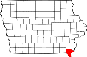
Montrose, Iowa — City —  Location of Montrose, Iowa
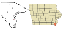
Coordinates: 40°31′46″N 91°24′58″W / 40.52944°N 91.41611°WCoordinates: 40°31′46″N 91°24′58″W / 40.52944°N 91.41611°W Country  United States
State  Iowa
IowaCounty Lee Area – Total 1.1 sq mi (3.0 km2) – Land 1.1 sq mi (2.9 km2) – Water 0.0 sq mi (0.0 km2) Elevation 531 ft (162 m) Population (2000) – Total 957 – Density 852.1/sq mi (329.0/km2) Time zone Central (CST) (UTC-6) – Summer (DST) CDT (UTC-5) ZIP code 52639 Area code(s) 319 FIPS code 19-53760 GNIS feature ID 0459199 Montrose is a city in Lee County, Iowa, United States. The population was 957 at the 2000 census. The town is located on the Mississippi River. It is part of the Fort Madison–Keokuk, IA-MO Micropolitan Statistical Area.
Contents
History
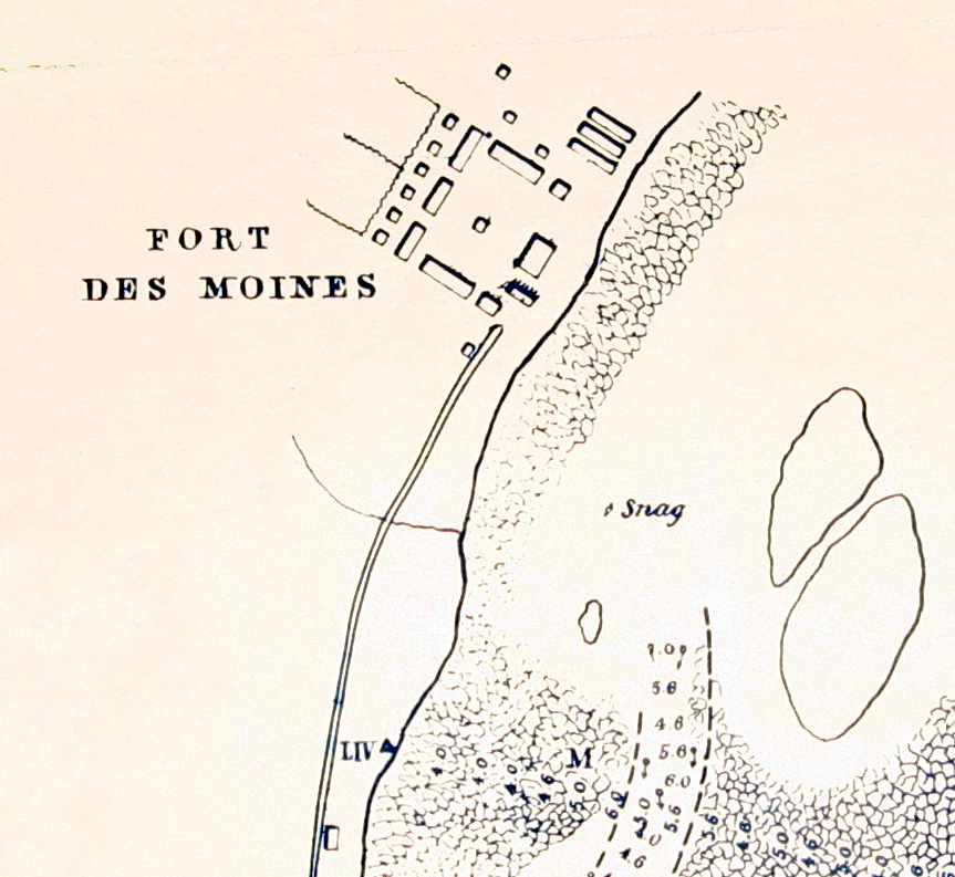
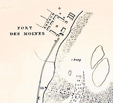 Robert E. Lee map of the head of the Des Moines Rapids, 1837, showing Fort Des Moines No. 1, later Montrose, Iowa.
The area around Montrose has been occupied continuously since at least the 1780s, when Quashquame's village was established nearby. The area was strategically important because it is at the head of the Des Moines Rapids, a major impediment to river traffic that caused large boats to land in this area and transfer freight overland to avoid the rapids.[1] Montrose was the location of Fort Des Moines No. 1, a military post from 1834-1837. From 1839-1846 Montrose was the home of many members of the Church of Jesus Christ of Latter Day Saints. This was especially true in 1839 when many people lived in an abandoned barracks at Montrose that served as a good short term residence while homes were being built in Nauvoo. Among Montrose's residents at this time were Brigham Young, Wilford Woodruff and Erastus Snow. Despite legends that the streets of Montrose were aligned to allow a direct view of the Nauvoo Temple across the Mississippi River in Illinois,[2] the streets actually align with the 1834 layout of Fort Des Moines.[3]
Geography
Montrose's longitude and latitude coordinates
in decimal form are 40.529532, -91.415995. [4]According to the United States Census Bureau, the city has a total area of 1.1 square miles (2.8 km2), of which, 1.1 square miles (2.8 km2) of it is land and 0.04 square miles (0.10 km2) of it (1.75%) is water.
Demographics
As of the census[5] of 2000, there were 957 people, 374 households, and 255 families residing in the city. The population density was 852.1 people per square mile (329.9/km²). There were 399 housing units at an average density of 355.3 per square mile (137.5/km²). The racial makeup of the city was 97.81% White, 0.10% African American, 0.73% Native American, 0.10% Asian, 0.21% from other races, and 1.04% from two or more races. Hispanic or Latino of any race were 0.84% of the population.
There were 374 households out of which 31.8% had children under the age of 18 living with them, 54.5% were married couples living together, 9.4% had a female householder with no husband present, and 31.8% were non-families. 29.9% of all households were made up of individuals and 16.0% had someone living alone who was 65 years of age or older. The average household size was 2.44 and the average family size was 3.00.
In the city the population was spread out with 24.3% under the age of 18, 7.0% from 18 to 24, 25.3% from 25 to 44, 24.7% from 45 to 64, and 18.7% who were 65 years of age or older. The median age was 41 years. For every 100 females there were 87.6 males. For every 100 females age 18 and over, there were 84.2 males.
The median income for a household in the city was $35,341, and the median income for a family was $40,865. Males had a median income of $30,855 versus $21,845 for females. The per capita income for the city was $17,010. About 7.0% of families and 8.9% of the population were below the poverty line, including 10.9% of those under age 18 and 6.8% of those age 65 or over.
Notable people
- Margaret Warner Morley (1858–1923) educator, scholar and writer.[6]
- Montrose is the resting place of Cato Mead, the only known Black revolutionary War veteran buried west of the Mississippi River.
Buildings
- St. Barnabas Episcopal Church (Montrose, Iowa)
References
- ^ Hallwas, John E. (2001) Keokuk and the Great Dam. Arcadia Publishing, Chicago.
- ^ Wills, Christopher. Associated Press (AP), December 7, 2007.
- ^ several maps exist of Fort Des Moines showing the same alignment as modern Montrose, including one drawn by Robert E. Lee, (1837) Map of the Des Moines Rapids of the Mississippi River. Surveyed by Lt. R. E. Lee, September 1837. National Archives, Washington, D. C.
- ^ "US Gazetteer files: 2010, 2000, and 1990". United States Census Bureau. 2011-02-12. http://www.census.gov/geo/www/gazetteer/gazette.html. Retrieved 2011-04-23.
- ^ "American FactFinder". United States Census Bureau. http://factfinder.census.gov. Retrieved 2008-01-31.
- ^ "Margaret Warner Morley". Encyclopædia Britannica Online. (2011). http://www.britannica.com/EBchecked/topic/392455/Margaret-Warner-Morley. Retrieved 2011-06-18.
External links
- Welcome to Montrose, Iowa
- City-Data Comprehensive statistical data and more about Montrose
Municipalities and communities of Lee County, Iowa Cities Donnellson | Fort Madison | Franklin | Houghton | Keokuk | Montrose | St. Paul | West Point
Unincorporated
communitiesArgyle | Charleston | Denmark | New Boston | Pilot Grove | Wever
Categories:- Cities in Iowa
- Iowa populated places on the Mississippi River
- Populated places in Lee County, Iowa
- Fort Madison-Keokuk micropolitan area


Wikimedia Foundation. 2010.