- Chiddingfold Forest
-
Chiddingfold Forest Site of Special Scientific Interest 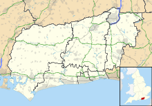
 Shown within West Sussex
Area of Search Surrey & West Sussex Grid reference SU994310 Coordinates 51°04′11″N 0°34′50″W / 51.069621°N 0.580428°WCoordinates: 51°04′11″N 0°34′50″W / 51.069621°N 0.580428°W Interest Biological Area 543.9 ha (1,344 acres) Notification 1975 Natural England website Chiddingfold Forest is a Site of Special Scientific Interest (SSSI) in south west Surrey and west Sussex, England. It lies near Chiddingfold and Dunsfold. The Forestry Commission owns and/or manages some 830 hectares (2,100 acres) of woodland in the forest complex of which 543.9 hectares (1,344 acres) is designated SSSI. It is one of fifteen SSSIs lying the borough of Waverley.
The site lies within the Low Weald natural area and Surrey Hills Area of Outstanding Natural Beauty (AONB).
The rare pearl-bordered fritillary grows in the forest. This is an important butterfly egg-laying area. There are also rare moths in this locality including: the Argent & Sable, Common Fan-foot, White-line snout, Waved carpet and Drab looper moth.[1]
Chiddingfold Forest is home to the Bechstein's Bat. Three maternity colonies have been identified which have at least eighty breeding females.[2]
Fir Tree Copse, which lies within the forest is particularly noted for rare moths, lichen and fungi. The smaller plants include Enchanter’s Nightshade, Wood Speedwell, Lily of the Valley and wild daffodils.[3]
References
Surrey Hills Area of Outstanding Natural Beauty North Downs Botley Hill · Box Hill · Combe Bottom · Gatton Park · Hackhurst and White Downs · Headley Heath · Hog's Back · Mole Gap to Reigate Escarpment · Newlands Corner · Norbury Park · Ranmore Common · Seale Chalk Pit · Woldingham and Oxted DownsGreensand Ridge Albury Heath · Blackheath · Colyers Hanger · Devil's Jumps · Devil's Punch Bowl · Frensham Common · Gibbet Hill · Gong Hill · Hankley Common · Hankley Farm · Holmbury Hill · Leith Hill · Moor Park · Oxmoor Copse · Puttenham & Crooksbury Commons · St. Martha's Hill · Stockstone Quarry · Thursley Common · Winterfold Forest · Witley CommonLow Weald Rivers Lakes and ponds Long Distance Paths Downs Link · Greensand Way · Mole Gap Trail · North Downs Way · Thames Down Link · Vanguard Way · Wey South PathNational Cycle Routes Categories:- Sites of Special Scientific Interest in Surrey
- Sites of Special Scientific Interest in West Sussex
- Sites of Special Scientific Interest notified in 1975

Wikimedia Foundation. 2010.