- Robinson Crusoe Island
-
This article is about the Chilean island. For the island in Fiji, see Robinson Crusoe Island (Fiji).
Robinson Crusoe Island Native name: Isla Robinson Crusoe 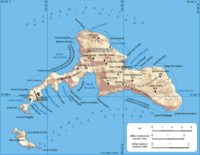
Map of Robinson Crusoe Island/Isla Más a Tierra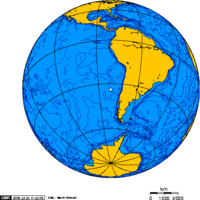
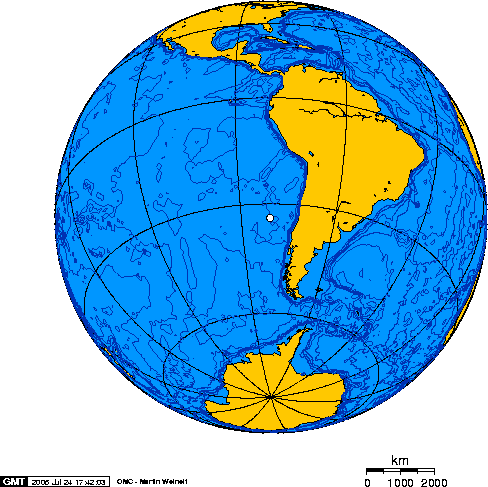
Geography Location Pacific Ocean Coordinates 33°38′29″S 78°50′28″W / 33.64139°S 78.84111°W Archipelago Juan Fernández Islands Area 93 km2 (35.9 sq mi) Highest elevation 916 m (3,005 ft) Highest point El Yunque Country CHLDemographics Population 859 (as of 2011 est.) Robinson Crusoe Island (Spanish: Isla Robinson Crusoe), formerly known as Más a Tierra (Closer to land), or Aguas Buenas,[1] is the largest island of the Chilean Juan Fernández archipelago, situated 674 kilometres west of South America in the South Pacific Ocean. The archipelago is made up of three islands, Robinson Crusoe, Alejandro Selkirk and the small Santa Clara.
Contents
Geography
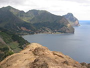
The island has a mountainous and undulating terrain, formed by ancient lava flows which have built up from numerous volcanic episodes. The highest point on the island is 3,005 ft (916m) above sea level at El Yunque. Intense erosion has resulted in the formation of steep valleys and ridges. A narrow peninsula is formed in the southwestern part of the island called Cordón Escarpado. The island of Santa Clara is 1.5 km from the coast off the southern part of the island. The western end of the island is lower and drier than the other parts. The climate is distinctly Mediterranean, with clearly defined warm, dry summers and cool, wet winters. The town of San Juan Bautista is on Cumberland Bay.
Geology
The island sits to the west of the boundary between the Nazca Plate and the South American Plate.
Flora and fauna
The Fernandezian Region is a Floristic Region which includes the Juan Fernández Islands archipelago. It is in the Antarctic Floristic Kingdom, but often also included within the Neotropical Kingdom.
As World Biosphere Reserves since 1977, these islands have been considered of maximum scientific importance because of the endemic plant families, genera, and species of flora and fauna (101 of the 146 native species of plants are endemic.)
Endemic plant families include Lactoridaceae. The Magellanic Penguin is found at Robinson Crusoe Island.[2] The Juan Fernández Firecrown is an endemic and critically endangered red hummingbird and is most famous for its needle-fine black beak and silken feather coverage.
History
The island was first named Juan Fernandez Island after Juan Fernández, a Spanish captain and explorer who was the first to land there in 1574. It was also known as Más a Tierra. There is no evidence of earlier discovery either by Polynesians, despite the proximity of Easter Island, or Native Americans,[3] though one man claims the Mayans came here (Apocalypse Island).
It was here that the sailor Alexander Selkirk was marooned as a castaway in 1704, and lived in solitude for four years and four months. Selkirk had been gravely concerned for the seaworthiness of his ship, the Cinque Ports, and declared his wish to be left on the island during a mid-voyage restocking stop. His captain, Thomas Stradling, a colleague on the voyage of privateer and explorer William Dampier, was tired of his dissent and obliged by leaving Selkirk. All he had brought with him was a musket, gunpowder, carpenter's tools, a knife, a Bible and some clothing. The sailor may have inspired Daniel Defoe to write the classic 1719 novel Robinson Crusoe.[4] In his 1840 classic, Two Years Before the Mast, Richard Henry Dana, Jr. described the port of Juan Fernandez as a young prison colony.[5] To reflect the literary lore associated with the island, the Chilean government named the location Robinson Crusoe Island in 1966.
At Más a Tierra, Admiral Maximilian von Spee's cruiser squadron stopped and re-coaled between 26–28 October 1914, during World War I. It was here, too, that the Admiral was unexpectedly rejoined by the armed merchant cruiser Prinz Eitel Friedrich, which he had earlier detached to attack Allied shipping in Australian waters. Here was also the location of the Battle of Más a Tierra.
- Tsunami
The island was hit by a tsunami on February 27, 2010 after the 8.8 earthquake in Chile. There were 5 people killed in San Juan Batista. The tsunami was about 5m high [6][7] Much of the village was destroyed by the tsunami.[8] A 12 year old girl named Martina Maturana warned her neighbours and saved them from the tsunami.[9]
Culture

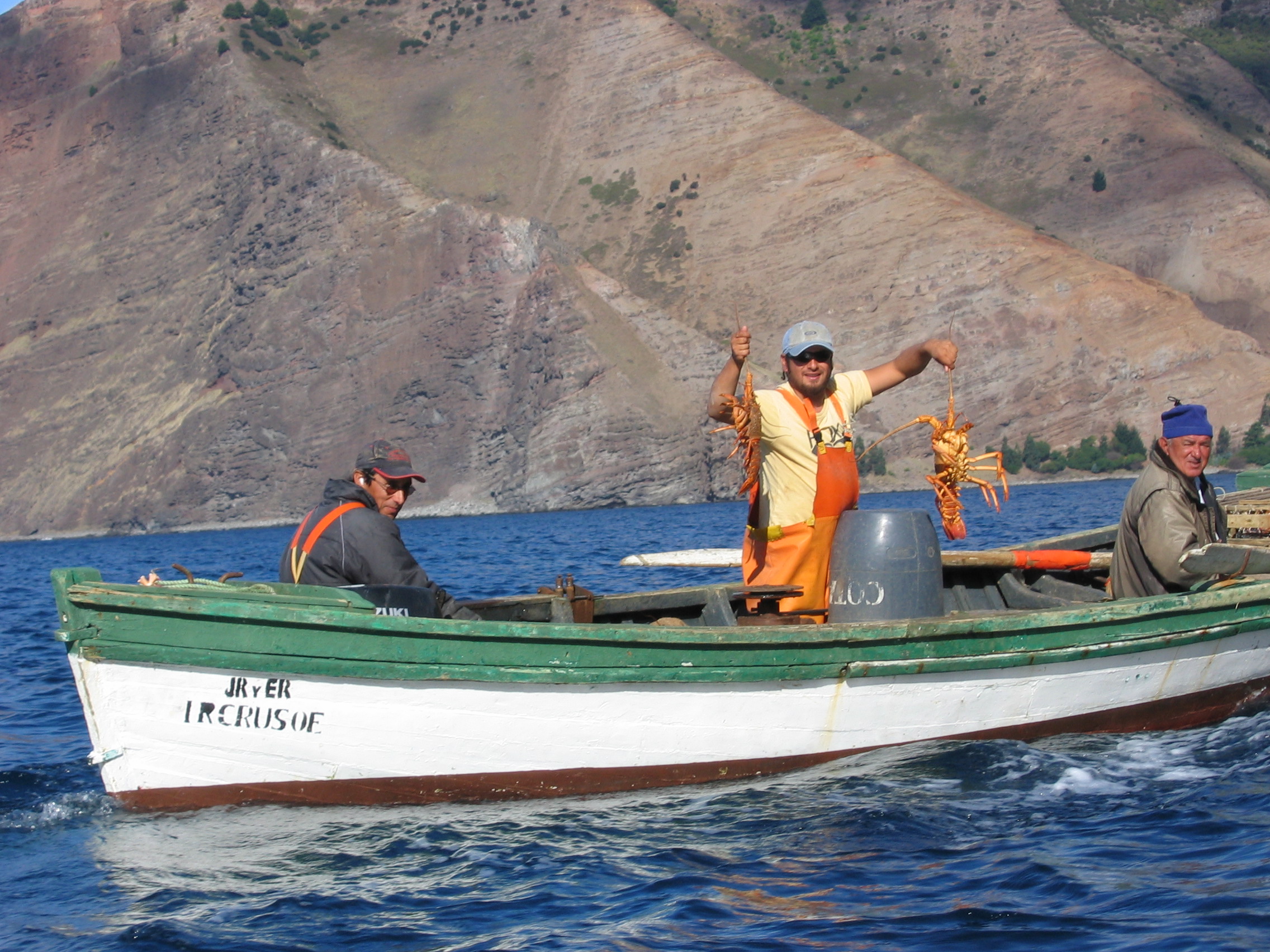
Robinson Crusoe has an estimated population for 2011 of 859 (525 men, 334 women) living in the village of San Juan Bautista.[10] Although the community maintains a rustic serenity dependent on the spiny lobster trade, residents employ a few vehicles, a satellite internet connection, and many television sets. There is an airstrip[11][12] on the island, near the tip of the island's southwestern peninsula. The flying time from Santiago de Chile is just under three hours,[13] and there is a ferry from the airstrip to San Juan Bautista.
Tourists number in the hundreds per year. One activity gaining popularity is scuba diving, particularly on the wreck of the German light cruiser SMS Dresden, which was scuttled in Cumberland Bay during the Battle of Más a Tierra during the First World War. Apocalypse Island, a television show on the History Channel, filmed at Robinson Crusoe Island to show the viewers two rock formations a Canadian explorer claims are Mayan statues.
See also
- Flora of the Juan Fernández Islands
- Endemic flora of the Juan Fernández Islands
- Endemic fauna of the Juan Fernández Islands
References
- ^ Dig finds camp of 'real Crusoe' – BBC News
- ^ C. Michael Hogan (2008) Magellanic Penguin, GlobalTwitcher.com, ed. N. Stromberg
- ^ A. Anderson, S. Hoberle, G. Rojas, An Archeological exploration of Robinson Crusoe Island, Juan Fernandez Archipelago, Chile
- ^ B. Selcraig (July 2005). The Real Robinson Crusoe. Smithsonian, p.82–90.
- ^ Richard Henry Dana (1840). Two Years Before the Mast, p.28–32.
- ^ Tsunami warning came too late for Robinson Crusoe Island Earth Times
- ^ Narrative by tourists who were there during the tsunami
- ^ (French) AFP, 'Tsunami sur l'île Robinson Crusoé: "la moitié du village emportée"', Patrick Filleux, 3 March 2010 (accessed 4 March 2010)
- ^ Huffington Post, "Chilean Girl Saves Her Island From Tsunami After Earthquake", Erica Liepmann, 4 March 2010 (accessed 4 March 2010)
- ^ Instituto Nacional de Estadísticas.
- ^ La Punta Airport
- ^ Juan Fernandez, A Living Treasure
- ^ Chile: The real Crusoe had it easy
External links
- Routes around the island with descriptions and photos of sights
- Robinson Crusoe Island satellite map with anchorages and other ocean-related information
- A detailed map of the island, showing footpaths and walkers' refuges is available in this online document
- Juan Fernandez Photo Gallery - images of landscapes, flora and fauna of Robinson Crusoe Island
- Robinson Crusoe, Moai statues and the Rapa Nui: the stories of Chile’s far-off islands
- A digital field trip to Robinson Crusoe Island.
- Chasing Crusoe: A multimedia documentary website about the island
- Apocalypse Island Information about the History Channel program on rock formations on the island.
- Apocalypse Island Debate about a History Channel program on rock formations on the island.
2010 Chile earthquake Humanitarian responses · Timeline of relief effortsAffected geography Atacama Trench | Chile • Biobío Region (Concepción · Dichato · Talcahuano) / Maule Region (Cauquenes · Constitución) / O'Higgins Region (Santa Cruz · Rancagua · Pichilemu · Bucalemu) / Valparaíso Region (Juan Fernández Islands · Robinson Crusoe Island)Other Chile helps Chile · Gracias a la Vida · Que Cante la Vida · 03:34: Earthquake in ChileCategories:- Juan Fernández Islands
- Islands of Chile
- Islands of the Pacific Ocean
- Biosphere reserves of Chile


Wikimedia Foundation. 2010.