- Moulton, Iowa
-
Moulton, Iowa — City — Location of Moulton, Iowa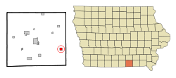
Coordinates: 40°41′7″N 92°40′40″W / 40.68528°N 92.67778°WCoordinates: 40°41′7″N 92°40′40″W / 40.68528°N 92.67778°W Country  United States
State  Iowa
IowaCounty Appanoose Area – Total 1.0 sq mi (2.6 km2) – Land 1.0 sq mi (2.6 km2) – Water 0.0 sq mi (0.0 km2) Elevation 991 ft (302 m) Population (2000) – Total 658 – Density 647.8/sq mi (250.1/km2) Time zone Central (CST) (UTC-6) – Summer (DST) CDT (UTC-5) ZIP code 52572 Area code(s) 641 FIPS code 19-54390 GNIS feature ID 0459266 Moulton is a city in Appanoose County, Iowa, United States. The population was 658 at the 2000 census.
Contents
Geography
Moulton is located at 40°41′7″N 92°40′40″W / 40.68528°N 92.67778°W (40.685304, -92.677862)[1].
According to the United States Census Bureau, the city has a total area of 1.0 square mile (2.6 km2), all of it land.
Demographics
As of the census[2] of 2000, there were 658 people, 302 households, and 176 families residing in the city. The population density was 647.8 people per square mile (249.1/km²). There were 332 housing units at an average density of 326.9 per square mile (125.7/km²). The racial makeup of the city was 97.72% White, 0.30% African American, 1.22% Native American, 0.15% Asian, and 0.61% from two or more races. Hispanic or Latino of any race were 0.15% of the population.
There were 302 households out of which 23.8% had children under the age of 18 living with them, 45.4% were married couples living together, 8.3% had a female householder with no husband present, and 41.4% were non-families. 38.1% of all households were made up of individuals and 18.2% had someone living alone who was 65 years of age or older. The average household size was 2.18 and the average family size was 2.88.
In the city the population was spread out with 22.9% under the age of 18, 9.1% from 18 to 24, 22.6% from 25 to 44, 22.0% from 45 to 64, and 23.3% who were 65 years of age or older. The median age was 42 years. For every 100 females there were 97.6 males. For every 100 females age 18 and over, there were 98.8 males.
The median income for a household in the city was $22,692, and the median income for a family was $31,875. Males had a median income of $23,250 versus $17,353 for females. The per capita income for the city was $14,744. About 11.4% of families and 14.8% of the population were below the poverty line, including 24.8% of those under age 18 and 10.1% of those age 65 or over.
Notable natives
- Claude R. Porter, government official and politician
- Nellie Walker, American sculptor
References
- ^ "US Gazetteer files: 2010, 2000, and 1990". United States Census Bureau. 2011-02-12. http://www.census.gov/geo/www/gazetteer/gazette.html. Retrieved 2011-04-23.
- ^ "American FactFinder". United States Census Bureau. http://factfinder.census.gov. Retrieved 2008-01-31.
Municipalities and communities of Appanoose County, Iowa Cities Centerville | Cincinnati | Exline | Moravia | Moulton | Mystic | Numa | Plano | Rathbun | Udell | Unionville

Townships Categories:- Populated places in Appanoose County, Iowa
- Cities in Iowa

Wikimedia Foundation. 2010.