- Norcot
-
Coordinates: 51°27′36″N 1°01′37″W / 51.460°N 1.027°W
Norcot 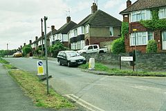
Osborne Road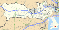
 Norcot
Norcot shown within BerkshireOS grid reference SU6873 Unitary authority Reading Ceremonial county Berkshire Region South East Country England Sovereign state United Kingdom Post town Reading Postcode district RG31 Dialling code 0118 Police Thames Valley Fire Royal Berkshire Ambulance South Central EU Parliament South East England UK Parliament Reading East List of places: UK • England • Berkshire Norcot is an area of Tilehurst and a ward of Reading in the English county of Berkshire.
Location and origins
Norcot ward is the south-eastern sector of the Reading borough portion of Tilehurst. However, as a suburban area, Norcot centres on Norcot Road and the upper Oxford Road on Norcot Hill. It is partly in Norcot ward and partly in Kentwood. The original hamlet was near the junction of Norcot Road and Romany Lane and was largely made up of Norcot Farm in the north-east of old Tilehurst parish. The name means 'North Cottage' and is thus twinned with Southcote, below Tilehurst church and manor.
Buildings and structures
The Norcot Water Tower, built at the end of the 19th century, is somewhat older than the more prominent Tilehurst Water Tower. It is 50ft high, a Grade II listed building[1] and since 2002 has been converted into a luxury apartment. Norcot School was built in 1906. In its lifetime, it was both a senior and a junior school. It closed in 1989. Like much of Tilehurst, Norcot Hill was used for the extraction of clay for brickmaking. In the 1920s, S. E. Collier's transported the clay via overhead cables to their main site in the Dee Road area of Tilehurst. St George's Church was built on the north-eastern edge of Norcot in 1886, largely to service the soldiers of the nearby Brock Barracks. Norcot Mission Church was started in 1929 to serve the new Norcot council estate. It started in a hut on land rented from the Pulsometer Engineering Works. The church moved to a permanent building in Brockley Close in 1972. The post office is on the Oxford Road.
References
- ^ "Water Tower, Reading". British Listed Buildings. http://www.britishlistedbuildings.co.uk/en-39282-water-tower-reading. Retrieved 6 June 2011.
Reading, Berkshire Topics Politics ConstituenciesElectionsReading by-election, 1910 · Reading Borough Council election, 2011Places Within the boroughCaversham · Caversham Heights · Caversham Park Village · Coley · Coley Park · East Reading · Emmer Green · Horncastle · Katesgrove · Lower Caversham · Newtown · Norcot · Southcote · Tilehurst · West Reading · Whitley · Whitley WoodOutside the boroughBeansheaf Farm · Calcot · Earley · Fords Farm · Holybrook · Little Heath · Lower Earley · Maiden Erlegh · Purley-on-Thames · WoodleyCategories:- Suburbs of Reading, Berkshire
- Tilehurst
- Villages in Berkshire
- Berkshire geography stubs


Wikimedia Foundation. 2010.