Chum Kiri District

Chum Kiri District
Chum Kiri
ស្រុកជុំគីរី
—  District (srok)  —
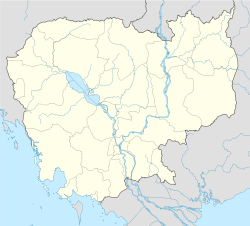
Chum Kiri is located in Cambodia
Chum Kiri
Location in Cambodia
Coordinates: 10°51′N 104°24′E / 10.85°N 104.4°E / 10.85; 104.4
Country  Cambodia
Province Kampot
Communes 7
Villages 37
Population (1998)[1]
 – Total 39,320
Time zone +7
Geocode 0704

Chum Kiri District (Khmer: ស្រុកជុំគីរី) is a district located in Kampot Province, in southern Cambodia.

References

  1. ^ General Population Census of Cambodia, 1998: Village Gazetteer. National Institute of Statistics. February, 2000. pp. 214–215. 


Coordinates: 10°51′N 104°24′E / 10.85°N 104.4°E / 10.85; 104.4


Wikimedia Foundation. 2010.

Игры ⚽ Поможем решить контрольную работу

Look at other dictionaries:

  • Chol Kiri District — Chol Kiri ស្រុកជលគីរី   District (srok)   …   Wikipedia

  • Ou Chum District — For the commune and the village, see Ou Chum (commune). Ou Chum អូរជុំ   District   …   Wikipedia

  • Ou Ya Dav District — Ou Ya Dav អូរយ៉ាដាវ   District   Location of Ou Ya Dav in Ratanakiri …   Wikipedia

  • Cheung Prey District — Cheung Prey ស្រុកជើងព្រៃ   District (srok)   …   Wikipedia

  • Dang Tong District — Dang Tong ស្រុកដងទង   District (srok)   …   Wikipedia

  • Chi Kraeng District — Chi Kraeng   District (srok)   Country  Cambodia Province …   Wikipedia

  • Malai District — Malai ស្រុកម៉ាឡៃ   District (srok)   Map showing the location of the district within Banteay Meanchey Province …   Wikipedia

  • Mongkol Borei District — Mongkol Borei ស្រុកមង្គលបុរី   District (srok)   Map showing the location of the district within Banteay Meanchey Province …   Wikipedia

  • Ou Reang Ov District — Ou Reang Ov ស្រុកអូរាំងឪ   District (srok)   …   Wikipedia

  • Memot District — Memot ស្រុកមេមត់   District (srok)   …   Wikipedia

Share the article and excerpts

Direct link
Do a right-click on the link above
and select “Copy Link”