- Mukh Kamphool District
-
Mukh Kamphool
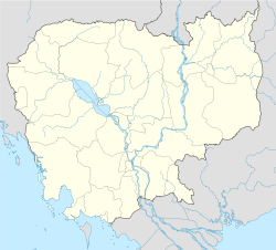
ស្រុកមុខកំពូល— District (srok) — Location in Cambodia Coordinates: 11°44′32″N 104°58′51″E / 11.74222°N 104.98083°E Country  Cambodia
Province Kandal Communes 9 Villages 47 Population (1998)[1] – Total 77,456 Time zone +7 Geocode 0807 Mukh Kamphool District (Khmer: ស្រុកមុខកំពូល) is a district (srok) of Kandal Province, Cambodia. The district is subdivided into 9 communes (khum) and 47 villages (phum).[2]
References
- ^ General Population Census of Cambodia, 1998: Village Gazetteer. National Institute of Statistics. February, 2000. pp. 149–152.
- ^ "Kandal Administration". Royal Government of Cambodia. http://www.cambodia.gov.kh/unisql1/egov/english/province/kandal.html. Retrieved 2009-02-01.
External links
 Kandal Province
Capital city Ta Khmau
Districts Kandal Stueng • Kien Svay • Khsach Kandal • Koh Thum • Leuk Daek • Lvea Aem • Mukh Kamphool •Angk Snuol • Ponhea Leu • S'ang • Ta KhmauCoordinates: 11°44′32″N 104°58′51″E / 11.74222°N 104.98083°E
Categories:- Cambodia geography stubs
- Districts of Cambodia
- Kandal Province
Wikimedia Foundation. 2010.

