- Washington State Route 125
Infobox road
state=WA
type=SR
route=125
maint=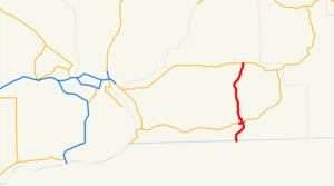
map_notes=SR 125 highlighted in red
length_mi=23.65
length_round=2
length_ref=cite web|author=Washington State Department of Transportation |url=http://www.wsdot.wa.gov/mapsdata/tdo/PDF_and_ZIP_Files/HwyLog2006.pdf|title=State Highway Log, 2006|accessdate=2008-08-30]
established=1964cite web |url=http://apps.leg.wa.gov/RCW/default.aspx?cite=47.17.240 |title=RCW 47.17.240: State Route 125 |accessmonthday=July 11 |accessyear=2008 |author=Washington State Legislature ]
direction_a=South
terminus_a=jct|state=OR|OR|11 near Walla Walla
junction=jct|state=WA|US|12 in Walla Walla
direction_b=North
terminus_b=jct|state=WA|SR|124 near Prescott
previous_type=SR
previous_route=124
next_type=SR
next_route=127
spur_of=12
spur_type=USState Route 125 (SR 125) is a
state highway in theU.S. state ofWashington . It extends convert|23.65|mi|km|2 from OR 11 south of Walla Walla, north to State Route 124 west of Prescott. SR 125 passes U.S. Route 12 and Walla Walla. The route serves as a connector from US 12 to SR 124, Prescott, andPendleton, Oregon (via OR 11).cite map |publisher=Google Maps |title=State Route 125 Overview Map |url=http://maps.google.com/maps?f=d&saddr=WA-125+S+%4046.000700,+-118.387380&daddr=46.298693,-118.3408&hl=en&geocode=11520840610225252316,46.000700,-118.387380%3B&mra=mi&mrsp=1,0&sz=16&sll=46.298397,-118.340907&sspn=0.004492,0.008926&ie=UTF8&ll=46.17983,-118.369446&spn=0.576213,1.142578&z=9 |year=2008 |cartography=NATVEQ |accessdate=2008-08-30] [cite map |publisher=Google Maps |title=Oregon Route 11 Overview Map |url=http://maps.google.com/maps?f=d&saddr=Oregon-Washington+Hwy+%4045.662910,+-118.777786&daddr=46.000694,-118.387374&hl=en&geocode=16429333159201818978,45.662910,-118.777786%3B&mra=dme&mrcr=0&mrsp=1&sz=19&sll=46.000867,-118.38736&sspn=0.000565,0.001116&ie=UTF8&ll=45.821143,-118.564453&spn=0.579961,1.142578&z=9 |year=2008 |cartography=NATVEQ |accessdate=2008-08-30]SR 125 was established in 1964 after the 1964 highway renumbering, along its current route. Before SR 125 was established, the route from Oregon to Walla Walla was the Walla Walla branch of Primary State Highway 3 and the route from Walla Walla to Prescott was
Secondary State Highway 3E . Even though SR 125 was established in 1964, no signs went up until the law that made SR 125 was approved by theWashington State Legislature in 1970. SR 125 also has a spur route that connects the highway with U.S. Route 12 eastbound towards Clarkston. The spur route is located entirely in Walla Walla.cite map |publisher=Google Maps |title=State Route 125 Spur Map |url=http://maps.google.com/maps?f=d&saddr=W+Pine+St+%4046.069480,+-118.369310&daddr=W+Pine+St+%4046.068750,+-118.356440&hl=en&geocode=5825983074827763527,46.069480,-118.369310%3B3009550805179495571,46.068750,-118.356440&mra=ls&sll=46.069405,-118.370025&sspn=0.002255,0.004463&ie=UTF8&ll=46.068765,-118.363481&spn=0.009022,0.017853&z=15 |year=2008 |cartography=NATVEQ |accessdate=2008-08-30]Route description
State Route 125 runs approximately convert|23.65|mi|km|2 from OR 11 south of Walla Walla, north to State Route 124 west of Prescott. The route links the communities of
Pendleton, Oregon (via OR 11),Milton-Freewater, Oregon (via OR 11), College Place, Walla Walla, and Prescott, and passesWalla Walla College andFort Walla Walla . The road intersects two major arterials:Oregon Route 11 and US 12 before ending at State Route 124.cite map |author=GM Johnson |title=Walla Walla, Hermiston, Pendleton |url=http://store.maplink.com/map.aspx?pid=523000 |publisher=GM Johnson |location=Burnaby ,British Columbia |year=2008 |edition=2008 |series=City Street Maps |accessdate=2008-08-30] [cite map |title=Official State Highway Map |url=http://www.wsdot.wa.gov/NR/rdonlyres/87105CAD-83A9-49A7-80F3-5719637C1E2D/0/FrontMapBig.pdf |publisher=Washington State Department of Transportation |location=Olympia, Washington |year=2008 |edition=2008-2009 |scale=1:842,000 |series=Official State Highway Maps |cartography=U.S. Geological Survey |section=7G |accessdate=2008-08-30]Starting at the Oregon-Washington border, the route runs north as a four-lane
divided highway into College Place, where the road becomes undivided and goes northeast into Walla Walla. Within Walla Walla, the route passes theWalla Walla Park and Jefferson Park before turning north to Downtown. In Downtown, SR 125 Spur branches off and SR 125 passes under US 12's divided highway and goes north towards Prescott. [cite map |publisher=Google Maps |title=State Route 125 Map (Oregon to Walla Walla) |url=http://maps.google.com/maps?f=d&saddr=46.001195,-118.387127&daddr=13th+Ave+N+%4046.069736,+-118.356470&hl=en&geocode=%3B13299222247617789485,46.069736,-118.356470&mra=dme&mrcr=0&mrsp=0&sz=14&sll=46.00507,-118.391418&sspn=0.018064,0.035706&ie=UTF8&ll=46.037254,-118.376999&spn=0.072214,0.142822&z=12 |year=2008 |cartography=NATVEQ |accessdate=2008-08-30] [cite map |publisher=Rand McNally |title=The Road Atlas |year=2008 |page=108 |section=L17 |isbn=0528939610] The section of SR 125 from Oregon to Walla Walla is the only portion of SR 125 to be part of the National Highway System.cite web |url=http://www.wsdot.wa.gov/NR/rdonlyres/F934B0E9-1EAB-47B3-8086-E5A00C9DDDEB/0/NHSlist.pdf |title=Washington State National Highway System (NHS) Designated Highways |author=Washington State Department of Transportation |accessdate=2008-08-30]After leaving Walla Walla, SR 125 goes north to Valley Grove, where the highway starts to parallel the route of the
Palouse River and Coulee City Railroad , a railroad that runs from Wallula to Walla Walla, Oregon, Waitsburg, and Dayton. [cite map |title=Washington State Railroad System |url=http://www.wsdot.wa.gov/NR/rdonlyres/8CFBC47D-3549-4CB9-9DE6-14CE9739671F/0/RailSystemMap_Aug2007.pdf |publisher=Washington State Department of Transportation |year=2007 |month=August |cartography=U.S. Geological Survey |accessdate=2008-08-30] [cite web |url=http://www.wsdot.wa.gov/Freight/Rail/railroadsContacts.htm |title=Railroad Contacts in Washington State |author=Washington State Department of Transportation |accessdate=2008-08-30] [cite web |url=http://www.watcocompanies.com/railroads.htm |title=Watco Companies Railroads |author=Watco Companies |accessdate=2008-08-30] The highway continues northeast from Valley Grove and passes Hadley, Berryman, and Ennis, before ending at SR 524 approximately convert|1.30|mi|km|2 [cite map |publisher=Google Maps |title=Directions from SR 125/124 to Prescott |url=http://maps.google.com/maps?f=d&saddr=WA-125+%4046.298680,+-118.340840&daddr=46.299627,-118.313227&hl=en&geocode=11391384239374606603,46.298680,-118.340840%3B&mra=mi&mrsp=1&sz=15&sll=46.300309,-118.313913&sspn=0.008984,0.017853&ie=UTF8&ll=46.298382,-118.327217&spn=0.017968,0.035706&z=14 |year=2008 |cartography=NATVEQ |accessdate=2008-08-30] west of Prescott. [cite map |publisher=Google Maps |title=State Route 125 Map (Walla Walla to SR 124) |url=http://maps.google.com/maps?f=d&saddr=13th+Ave+N+%4046.069736,+-118.356470&daddr=46.298682,-118.340837&hl=en&geocode=13299222247617789485,46.069736,-118.356470%3B&mra=mi&mrsp=1&sz=19&sll=46.298627,-118.340714&sspn=0.000562,0.001116&ie=UTF8&ll=46.205498,-118.320007&spn=0.287974,0.571289&z=10 |year=2008 |cartography=NATVEQ |accessdate=2008-08-30] [cite map |publisher=Rand McNally |title=The Road Atlas |year=2008 |page=108 |section=K17 |isbn=0528939610]tate Route 125 Spur
Shban
state = WA
route = 125
banner = SPUR
location =Walla Walla, Washington
active = 1964endashState Route 125 Spur (SR 125 Spur) is a 0.67 long
spur route of SR 125 in Walla Walla. The route runs from US 12 east to SR 125. The road serves traffic from US 12 eastbound into Walla Walla and connects SR 125 with US 12 eastbound. SR 125 Spur is part of the National Highway System.cite web |url=http://www.wsdot.wa.gov/NR/rdonlyres/F934B0E9-1EAB-47B3-8086-E5A00C9DDDEB/0/NHSlist.pdf |title=Washington State National Highway System (NHS) Designated Highways |author=Washington State Department of Transportation |accessdate=2008-08-30]History
SR 125 became a state highway during the 1964 highway renumbering, in which the
Washington State Department of Transportation (WSDOT) replaced the old system (Primary and Secondary Highways) with a new system (State Routes), which is still in use today. In the Primary and Secondary system, SR 125 from Oregon to US 12 (then US 410) was the Walla Walla branch of Primary State Highway 3 and SR 125 from US 12 to SR 124 wasSecondary State Highway 3E .Before and after the establishment, the route of SR 125 has gone through 19 documented WSDOT construction projects from 1921 to 2003. [cite web |url=http://www.wsdot.wa.gov/eesc/design/rowplans/CurrentPlans/SR%20125.PDF |title=Current List of SR 125 R/W Plans |author=
Washington State Department of Transportation |date=2004-11-03 |accessdate=2008-08-30] Many were small, minor projects including repavings and intersection improvements. The latest project was a repaving project along SR 125 from Military Road south of Walla Walla to SR 125 Spur. The project cost $1,962,783 USD and happened in 2003. [cite web |url=http://www.wsdot.wa.gov/Projects/Highlights/2003/sr125Paving.htm |title=2003 Construction Highlights - SR 125 - Military Rd. to US 12 Paving Project Evaluation |author=Washington State Department of Transportation |year=2003 |accessdate=2008-08-30]Major intersections
References
External links
* [http://www.angelfire.com/wa2/hwysofwastate/sr125.html Highways of Washington State]
* [http://www.highwaygeek.com/WA125.htm HighwayGeek]
* [http://apps.leg.wa.gov/RCW/default.aspx?cite=47.17.240 RCW 47.17.240: State Route 125]

Wikimedia Foundation. 2010.