- North End, Halifax
-
Part of a series about
Places in Nova Scotia
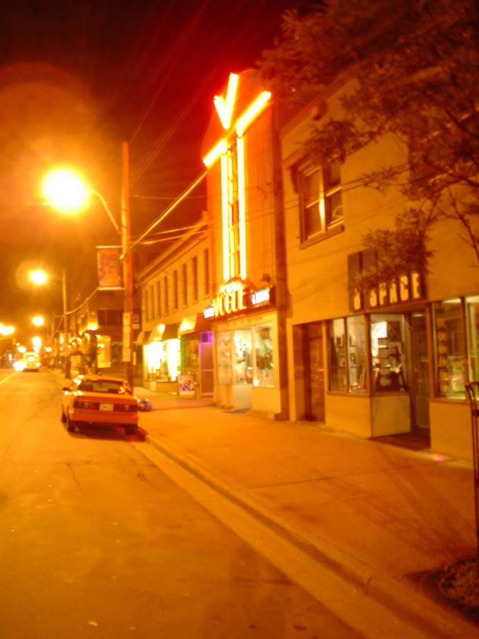
Places and Communities in Halifax Regional Municipality North End, Halifax  Gottingen Street commercial district at night, looking north.
Municipality: Halifax Regional Municipality Community Council: Peninsula Council Planning Area: Halifax Peninsula Halifax Peninsula Neighbourhoods or Villages Armdale, Downtown, Hydrostone, North End, Quinpool, South End, Spring Garden, West End Template:Infobox HRM Community Neighbourhood The North End of Halifax is a neighbourhood located in the urban core of Nova Scotia's Halifax Regional Municipality, occupying the northern part of the Halifax Peninsula.
Contents
Geography
The northern part of the Halifax Peninsula comprises thin soil resulting from glacial deposits, as well as outcroppings of a dark metamorphic slate known as “ironstone”. The entire peninsula has no significant surface water, unlike the areas northeast and southwest of Halifax Harbour (the Eastern Shore and South Shore respectively).
At 60m in elevation, Citadel Hill is the highest point on the peninsula and when combined with the expansive undeveloped parkland of the North Common, creates a physical boundary that separates the various neighbourhoods; the South Common having been developed for institutional and commercial/residential use is mostly considered. Fort Needham is another glacial drumlin located in the heart of the North End.
Boundaries
The neighbourhood referred to as the "North End" by Halifax residents was bounded on the east and north by "The Narrows" of Halifax Harbour and the Bedford Basin. Its other boundaries as not as sharply defined, but the western limit of the neighbourhood is generally agreed to lie somewhere between Oxford Street and Robie Street, with many settling on Windsor Street as a convenient delimiting line.
The southern boundary was, traditionally, the northern limit of General Cornwallis's original Halifax settlement along the slope of Citadel Hill (now Cogswell Street), and continuing along the northern edge of the North Common to Quinpool Road.
The northern boundary has steadily migrated toward the Bedford Basin since Halifax's founding. The boundary originally ended at North Street, just as the South End ended at South Street. Another community further to the north was Richmond, and was located on the eastern slope of Fort Needham. Further north of Richmond, at the end of the Campbell Road, was the black community of Africville.
By the end of the 19th century, the perception of the North End had come to generally include Richmond as well. Following its total destruction in the Halifax Explosion (December, 1917), Richmond never again regained its individual identity. The area underwent significant redevelopment during the inter-war period and gradually became an extension of the original North End.
Africville held out as a separate community until the 1960s when it was demolished by city authorities and its residents relocated, many to public housing projects such as Uniacke Square. With the removal of Africville, public perception of the northern boundary then extended to the shores of the Bedford Basin.
During the same time period, the perception of the southern boundary became less clear, with some contending the North End starts at North Street, and that the original north suburb is in fact a part of central Halifax. Today residents consider the North End to be north of North Street.
History
The North End is best known for the disaster of December 6, 1917, commonly referred to as the Halifax Explosion. Prior to the explosion, the North End and Richmond was the focus of the city's industrial community, with the railway station located at the foot of North Street, factories, cotton mills and prisons lining the waterfront, along with major defence installations such as HMC Dockyard and Stadacona (formerly HMCS Stadacona, now part of CFB Halifax).
The explosion's aftermath saw the area north of North Street razed and a new street grid established. New residential construction saw the creation of the historic Hydrostone neighbourhood, built during the relief construction following the disaster. Today the memorial bells at Fort Needham, which were recovered from a church that didn't survive the event, may be heard in the carillon and monument to the disaster.
The Halifax North Memorial Public Library was opened in 1966 in memory of the victims of the explosion. Located on Gottingen Street, south of North Street, the library offers a welcoming environment as well as programs that strongly reflect the diverse make-up of the community.
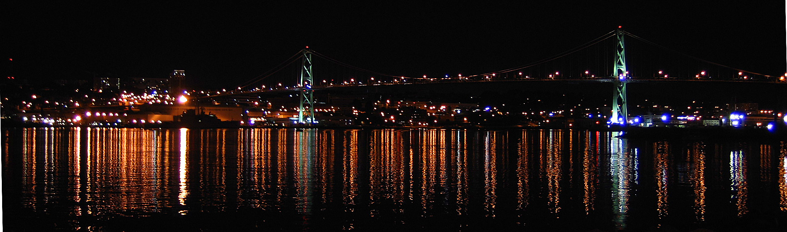
 The Angus L. MacDonald Bridge opened in 1955, changing the North End and the Halifax-Dartmouth region forever. Its western abutment is located at the foot of the North End and the bridge connects North Street with Dartmouth.
Seaview Park on the Bedford Basin is the site of Africville, the former African-Canadian community that was a safe haven for African slaves coming to Canada. The community was torn down in the 1960s preceding a proposed urban redevelopment of the region which would see new highways and the construction of the A. Murray MacKay Bridge, although the lands of the community were never used in a proposed port expansion. In the ensuing controversy it was designated as parkland.
The Africville expropriation is often characterized as an example of institutional racism in Halifax. The municipal government justified the destruction of Africville by citing the poor living conditions of the community, despite having historically refused to extend those services to the community. The razing of Africville allowed for industrial development in the area and for the progress of the city's traffic grid, with the construction of the 'new' bridge. The Africville residents and descendants were dispersed among some of the North End's public housing projects, as well as into other parts of Halifax and Dartmouth.
Reputation of the North End
In recent years, the North End has become a popular destination for Halifax's growing university population. As the prices of apartments closer to Dalhousie University and Saint Mary's University continue to rise, and as the cost of transportation has fallen due to the introduction of the U-pass, students are finding cheaper accommodations in the North End. This has giving birth to a thriving artistic community, with many painters, musicians and writers being lured to this colourful section of the city.
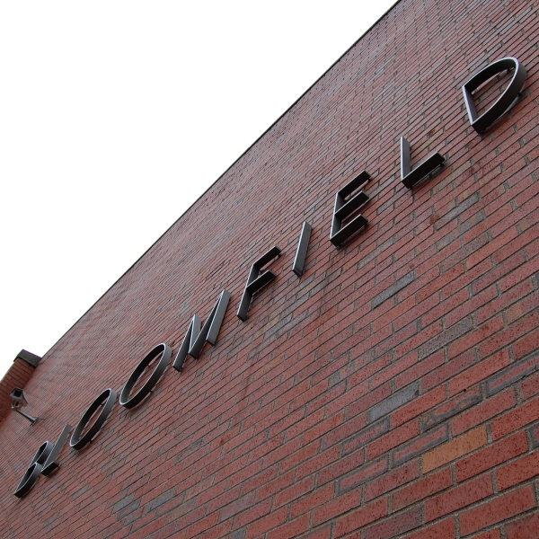
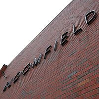 The former Bloomfield School is now Bloomfield Centre, a local arts community.
However, the North End is often linked to issues of crime and poverty. Its historic reputation as a largely blue collar, working class area[1] remains in the minds of much of the local population, especially the older citizens.[citation needed] Hugh MacLennan, in his 1941 novel of the Halifax Explosion, Barometer Rising described the North End as having always been "Catholic and poor". Land use has been defined by the proximity of the CFB Halifax naval base and various adjunct facilities, as well as the Halifax Shipyard, the devastation of the 1917 explosion, all of which contributed to a now-aging stock of residential and commercial buildings that are typically smaller and of lower assessed value than other areas in the metropolitan region. Socio-economically, the devastation of the explosion and the military and industrial concentration in the neighbourhood saw a flight of the middle class to other exclusively residential undevastated neighbourhoods during the early 20th century, leading to a decline in the reputation of the North End.
A perceived media bias against the North End, and media confusion over boudries, continues to generate controversy among residents, who believe they are targeted for racial and/or socio-economic reasons.[citation needed] Low rent in the smaller residential and commercial properties had contributed to a trend toward gentrification in recent decades, often spearheaded by artistic, cultural and activist organizations. The recent housing boom of the early 21st century has again re-valued property on the Halifax peninsula. The area has become home to organizations such as Bloomfield Centre,[2] North By North End,[3] Grainery Food Co-Op,[4] the Anchor Archive Zine Library[5] and the North End Community Gardening Association.[6] Plans are now under way for the redevelopment of Bloomfield Centre.[7]
Further reading
- Paul A. Erickson, Halifax's North End: An anthropologist looks at the city, Hantsport: Lancelot Press, 1987.
Notes
Coordinates: 44°39′47.3″N 63°36′4.6″W / 44.663139°N 63.601278°W
Categories:

Wikimedia Foundation. 2010.