- The Hydrostone
Infobox Settlement
official_name = Pagename
other_name =
native_name =
nickname =
settlement_type = Neighbourhood
motto =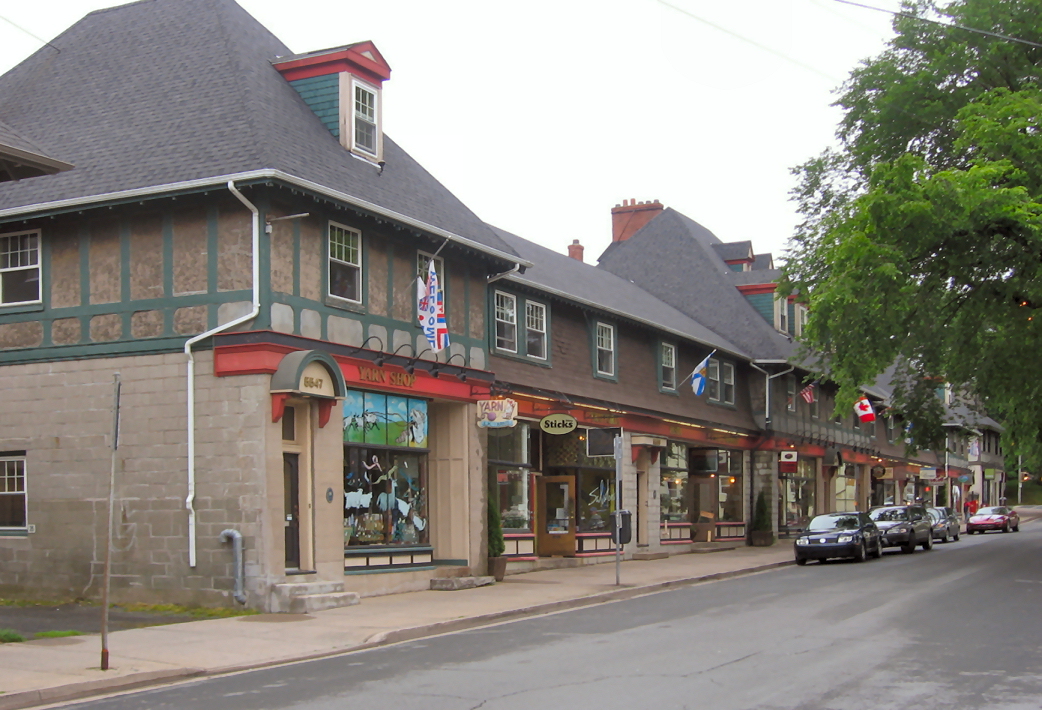
imagesize =
image_caption = Storefronts in the Hydrostone district of Halifax, Nova Scotia. The buildings date from about 1919
flag_size =
image_
seal_size =
image_shield =
shield_size =
city_logo =
citylogo_size =
mapsize = 275px
map_caption = Location of Pagename
mapsize1 =
map_caption1 =
image_dot_
dot_mapsize = 250px
dot_map_caption =Shown with a RED dot, the location of the neighbourhood of the Hydrostone within the planning area of Halifax Peninsula, HRM, Nova Scotia
dot_x = |dot_y =
pushpin_
pushpin_label_position =
pushpin_map_caption =
pushpin_mapsize =
subdivision_type = Country
subdivision_name = CAN
subdivision_type1 = Province
subdivision_name1 = NS
subdivision_type2 = Municipality
subdivision_name2 = Halifax Regional Municipality
subdivision_type3 = Planning area
subdivision_name3 =Halifax Peninsula
subdivision_type4 =
subdivision_name4 =
government_footnotes =
government_type =
leader_title =Council
leader_name =Peninsula Council
leader_title1 =
leader_name1 =
leader_title2 =
leader_name2 =
leader_title3 =
leader_name3 =
leader_title4 =
leader_name4 =
established_title =
established_date =
established_title2 =
established_date2 =
established_title3 =
established_date3 =
area_magnitude =
unit_pref =
area_footnotes =
area_total_km2 =
area_land_km2 =
area_water_km2 =
area_total_sq_mi =
area_land_sq_mi =
area_water_sq_mi =
area_water_percent =
area_urban_km2 =
area_urban_sq_mi =
area_metro_km2 =
area_metro_sq_mi =
population_as_of = 2006
population_footnotes =
population_note =
population_total =
population_density_km2 =
population_density_sq_mi =
population_metro =
population_density_metro_km2 =
population_density_metro_sq_mi =
population_urban =
population_density_urban_km2 =
population_density_urban_sq_mi =
population_blank1_title =
population_blank1 =
population_density_blank1_km2 =
population_density_blank1_sq_mi =
timezone = AST
utc_offset = -4
timezone_DST =
utc_offset_DST =
latd= |latm= |lats= |latNS=N
longd= |longm= |longs= |longEW=W
elevation_footnotes =
elevation_m =
elevation_ft =
postal_code_type =
postal_code =
area_code = 902
blank_name =
blank_info =
blank1_name = Halifax Peninsula Communities
blank1_info =Armdale, Downtown, Hydrostone, North End, Quinpool, South End, Spring Garden, West End
website =
footnotes =Part of a series about Places in Nova Scotia The Hydrostone is a neighbourhood in the North End of the
Halifax Peninsula in theHalifax Regional Municipality ,Nova Scotia ,Canada . It consists of ten short parallel streets and is bordered by Duffus Street to the north, Young Street to the south, Isleville Street to the west and Novalea Drive to the east.The neighbourhood was designed by architect Thomas Adams to provide housing for working-class families displaced by the
Halifax Explosion in 1917. Architectural design was by George Ross of theMontreal architectural firm ofRoss and Macdonald . The neighbourhood draws its name from the specialcinderblock s from which the houses were constructed. Most of the dwellings are row-houses in groups of four and six, except for the large, two-storey single-family houses at the eastern end of each street. Some have been converted to sets of flats.All of the streets in the Hydrostone are boulevards except Stanley Place. These boulevards have treed, grassy strips which serve as communal outdoor space for the neighbourhood. This is consistent with the
Garden city movement by which Adams was influenced. All streets are also served by back lanes, a feature not found in most otherNova Scotia communities.It is a registered National Historic Site.
Construction
Following the
Halifax Explosion , many of the wood-frame buildings collapsed on their coal stoves and furnaces and caught on fire, which was a concern when reconstruction was being planned. To minimize the danger of fire, Adams and Ross proposed the use of non-combustible hydrostone for the reconstruction of this area.Hydrostone was a concrete block that was finished with crushed rock (granite, in this case) to approximate the appearance of cut-stone construction. The concrete blocks and their faces were amalgamated through a hydraulic pressing process, patented by a Chicago firm. Manufacture of the blocks was done in a plant located in
Eastern Passage, Nova Scotia and the finished stones were hauled acrossHalifax Harbour by barge. [Smith, David G. 1981. Reconstruction of the Richmond District. Typed manuscript, research paper, presented to Benevolent Funipendulous Society of Nova Scotia, April, Public Archives of Nova Scotia, Manuscript Group 27, Vol. 9, No. 8, 6 pp.]Transporting the stones to the construction site was problematic, due to the steep rise from the harbour. To solve this problem and make the area more easily accessible, two diagonal streets were included in the Richmond district reconstruction plans: Devonshire Street/Avenue and Dartmouth Avenue.
References
External links
* [http://www.halifaxexplosion.org Halifax Explosion website]
Wikimedia Foundation. 2010.