- Mörschied
-
Mörschied 

 MörschiedLocation of Mörschied within Birkenfeld district
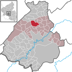
Coordinates 49°47′26″N 7°18′25″E / 49.79056°N 7.30694°ECoordinates: 49°47′26″N 7°18′25″E / 49.79056°N 7.30694°E Administration Country Germany State Rhineland-Palatinate District Birkenfeld Municipal assoc. Herrstein Mayor Dieter Brombacher Basic statistics Area 10.69 km2 (4.13 sq mi) Elevation 420 m (1378 ft) Population 865 (31 December 2010)[1] - Density 81 /km2 (210 /sq mi) Other information Time zone CET/CEST (UTC+1/+2) Licence plate BIR Postal code 55758 Area code 06785 Website www.moerschied.de Mörschied is an Ortsgemeinde – a municipality belonging to a Verbandsgemeinde, a kind of collective municipality – in the Birkenfeld district in Rhineland-Palatinate, Germany. It belongs to the Verbandsgemeinde of Herrstein, whose seat is in the like-named municipality.
Contents
Geography
Location
The municipality lies on the Naturpark Saar-Hunsrück. The municipal area is 64% wooded. To the east lies Herrstein. The nearest major town is Idar-Oberstein to the south.
Constituent communities
Also belonging to Mörschied are the outlying homesteads of Am Herrsteinerweg, Asbacherhütte, Hahnenmühle and Harfenmühle[2].
Politics
Municipal council
The council is made up of 12 council members, who were elected by majority vote at the municipal election held on 7 June 2009, and the honorary mayor as chairman[3].
Mayor
Mörschied’s mayor is Dieter Brombacher, and his deputies are Andreas Herbert and Christian Engel[4].
Coat of arms
The municipality’s arms might be described thus: Per bend sinister sable issuant from the line of partition a demilion with tail bifurcated argent crowned Or and chequy gules and argent issuant from base a mount of three.
Culture and sightseeing
Buildings
The following are listed buildings or sites in Rhineland-Palatinate’s Directory of Cultural Monuments:[5]
- Evangelical church, Äckerchen – aisleless church with ridge turret, 1731-1746; décor; organ, firm of G. Stumm, 1896; two tomb slabs
- Herrsteiner Straße 11 – stately timber-frame Quereinhaus (a combination residential and commercial house divided for these two purposes down the middle, perpendicularly to the street), partly solid, partly slated, half-hipped roof, 19th century
- Herrsteiner Straße 21 – Quereinhaus, partly timber-frame (plastered), timber-frame gallery, marked 1830, conversion 1860
- Hahnenmühle, southeast of the village on the Fischbach – stately miller’s and farmer’s house, marked 1907; mill gear from time of building, bakehouse, mountain cellar
- Schleiferei Biehl (gemcutting shop), northwest of the village on the Fischbach – latter half of the 19th century, technical equipment
Regular events
Since 1990, Mörschied has had an open-air stage on which the Karl-May-Festspiele Mörschied are staged in the summer months each year. In 2010, the play Winnetou gegen Santer (gegen means “against”; both those named in the title are characters from Karl May’s writings) was produced.
Economy and infrastructure
Transport
To the south runs Bundesstraße 422. Serving nearby Idar-Oberstein is a railway station that, as a Regional-Express and Regionalbahn stop, is linked by way of the Nahe Valley Railway (Bingen–Saarbrücken) to the Saarland and the Frankfurt Rhine Main Region. The Rhein-Nahe-Express running the Mainz-Saarbrücken route serves the station hourly. Every other train goes through to the main railway station in Frankfurt with a stop at Frankfurt Airport. Formerly, fast trains on the Frankfurt-Paris route had a stop at Idar-Oberstein.
References
- ^ "Bevölkerung der Gemeinden am 31.12.2010" (in German). Statistisches Landesamt Rheinland-Pfalz. 31 December 2010. http://www.statistik.rlp.de/fileadmin/dokumente/berichte/A1033_201022_hj_G.pdf.
- ^ Statistisches Landesamt Rheinland-Pfalz – Amtliches Verzeichnis der Gemeinden und Gemeindeteile, Seite 20 (PDF)
- ^ Kommunalwahl Rheinland-Pfalz 2009, Gemeinderat
- ^ Mörschied’s council
- ^ Directory of Cultural Monuments in Birkenfeld district
External links
- This article incorporates information from the German Wikipedia.
Categories:- Municipalities in Rhineland-Palatinate
- Birkenfeld district geography stubs


Wikimedia Foundation. 2010.