- Saarland
Infobox German Bundesland
Name = Saarland
German_name =
state_coa = Coa de-saarland.svg
coa_size =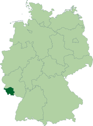

flag_link = Flag of Saarland
capital = Saarbrücken
area = 2568.65
area_source =
population = 1039000
pop_ref = [cite web |url=http://www.statistik-portal.de/Statistik-Portal/de_zs01_saa.asp |title= State population |work= Portal of the Federal Statistics Office Germany |accessdate=2007-04-25]
pop_date = 2007-09-30
GDP = 27
GDP_year = 2005
GDP_percent = 1.2
Website = [http://www.saarland.de/ saarland.de]
leader_title =
leader = Peter Müller
leader_party = CDU
ruling_party1 = CDU
ruling_party2 =
votes = 3
NUTS = DEC
iso region = DE-SLSaarland (pronounced|ˈzaːɐ̯lant in German; French: "Sarre") is one of the 16 federal states (German: "Bundesländer") of
Germany . The capital isSaarbrücken . It has an area of 2570 km² and 1,045,000 inhabitants. In both area and population it is the smallest of the German "Flächenländer" ("area states"), i.e., those that are notCity State s (Berlin , Bremen andHamburg ). Its location between French and German powers has given Saarland a unique history. It was the only state to join the "Bundesrepublik" between its formation in 1949 and theGerman reunification in 1990. With 65.1 percent of the population being Catholic, it is one of two states (the other beingBavaria ) that has a majority Catholicpopulation and is the mostCatholic state in Germany.Geography
The state borders
France (département of theMoselle ) in the south and west,Luxembourg in the west and Rheinland-Pfalz in the north and the east.It is named after the
Saar River , which is, in fact atributary of theMoselle River (aRhine tributary) and runs through the state from the south to the northwest. One third of the land area of the Saarland is covered by forest, one of highest percentages in Germany. The state is generally hilly, the highest mountain is the Dollberg with a height of 695.4 m (about 2,280 feet).Most inhabitants live in a city agglomeration on the French border, surrounding the capital of Saarbrücken.
See also
List of places in Saarland .Districts
Saarland is divided into 6 districts (German: "Landkreise"):
#
Merzig-Wadern
# Neunkirchen
# Saarbrücken
# Saarlouis
#Saarpfalz
# Sankt WendelHistory
Before World War I
Before World War I there existed no shared independent territory in the region of the Saarland. The region of the Saarland was settled by the
Celt ic tribes ofTreveri andMediomatrices . The most impressive relic of their time is the remains of a fortress of refuge atOtzenhausen in the north of the Saarland. In the first century BC, theRoman Empire made the region part of its provinceBelgica . The Celtic population mixed with the Roman immigrants. The region gained wealth, which can still be seen in the remains of Roman villas and villages.Roman rule ended in the 5th century, when the
Franconian s conquered the territory. The region of the Saarland was divided into several small territories, some of which were ruled by sovereigns from adjoining regions. Over the years these territories gained a wide range of independence, threatened only by the French kings, who wanted to incorporate all the territories on the western side of the riverRhine .It was not the
king of France but the armies of theFrench Revolution who terminated the independence of the states in the region of the Saarland. In 1792 they conquered the region and made it part of theFrench Republic . Most of the villages became part of the Département de la Sarre, with some villages in the east becoming part of the Département Donnersberg. After the defeat ofNapoleon in 1815, the region was divided into three parts. Most of it became part of the Prussian Rhine Province. Another part, similar to the Saarpfalz district was allocated to theKingdom of Bavaria . The smallest part, the village of Nohfelden, was ruled by the Duke of Oldenburg.On July 31, 1870, the French Emperor
Napoleon III ordered an invasion across theSaar River to seize Saarbrücken. The first shots of theFranco-Prussian War 1870/71 were fired on the heights of Spichern, south ofSaarbrücken . After the war, theGerman Empire was founded and the Saar region became part of it.Interwar history
In 1920 the Saargebiet was occupied by Britain and
France under the auspices of theTreaty of Versailles . The occupied area also included portions of thePrussia nRhine Province and theBavaria nRhenish Palatinate . In practice the region was administered by France. In 1920 this was formalized by a 15 yearLeague of Nations mandate.In 1933, a considerable number of political opponents of
National Socialism fled to the Saar, as it was the only part of Germany that remained under foreign occupation following the first world war. As a result, anti-Nazi groups agitated for the Saarland to remain under French administration. However, with most of the population being ethnically German and with strong local anti-French sentiments deeply entrenched, such views were considered suspect or even treasonous, and therefore found little support. When the original 15-year-term was over, aplebiscite was held in the territory on13 January 1935 ; 90.3% of those voting favored re-joiningGermany .Following the referendum
Josef Bürckel (member of theNSDAP party) (b. 1895 – d. 1944) was appointed on 1 March 1935 as theGerman Reich 's commissioner for re-integration ("Reichskommissar für die Rückgliederung des Saarlandes"). When the reincorporation was considered accomplished, his title was changed (after 17 June 1936) to "Reichskommissar für das Saarland". A further change was made after 8 April 1940 to "Reichskommissar für die Saarpfalz"; finally, after 11 March 1941, he was made "Reichsstatthalter in der "Westmark" (the region's new name, meaning "Western March or Border"), until 28 September 1944, when he was succeeded byWilli Stöhr (b. 1903, alsoNSDAP ), until 21 March 1945.History after World War II
After
World War II , the Saarland came under French occupation and administration again, as the Saar Protectorate.Under the
Monnet Plan France attempted to gain economic control of German industrial areas with large coal and mineral deposits that were not in Soviet hands-- theRuhr area and theSaar area . Attempts to gain control of or permanently internationalize the Ruhr (seeInternational Authority for the Ruhr ) area were abandoned in 1951 with the German agreement to pool its coal and steel resources (seeEuropean Coal and Steel Community ) in return for full political control of the Ruhr. The French attempt to gain economic control over the Saar was more successful at the time, with the final vestiges of French economic influence ending in 1981. Unlike the Soviets in UpperSilesia (Germany's largest center of mining and industry), France did not annex the Saar and did not forcibly expel the local German population.In the speech
Restatement of Policy on Germany , held in Stuttgart on September 6, 1946, the United StatesSecretary of State James F. Byrnes stated the U.S. motive in detaching the Saar from Germany as "The United States does not feel that it can deny to France, which has been invaded three times by Germany in 70 years, its claim to the Saar territory". (See alsoMorgenthau plan forU.S. andUK designs for the Saar area.)In the years from 1945 to 1951 a policy of industrial disarmament was pursued in Germany by the Allies (see
the industrial plans for Germany ). As part of this policy limits were placed on allowed production levels, and industries in the Saar were dismantled just as in the Ruhr, although mostly in the period prior to the detachment (see also [http://www.ena.lu/?lang=2&doc=16822 the 1949 letter] from the UK Foreign ministerErnest Bevin to the French Foreign ministerRobert Schuman , urging a reconsideration of dismantling policy).The Saar Protectorate was headed by a military governor from 30 August 1945: Gilbert Yves Édmond Grandval (b. 1904 - d. 1981), who remained on 1 January 1948 as
High Commissioner , and January 1952 - June 1955 as the first of two French ambassadors, his successor being Eric de Carbonnel (b. 1910 - d. 1965) until 1956. Saarland, however, was allowed a regional administration very soon, consecutively headed by:
*a President of the Government:
**31 July 1945 - 8 June 1946: Hans Neureuther, Non-party
*a Chairman of the (until 15 December 1947, Provisional) Administration Commission:
** 8 June 1946 - 20 December 1947: Erwin Müller (b. 1906 - d. 1968), Non-party
*Minister-presidents (as in any "Bundesland"):
**20 December 1947 - 29 October 1955 Johannes Hoffmann (b. 1890 - d. 1967), CVP
**29 October 1955 - 10 January 1956 Heinrich Welsch (b. 1888 - d. 1976), Non-party
**10 January 1956 - 4 June 1957 Hubert Ney (b. 1892 - d. 1984), CDUIn 1954, France and the
Federal Republic of Germany (West Germany) developed a detailed plan called the "Saarstatut" to establish an independent Saarland, but a plebiscite rejected it by 67.7%. OnOctober 27 ,1956 , theSaar Treaty declared that Saarland should be allowed to join the Federal Republic of Germany, which it did onJanuary 1 ,1957 . This was the last significant international border change in Europe until thefall of Communism .The Saarland's reunification with the Federal Republic of Germany was sometimes referred to as the "kleine Wiedervereinigung" ("small reunification", in contrast with the post-Cold War re-absorption of the
GDR ). Even after reunification, theSaar franc remained as the territory's currency, until West Germany'sDeutsche Mark replaced it onJuly 7 ,1959 . The Saar Treaty established that French, not English as in the rest of West Germany, should remain the first foreign language taught in Saarland schools; this provision is still largely followed today, although no longer binding.Since 1971, Saarland has been a member of
SaarLorLux , aeuroregion created of Saarland,Lorraine ,Luxembourg ,Rhineland Palatinate andWallonia .Other
The Saar competed in the qualifying section of the 1954 football World Cup, but failed after coming second to West Germany but ahead of Norway. It also competed in the
1952 Summer Olympics (seeSaar at the 1952 Summer Olympics ).From 1920 to 1935, and then from 1947 to 1959, the inhabitants used
postage stamp s issued specially for the territory; seepostage stamps and postal history of the Saar for details.In 1954, the Paris mint coined 10, 20, and 50 "franken" pieces. The following year a 100 franken was also minted. After reunification Saarland switched to the West German mark.
Between 1950 and 1956, Saarland was a member of the
Council of Europe .Politics
Saarland has been governed by the rightist
Christian Democratic Union since 1999. In the most recent elections in 2004, the CDU increased its majority in the SaarlandLandtag from 1 to 3.Since Saarland joined the Federal Republic of Germany, the CDU has governed the state for 37 out of 51 years, with the leftist
Social Democratic Party of Germany ruling for the remaining fourteen years, thereof 14 years (1985-1998) withOskar Lafontaine serving as minister-president.Language
Local dialect
People in the Saarland speak
Rhine Franconian (in the southeast, very similar to that dialect spoken in the western part of the Palatinate) andMoselle Franconian (in the northwest, very similar to that dialect spoken along theMoselle River and the cities ofTrier or even inLuxembourg ), dialects of German. Outside of the Saarland, specifically the Rhine-Franconian variant spoken in the LandeshauptstadtSaarbrücken is generally considered to be "the" Saarland dialect. In general, both dialects are an integral part of the “Saarlandish” identity and thus a strong source of local patriotism.Both dialects, even more so in their respective Saarland flavour, share many characteristic features, some of which will be explained below.
Women and girls are often referred to using the neuter
grammatical gender , "es", with the pronunciation being something like "Ähs". "Ähs hat mir's gesaat" ("it told me so", instead of "she told me so"; vs. High German: "Sie hat es mir gesagt"). This stems from the word "Mädchen" (girl) being neuter in German ("es" is correct in German when referring to words like "Mädchen" but would not be used by itself in reference to a woman).The
conjunctive in Rhine Franconian is normally composed with the words "dääd" (High German “tät” = “would do”) or "gäng" (“would go”) as auxiliary verbs: "Isch dääd saan, dass..." (“I would say that...”) instead of the High German "Ich würde sagen, dass...".Declension is rather different:
*Thegenitive case does not exist at all and is entirely replaced by constructs with thedative case .
*In most instances, a word is not altered when cast into the dative case. Exceptions are mostlypronoun s.
*The same holds for theaccusative case. Even more so, it is accepted practice to use thenominative case instead of the accusative.Diphthongs are almost non-existent. The Saarlandish variant of a High-German word that contains a diphthong usually will have a longvowel in its place. Moreover, the vowels "ö" and "ü" do not exist in the dialect. They are generally replaced by "e" and "i" respectively.French has had a considerable influence on the vocabulary, although the pronunciation of imported French words usually is quite different from their original. Popular examples comprise "Trottwaa" (from "trottoir"), "Fissääl" (from "ficelle"), and the imperative or greeting "aalleh!" (from "allez!").
The English phrase "My house is green" is pronounced almost the same (in the Rhine Franconian variant): "Mei Haus is grien". The main difference lies in the pronunciation of the "r" sound.
Regional beer brewer Karlsberg has taken advantage of the Saarlandish dialect to create clever advertising for its staple product, UrPils. Examples include a trio of men enjoying a beer, flanked by baby carriages, the slogan reading "Mutter schafft" (meaning "Mom's at work" in Saarlandish, but plays on the High German word "Mutterschaft", or "motherhood"); another depicts a trio of men at a bar, with one realizing his beer has been drunk by one of the others, the slogan reading "Kenner war's" (meaning "It was no one" ["Keiner war es"] in Saarlandish, but playing on the High German word "Kenner", or "connoisseur", translating to "It was a connoisseur"); a third shows an empty beer crate in the middle of outer space, the text reading "All" (meaning "empty" in Saarlandish, but playing on the same High German word meaning "outer space").
French
The
French language has a long tradition and special standing in Saarland. This is not least due to the fact that France sought to incorporate the region into the French state shortly afterWorld War II . Today, a large part of the population is able to speak French, and it is compulsory at many schools [ [http://www.saarland.de/27247.htm Kernlehrpläne - Gesamtschule | Saarland.de ] ] . Saarbrücken is also home to the bilingual "Deutsch-Französisches Gymnasium" (German-French high school) [http://de.wikipedia.org/wiki/Deutsch-Franz%C3%B6sisches_Gymnasium] .ources and external links
* [http://www.saarland.de/ Official governmental portal]
* [http://www.statistik.saarland.de/ Statistics office]
* [http://www.worldstatesmen.org/Germany.html#Saarland WorldStatesmen - Germany]
* [http://www.american.edu/ted/ice/saar.htm France, Germany and the Struggle for the War-making Natural Resources of the Rhineland] Describes the contest for the Saar over the centuries.References


Wikimedia Foundation. 2010.