- Dennyloanhead
-
Coordinates: 55°59′57″N 3°54′37″W / 55.999269°N 3.910275°W
Dennyloanhead 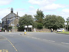
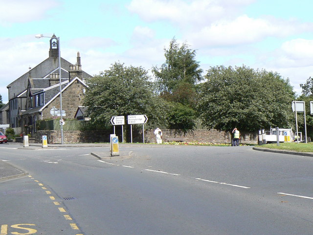
The junction of the A803 road to Glasgow and the A872 road to Stirling at Dennyloanhead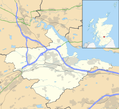
 Dennyloanhead
Dennyloanhead shown within the Falkirk council areaCouncil area Falkirk Lieutenancy area Stirling and Falkirk Country Scotland Sovereign state United Kingdom Post town FALKIRK Postcode district FK4 Dialling code 01324 Police Central Scotland Fire Central Scotland Ambulance Scottish EU Parliament Scotland UK Parliament Falkirk Linlithgow and East Falkirk Scottish Parliament Falkirk East Falkirk West List of places: UK • Scotland • Dennyloanhead (aka D.L.H.) is a village located in the Falkirk council area, Central Scotland, that is between Head of Muir and Longcroft.
The main features include the Crown Hotel and Casserta's chip shop. There is another pub called the Railway Inn.
Famous people born or living in Dennyloanhead include Alex Totten (ex Falkirk manager).
Coordinates: 55°59′56″N 3°54′35″W / 55.999°N 3.9096°W
Towns 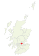
Villages Other villages Allandale · Avonbridge · Binniehill · Blackness · California · Dennyloanhead · Dunmore · Fankerton · Glensburgh · Greenhill · Haggs · Head of Muir · High Bonnybridge · Letham · Limerigg · Longcroft · Muirhouses · Reddingmuirhead · Rumford · Skinflats · South Alloa · Standburn · Stoneywood · Tamfourhill · Torwood · Wallacestone · Westquarter · WhitecrossCategories:- Villages in Falkirk council area
- Central Scotland geography stubs


Wikimedia Foundation. 2010.