- Newtok, Alaska
-
Newtok
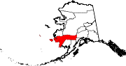
Niugtaq— CDP — Location of Newtok, Alaska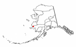
Coordinates: 60°56′40″N 164°38′39″W / 60.94444°N 164.64417°WCoordinates: 60°56′40″N 164°38′39″W / 60.94444°N 164.64417°W Country United States State Alaska Census Area Bethel Area – Total 1.1 sq mi (2.9 km2) – Land 1.0 sq mi (2.7 km2) – Water 0.1 sq mi (0.2 km2) Population (2000) – Total 321 – Density 313.1/sq mi (120.9/km2) Time zone Alaska (AKST) (UTC-9) – Summer (DST) AKDT (UTC-8) Area code(s) 907 FIPS code 02-53820 Newtok (Niugtaq in Central Alaskan Yup'ik) is a village on the Ninglick River in western Alaska, United States. At the 2000 census the population was 321. Erosion is forcing the primarily Yupik Alaska Native village to consider relocation. The town was featured in History Channel's Tougher in Alaska, episode "Dangerous Earth".[1] In 2007 the New York Times reported that erosion made Newtok an island between the widening Ninglick River and a slough to the north because Alaskan permafrost is melting due to climate change.[2] According to the Times, because the village is below sea-level and sinking, the town could be washed away within a decade.[2]
Contents
Geography
According to the United States Census Bureau, the CDP has a total area of 1.1 square miles (2.8 km2), of which, 1.0 square mile (2.6 km2) of it is land and 0.1 square miles (0.26 km2) of it (7.21%) is water.
Erosion of the tundra by the Ninglick River has destroyed much of the area of the village including the barge dock. Land has been acquired for a new townsite called Mertarvik on nearby Nelson Island about nine miles away, and $1 million in government funding has been obtained to build a dock for delivering building supplies.[3]
Demographics
As of the census[4] of 2000, there were 321 people, 63 households, and 51 families residing in the CDP. The population density was 313.1 people per square mile (120.3/km²). There were 67 housing units at an average density of 65.4/sq mi (25.1/km²). The racial makeup of the CDP was 3.12% White, 95.33% Native American, and 1.56% from two or more races.
There were 63 households out of which 68.3% had children under the age of 18 living with them, 63.5% were married couples living together, 11.1% had a female householder with no husband present, and 19.0% were non-families. 19.0% of all households were made up of individuals and none had someone living alone who was 65 years of age or older. The average household size was 5.10 and the average family size was 5.96.
In the CDP the population was spread out with 45.2% under the age of 18, 10.0% from 18 to 24, 26.8% from 25 to 44, 14.3% from 45 to 64, and 3.7% who were 65 years of age or older. The median age was 21 years. For every 100 females there were 118.4 males. For every 100 females age 18 and over, there were 112.0 males.
The median income for a household in the CDP was $32,188, and the median income for a family was $32,188. Males had a median income of $26,250 versus $15,625 for females. The per capita income for the CDP was $9,514. About 29.8% of families and 31.0% of the population were below the poverty line, including 38.9% of those under age 18 and none of those age 65 or over.
References
- ^ www.history.com "ABOUT TOUGHER IN ALASKA"
- ^ a b Victim of Climate Change, a Town Seeks a Lifeline, William Yardley, New York Times, May 27, 2007.
- ^ www.adn.com "State gives $3 million to fight Newtok erosion"
- ^ "American FactFinder". United States Census Bureau. http://factfinder.census.gov. Retrieved 2008-01-31.
External links
Municipalities and communities of Bethel Census Area, Alaska Cities Akiak | Aniak | Bethel | Chefornak | Chuathbaluk | Eek | Goodnews Bay | Kwethluk | Lower Kalskag | Mekoryuk | Napakiak | Napaskiak | Nightmute | Nunapitchuk | Platinum | Quinhagak | Toksook Bay | Upper Kalskag
CDPs Akiachak | Atmautluak | Crooked Creek | Kasigluk | Kipnuk | Kongiganak | Kwigillingok | Lime Village | Newtok | Oscarville | Red Devil | Sleetmute | Stony River | Tuluksak | Tuntutuliak | Tununak
Unincorporated
communitiesCategories:- Census-designated places in Alaska
- Populated places in Bethel Census Area, Alaska
- Populated places in Alaska with Native American majority populations


Wikimedia Foundation. 2010.