- Napaskiak, Alaska
-
Napaskiak
Napaskiaq— City — Location in Alaska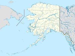
 Napaskiak
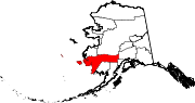
Coordinates: 60°42′25″N 161°45′39″W / 60.70694°N 161.76083°WCoordinates: 60°42′25″N 161°45′39″W / 60.70694°N 161.76083°W Country United States State Alaska Census Area Bethel Area - Total 3.8 sq mi (9.9 km2) - Land 3.5 sq mi (9.0 km2) - Water 0.4 sq mi (0.9 km2) Elevation 3 ft (1 m) Population (2007)[1] - Total 391 - Density 112.3/sq mi (43.4/km2) Time zone Alaska (AKST) (UTC-9) - Summer (DST) AKDT (UTC-8) Area code 907 FIPS code 02-52720 Napaskiak (Napaskiaq in Central Alaskan Yup'ik) is a city in Bethel Census Area, Alaska, United States. At the 2000 census the population was 390.
Geography
Napaskiak is located at 60°42′25″N 161°45′39″W / 60.706929°N 161.760961°W.[2]
According to the United States Census Bureau, the city has a total area of 3.8 square miles (9.8 km2), of which, 3.5 square miles (9.1 km2) of it is land and 0.3 square miles (0.78 km2) of it (9.14%) is water.
Demographics
As of the census[3] of 2000, there were 390 people, 82 households, and 70 families residing in the city. The population density was 112.3 people per square mile (43.4/km²). There were 95 housing units at an average density of 27.4 per square mile (10.6/km²). The racial makeup of the city was 1.54% White, 97.44% Native American, 0.26% Asian, and 0.77% from two or more races. 0.26% of the population were Hispanic or Latino of any race.
There were 82 households out of which 56.1% had children under the age of 18 living with them, 59.8% were married couples living together, 18.3% had a female householder with no husband present, and 14.6% were non-families. 13.4% of all households were made up of individuals and 8.5% had someone living alone who was 65 years of age or older. The average household size was 4.76 and the average family size was 5.24.
In the city the age distribution of the population shows 43.6% under the age of 18, 10.3% from 18 to 24, 27.7% from 25 to 44, 11.8% from 45 to 64, and 6.7% who were 65 years of age or older. The median age was 22 years. For every 100 females there were 104.2 males. For every 100 females age 18 and over, there were 96.4 males.
The median income for a household in the city was $31,806, and the median income for a family was $32,083. Males had a median income of $25,469 versus $25,000 for females. The per capita income for the city was $8,162. About 16.9% of families and 20.2% of the population were below the poverty line, including 20.1% of those under age 18 and 20.0% of those age 65 or over.
References
- ^ "Annual Estimates of the Population for Incorporated Places in Alaska". United States Census Bureau. 2008-07-10. http://www.census.gov/popest/cities/tables/SUB-EST2007-04-02.csv. Retrieved 2008-07-14.
- ^ "US Gazetteer files: 2010, 2000, and 1990". United States Census Bureau. 2011-02-12. http://www.census.gov/geo/www/gazetteer/gazette.html. Retrieved 2011-04-23.
- ^ "American FactFinder". United States Census Bureau. http://factfinder.census.gov. Retrieved 2008-01-31.
Municipalities and communities of Bethel Census Area, Alaska Cities Akiak | Aniak | Bethel | Chefornak | Chuathbaluk | Eek | Goodnews Bay | Kwethluk | Lower Kalskag | Mekoryuk | Napakiak | Napaskiak | Nightmute | Nunapitchuk | Platinum | Quinhagak | Toksook Bay | Upper Kalskag
CDPs Akiachak | Atmautluak | Crooked Creek | Kasigluk | Kipnuk | Kongiganak | Kwigillingok | Lime Village | Newtok | Oscarville | Red Devil | Sleetmute | Stony River | Tuluksak | Tuntutuliak | Tununak
Unincorporated
communitiesCategories:- Cities in Alaska
- Populated places in Bethel Census Area, Alaska
- Populated places in Alaska with Native American majority populations


Wikimedia Foundation. 2010.