- Chuathbaluk, Alaska
-
Chuathbaluk
Curarpalek— City — Nickname(s): Chewy Motto: Home of the Big Blueberries Location in Alaska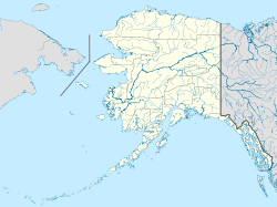
 Chuathbaluk
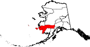
Coordinates: 61°34′32″N 159°14′50″W / 61.57556°N 159.24722°W Country United States State Alaska Census Area Bethel Area - Total 5.4 sq mi (13.9 km2) - Land 3.5 sq mi (9.1 km2) - Water 1.8 sq mi (4.8 km2) Elevation 154 ft (47 m) Population (2007)[1] - Total 119 Time zone Alaska (AKST) (UTC-9) - Summer (DST) AKDT (UTC-8) Area code 907 FIPS code 02-14330 Chuathbaluk (Curarpalek in Central Alaskan Yup'ik) is a city in Bethel Census Area, Alaska, United States. At the 2000 census the population was 119.
Contents
Geography
Chuathbaluk is located at 61°34′32″N 159°14′50″W / 61.57556°N 159.24722°W (61.575693, -159.247311)[2].
According to the United States Census Bureau, the city has a total area of 5.4 square miles (14 km2), of which, 3.5 square miles (9.1 km2) of it is land and 1.8 square miles (4.7 km2) of it (34.26%) is water.
Demographics
As of the census[3] of 2000, there were 119 people, 33 households, and 23 families residing in the city. The population density was 33.8 people per square mile (13.1/km²). There were 43 housing units at an average density of 12.2 per square mile (4.7/km²). The racial makeup of the city was 5.04% White, 91.60% Native American, 0.84% from other races, and 2.52% from two or more races.
There were 33 households out of which 45.5% had children under the age of 18 living with them, 30.3% were married couples living together, 27.3% had a female householder with no husband present, and 27.3% were non-families. 21.2% of all households were made up of individuals and 3.0% had someone living alone who was 65 years of age or older. The average household size was 3.61 and the average family size was 4.21.
In the city the age distribution of the population shows 42.9% under the age of 18, 8.4% from 18 to 24, 28.6% from 25 to 44, 16.0% from 45 to 64, and 4.2% who were 65 years of age or older. The median age was 23 years. For every 100 females there were 91.9 males. For every 100 females age 18 and over, there were 106.1 males.
The median income for a household in the city was $34,286, and the median income for a family was $34,167. Males had a median income of $46,250 versus $28,750 for females. The per capita income for the city was $10,100. There were 16.7% of families and 24.1% of the population living below the poverty line, including 27.5% of under eighteens and none of those over 64.
History
Chuathbaluk was the site of an Ingalik Indian [1] summer fish camp in the mid-19th century. The village has been known as Chukbak, St. Sergius Mission, Kuskokwim Russian Mission, and Little Russian Mission. The village was often confused with Russian Mission on the Yukon, so in the 1960s the name was changed to Chuathbaluk, which is derived from the Yup'ik word "Curapalek", meaning "the hills where the big blueberries grow." The Russian Orthodox church built the St. Sergius Mission by 1894, and residents of Kukuktuk from 20 miles downriver moved to the mission. Tragically, much of the village was lost in an influenza epidemic in 1900. By 1929, the site was deserted, although Russian Orthodox members continued to hold services at the mission. In 1954, the Crow Village Sam Phillips family from Crow Village resettled the mission, and were joined later by individuals from Aniak and Crooked Creek. The Church was rebuilt in the late 1950s, and a state school opened in the 1960s. The City was incorporated in 1975.
References
- ^ "Annual Estimates of the Population for Incorporated Places in Alaska". United States Census Bureau. 2008-07-10. http://www.census.gov/popest/cities/tables/SUB-EST2007-04-02.csv. Retrieved 2008-07-14.
- ^ "US Gazetteer files: 2010, 2000, and 1990". United States Census Bureau. 2011-02-12. http://www.census.gov/geo/www/gazetteer/gazette.html. Retrieved 2011-04-23.
- ^ "American FactFinder". United States Census Bureau. http://factfinder.census.gov. Retrieved 2008-01-31.
Coordinates: 61°34′32″N 159°14′50″W / 61.575693°N 159.247311°W
Municipalities and communities of Bethel Census Area, Alaska Cities Akiak | Aniak | Bethel | Chefornak | Chuathbaluk | Eek | Goodnews Bay | Kwethluk | Lower Kalskag | Mekoryuk | Napakiak | Napaskiak | Nightmute | Nunapitchuk | Platinum | Quinhagak | Toksook Bay | Upper Kalskag
CDPs Akiachak | Atmautluak | Crooked Creek | Kasigluk | Kipnuk | Kongiganak | Kwigillingok | Lime Village | Newtok | Oscarville | Red Devil | Sleetmute | Stony River | Tuluksak | Tuntutuliak | Tununak
Unincorporated
communitiesCategories:- Cities in Alaska
- Populated places in Bethel Census Area, Alaska
- Populated places in Alaska with Native American majority populations


Wikimedia Foundation. 2010.