- Currawinya National Park
-
Currawinya National Park Area 1,513 km2 (584 sq mi) Established 1991 Managing authorities Queensland Parks and Wildlife Service Official site Currawinya National Park Currawinya is a national park near Hungerford in south west Queensland, Australia, 828 km west of Brisbane. Part of the mulga lands bioregion this is an area of dry sandy plain with small trees and shrubs. The Paroo River passes through the park.
Contents
History
The park contains many Indigenous Australians' sites of cultural significance,[1] which indicate a long period of Aboriginal occupation and use of the wetlands within the park.[2]
The park was previously pastoral land. In 1991, the Government of Queensland purchased two properties, Currawinya and Caiwarro Homestead.[2] Remains of the homestead, machinery and a levee bank still exist today.[1]
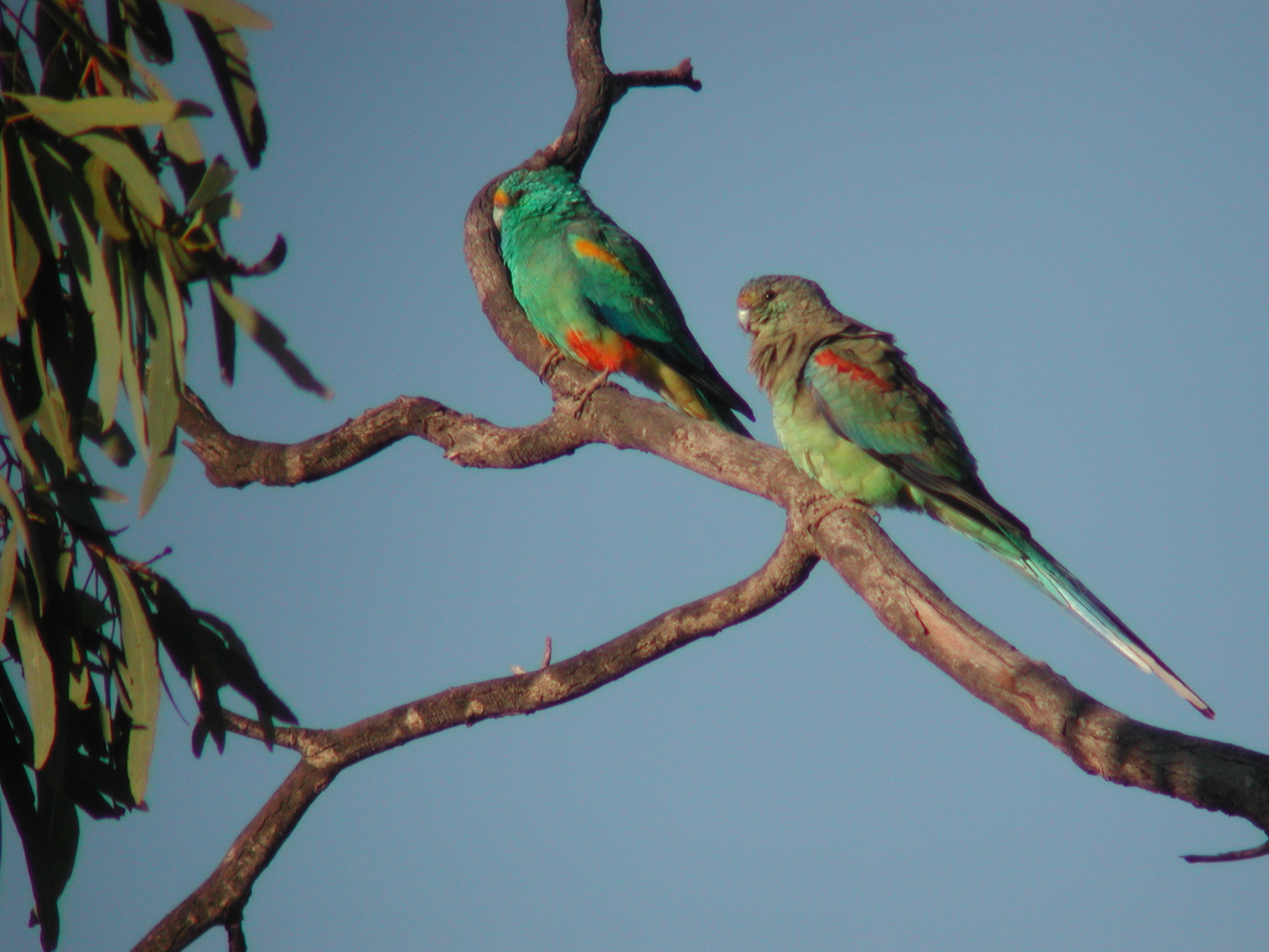
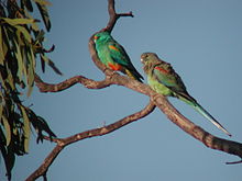 Male and female Mulga Parrots
Environment
Lakes Numalla and Wyara within the park are listed as Ramsar wetland sites of international importance. Lake Numalla is freshwater while Lake Wyara is saline.[1] These provide significant waterbird habitats at times of drought and for migrating waders which travel across inland Australia.[2] 200 bird species have been recorded in the park.[3] Most of the park lies within the Paroo Floodplain and Currawinya Important Bird Area, identified as such by BirdLife International because of its importance, when conditions are suitable, for large numbers of waterbirds.[4]
Facilities and attractions
Fishing, canoeing and swimming are popular recreational activities in the park.[3]
A feature of the park is a 25 square km bilby enclosure surrounded by a predator proof fence. The enclosure was opened in 2001.[1] Captive bred and rehabilitated bilbies thrive within the safety of the enclosure.
See also
- List of Ramsar sites in Australia
- Protected areas of Queensland
References
- ^ a b c d "Currawinya National Park: Nature, culture and history". Department of Environment and Resource Management. 27 August 2009. http://www.derm.qld.gov.au/parks/currawinya/culture.html. Retrieved 24 October 2010.
- ^ a b c Environmental Protection Agency (Queensland) (2002). Heritage Trails of the Queensland Outback. State of Queensland. pp. 113. ISBN 0-7345-1040-3.
- ^ a b "Currawinya National Park". Tourism Queensland. http://www.queenslandholidays.com.au/destinations/outback/places-to-visit/currawinya-national-park/. Retrieved 24 October 2010.
- ^ "IBA: Paroo Floodplain & Currawinya". Birdata. Birds Australia. http://www.birdata.com.au/iba.vm. Retrieved 2011-09-13.
Coordinates: 28°47′01.33″S 144°28′40.84″E / 28.7837028°S 144.4780111°E
Categories:- IUCN Category II
- National parks of Queensland
- Protected areas established in 1991
- Ramsar sites in Australia
- 1991 establishments in Australia
- Important Bird Areas of Australia
- Queensland protected area stubs
Wikimedia Foundation. 2010.