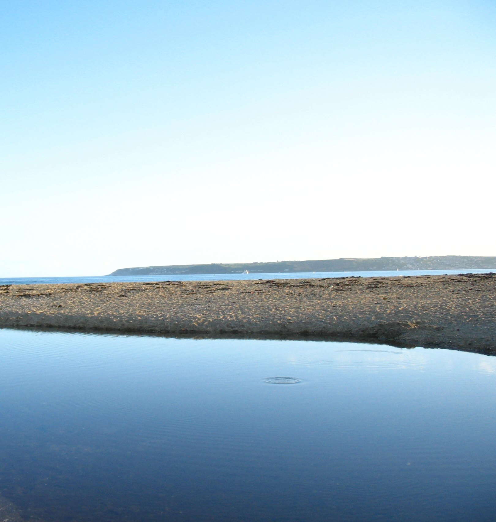
- Mount's Bay
-
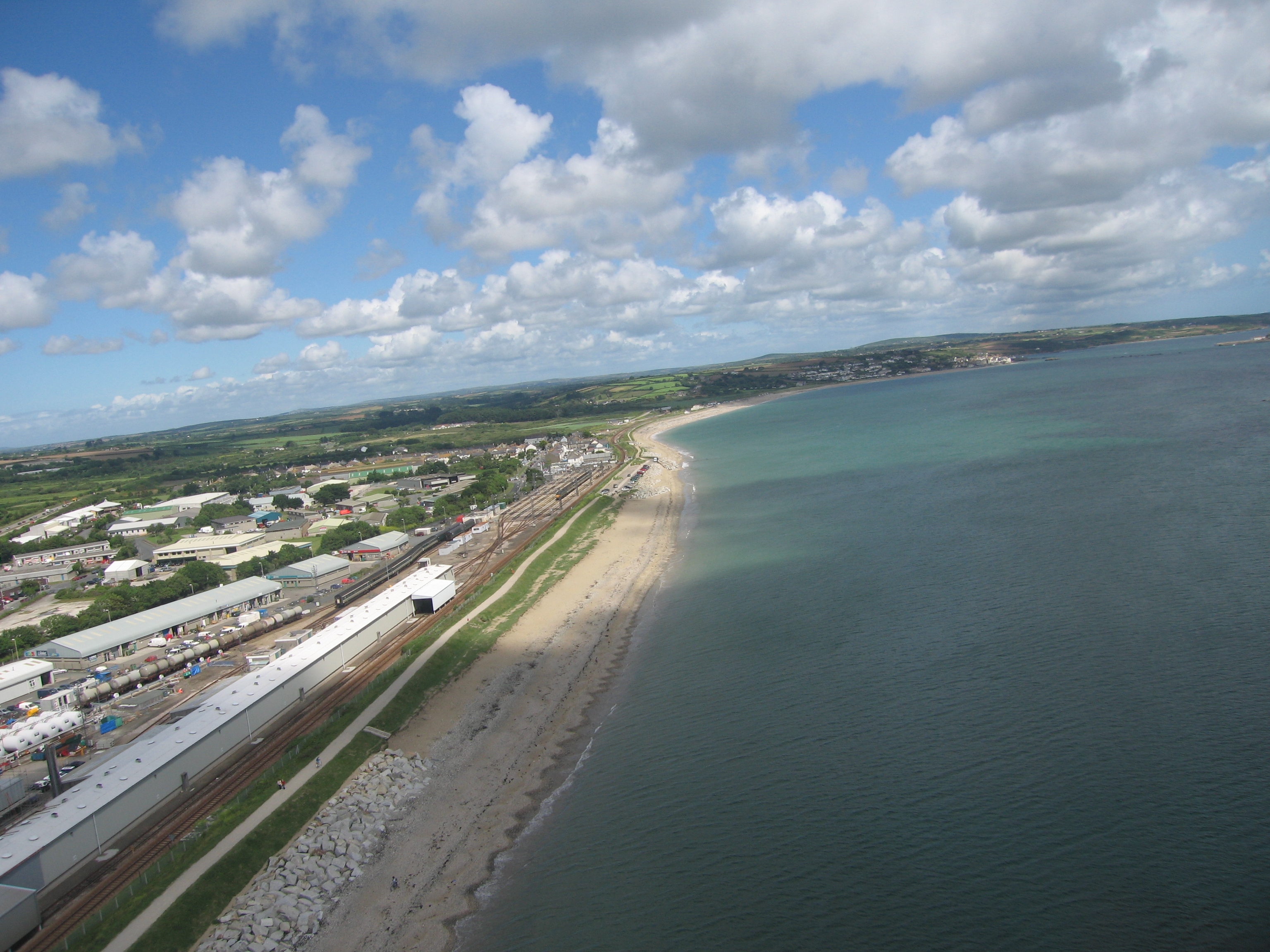
 Mount's Bay from helicopter
 Mount's Bay
- This page is on the geographical feature. For other meanings, see Mount's Bay (disambiguation).
Mount's Bay is a large, sweeping bay on the English Channel coast of Cornwall in the United Kingdom, stretching from the Lizard Point to Gwennap Head on the eastern side of the Land's End peninsula. Towards the middle of the bay (and probably the origin of the name) is St Michael's Mount.[1] Presenting a benign aspect to summer visitors of a large, scenic, natural harbour; in an onshore winter gale it presents a great danger to shipping as a "maritime trap". Especially in the days of sailing ships with an excess of 150 known wrecks in the nineteenth century.[2]
Contents
Geography
Mount's Bay is the biggest bay in Cornwall. Its half-moon shape is similar to that of Donegal Bay in Ireland and Cardigan Bay in Wales, although, unlike the aforementioned bays, Mount's Bay is relatively sheltered from the prevailing Atlantic westerlies. It is, however, a danger to shipping during onshore southerly and south-easterly gales.[2]
The coast is approximately 42 miles ([67 km) miles from Lizard Point to Gwennap Head.[3] Heading north and west from Lizard Point, the serpentine and hornblende schist cliffs reach a maximum height of 71 m (233 ft) at Vellan Head and are only broken by small streams and coves such as at Kynance, Gew-grade and Mullion Cove.[4] After Gunwalloe Fishing Cove the cliffs have the softer look of Devonian Meneage Formations of greywacke and mélange, with erosion a problem west of the naturally dammed ria of Loe Pool. West of Porthleven there are high Devonian slate and granite cliffs to Rinsey Head after which the cliffs are topped by Pleistocene periglacial head and have eroded to form sandy beaches such as those at Praa Sands and Kenneggy. These beaches are in deficit and the cliff line is retreating.[5] With the exception of the harder Devonian dolerite and gabbro of Cudden Point, the low, eroding cliffs and beaches continue to Mousehole. This part of the bay is the most populated with the towns of Penzance and Marazion and the villages of Newlyn and Mousehole. Beyond Mousehole the granite cliffs, rise to 60 m, and are broken by small streams such as at Lamorna Cove and Penberth.
There are small sand dune systems at Church Cove and Poldhu Cove, Porthleven Sands, Praa Sands and from Marazion to Eastern Green, Penzance. The former sand dunes of the Western Green are now covered by Penzance promenade. All, but Marazion to Penzance, are examples of bay dune systems which develop where there is a limited supply of sand trapped within the shelter of two rocky headlands. Church and Poldhu Coves are SSSI[6] and also have associated climbing dunes which occur when sand is blown inland of the main dune system.[7]
Evidence of higher sea-levels in the past can be seen at Marazion where the town is built on a raised beach. A second example is the road between Newlyn and Mousehole. Sea levels rise and fall as the ice sheets advance and retreat, and raised beaches now mark the interglacial periods when sea levels were higher.[7] Either side of Penzance, on the beaches at Ponsandane and Wherrytown, evidence of a 'submerged forest' can be seen at low tide in the form of several fossilised tree trunks. Geologists believe that a forest may have existed here before the most recent sea level rise. This correlates with the Cornish name of St Michael's Mount, Carrack Looz en Cooz — literally, "the grey rock in the wood".[8]
On 1st November, 1755, the Lisbon earthquake caused a tsunami to strike the Cornish coast at around 14:00. At Mounts Bay the sea rose ten feet at great speed and ebbed at the same rate. Little damage was recorded.[citation needed]
Settlements
There are several coastal towns and villages dotted around Mount's Bay of which the largest is Penzance. To the west are Newlyn, Paul, Mousehole and Lamorna. and to the east are Marazion, Perranuthnoe, Praa Sands, Porthleven and Mullion. The bay also incorporates many beaches, coves and features including Prussia Cove, Loe Pool (and Loe Bar), Church Cove, Poldhu Cove and Kynance Cove.
In the churchyard wall of the church of St. Paul Aurelian in Paul is the 1860 monument to Dolly Pentreath, according to tradition the last native speaker of the Cornish language.
Mount's Bay gives its name to a local secondary school, which is located in Heamoor and serves Penzance and the surrounding countryside. Mount's Bay School and Community Sports College (formerly Heamoor Secondary Modern School ) is one of Penzance's comprehensive schools.
RFA Mount's Bay
Commissioned by the Royal Fleet Auxiliary in 2006, RFA Mount's Bay is the latest-design Landing Ship Dock, the Bay Class used by the Royal Navy. Mount's Bay has good affiliations with the Sea Cadet Unit TS Zephyr in Caterham, Surrey.
References
- ^ Ordnance Survey: Landranger map sheet 203 Land's End ISBN 9780319231487
- ^ a b Corin, J and Farr, G. (1983) Penlee Lifeboat. Penzance: Penzance and Penlee Branch of the RNLI.
- ^ http://www.southwestcoastpath.com/main/walks_content/distanceCalculator.cfm
- ^ Lawman, J. (1994) A Natural History of the Lizard Peninsula. Pool: Institute of Cornish Studies.
- ^ http://projects.exeter.ac.uk/geomincentre/02MOUNTS%20BAY.pdf
- ^ http://www.sssi.naturalengland.org.uk/citation/citation_photo/2000125.pdf
- ^ a b Tonkin, B., Covey, R. and Moat T. (1997) Start Point to Land’s End Maritime Natural Area. A Nature Conservation Profile. Truro: English Nature.
- ^ Pool, P. A. S. (1974) The History of the Town and Borough of Penzance. Penzance: The Corporation of Penzance.
See also
- Battle of Cornwall
External links
Categories:- Bays of Cornwall
- Penwith
- Beaches of Penwith
Wikimedia Foundation. 2010.